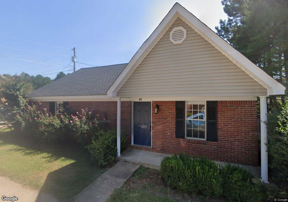
615 Huntington Place Oxford, MS 38655
Estimated Value: $273,000 - $332,127
3
Beds
3
Baths
1,218
Sq Ft
$248/Sq Ft
Est. Value
About This Home
This home is located at 615 Huntington Place, Oxford, MS 38655 and is currently estimated at $302,282, approximately $248 per square foot. 615 Huntington Place is a home located in Lafayette County with nearby schools including Lafayette Elementary School, Lafayette Upper Elementary School, and Lafayette Middle School.
Ownership History
Date
Name
Owned For
Owner Type
Purchase Details
Closed on
Sep 8, 2020
Sold by
Brown Stephen W and Brown Kristi V
Bought by
Wright Robyn and Dinai Gila
Current Estimated Value
Home Financials for this Owner
Home Financials are based on the most recent Mortgage that was taken out on this home.
Original Mortgage
$111,600
Outstanding Balance
$99,038
Interest Rate
2.9%
Mortgage Type
New Conventional
Estimated Equity
$203,244
Purchase Details
Closed on
May 26, 2005
Sold by
Stone Gary D
Bought by
Brown Stephen W and Brown Kristi V
Home Financials for this Owner
Home Financials are based on the most recent Mortgage that was taken out on this home.
Original Mortgage
$59,728
Interest Rate
5.8%
Mortgage Type
Future Advance Clause Open End Mortgage
Create a Home Valuation Report for This Property
The Home Valuation Report is an in-depth analysis detailing your home's value as well as a comparison with similar homes in the area
Home Values in the Area
Average Home Value in this Area
Purchase History
| Date | Buyer | Sale Price | Title Company |
|---|---|---|---|
| Wright Robyn | -- | None Available | |
| Brown Stephen W | -- | None Available |
Source: Public Records
Mortgage History
| Date | Status | Borrower | Loan Amount |
|---|---|---|---|
| Open | Wright Robyn | $111,600 | |
| Previous Owner | Brown Stephen W | $59,728 |
Source: Public Records
Tax History Compared to Growth
Tax History
| Year | Tax Paid | Tax Assessment Tax Assessment Total Assessment is a certain percentage of the fair market value that is determined by local assessors to be the total taxable value of land and additions on the property. | Land | Improvement |
|---|---|---|---|---|
| 2024 | $812 | $11,223 | $0 | $0 |
| 2023 | $812 | $11,223 | $0 | $0 |
| 2022 | $797 | $11,223 | $0 | $0 |
| 2021 | $810 | $11,223 | $0 | $0 |
| 2020 | $1,776 | $16,736 | $0 | $0 |
| 2019 | $1,776 | $16,736 | $0 | $0 |
| 2018 | $1,780 | $16,736 | $0 | $0 |
| 2017 | $1,780 | $16,736 | $0 | $0 |
| 2016 | $1,450 | $13,791 | $0 | $0 |
| 2015 | -- | $10,862 | $0 | $0 |
| 2014 | -- | $10,862 | $0 | $0 |
Source: Public Records
Map
Nearby Homes
- 1701 Rhett's Dr
- 1817 Atlanta Ave
- 717 Savannah Dr
- 710 Happy Ln
- 607 Happy Ln
- 100 Heights Dr
- 133 Heights Dr
- 108 Cedar Hill Dr
- 11 County Road 1057
- 128 Cedar Hill Dr
- 4144 Fieldstone Loop
- 1048 Fieldstone Ln
- 1054 Fieldstone Ln
- 201 Cotton Creek Cove
- 8021 Cart Path Ln
- 8017 Cart Path Ln
- 8013 Cart Path Ln
- 8001 Cart Path Ln
- 8015 Cart Path Ln
- 8023 Cart Path Ln
- 616 Huntington Place
- 617 Huntington Place
- 613 Huntington Place
- 706 Deerfield Dr
- 618 Huntington Place
- 614 Huntington Place
- 708 Deerfield Dr
- 704 Deerfield Dr
- 619 Huntington Place
- 1236 Westbrook Dr
- 1236 Westbrook Dr
- 1238 Westbrook Dr
- 710 Deerfield Dr
- 620 Huntington Place
- 702 Deerfield Dr
- 1234 Westbrook Dr
- 1240 Westbrook Dr
- 609 Huntington Place
- 607 Huntington Place
- 1242 Westbrook Dr