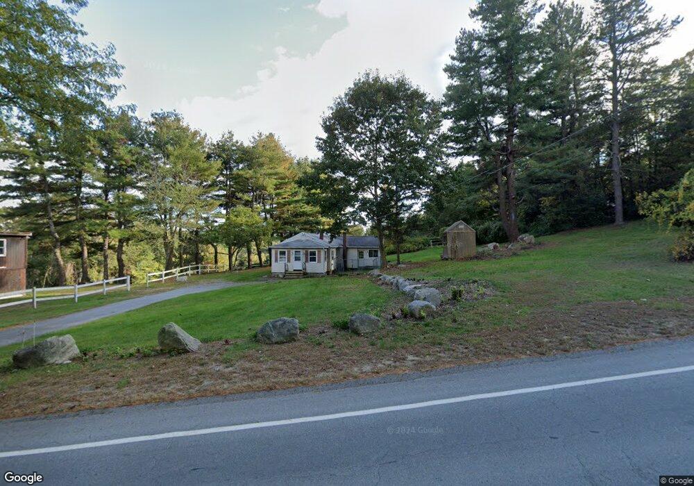
615 Manning St Jefferson, MA 01522
Estimated Value: $409,000 - $470,000
3
Beds
2
Baths
1,546
Sq Ft
$283/Sq Ft
Est. Value
About This Home
This home is located at 615 Manning St, Jefferson, MA 01522 and is currently estimated at $438,048, approximately $283 per square foot. 615 Manning St is a home located in Worcester County with nearby schools including Wachusett Regional High School and Holden Christian Academy.
Ownership History
Date
Name
Owned For
Owner Type
Purchase Details
Closed on
Sep 1, 2022
Sold by
Miller Kimberly J and Gordon Michael R
Bought by
Trotto Bruce R
Current Estimated Value
Home Financials for this Owner
Home Financials are based on the most recent Mortgage that was taken out on this home.
Original Mortgage
$170,000
Outstanding Balance
$162,348
Interest Rate
5.54%
Mortgage Type
Purchase Money Mortgage
Estimated Equity
$275,700
Purchase Details
Closed on
Dec 4, 1998
Sold by
Lomax Robert R and Lomax Joan A
Bought by
Miller Kimberly J
Home Financials for this Owner
Home Financials are based on the most recent Mortgage that was taken out on this home.
Original Mortgage
$92,800
Interest Rate
6.68%
Mortgage Type
Purchase Money Mortgage
Create a Home Valuation Report for This Property
The Home Valuation Report is an in-depth analysis detailing your home's value as well as a comparison with similar homes in the area
Home Values in the Area
Average Home Value in this Area
Purchase History
| Date | Buyer | Sale Price | Title Company |
|---|---|---|---|
| Trotto Bruce R | $215,000 | None Available | |
| Miller Kimberly J | $116,000 | -- |
Source: Public Records
Mortgage History
| Date | Status | Borrower | Loan Amount |
|---|---|---|---|
| Open | Trotto Bruce R | $170,000 | |
| Previous Owner | Miller Kimberly J | $92,800 | |
| Previous Owner | Miller Kimberly J | $59,000 | |
| Previous Owner | Miller Kimberly J | $49,000 | |
| Closed | Miller Kimberly J | $11,600 |
Source: Public Records
Tax History Compared to Growth
Tax History
| Year | Tax Paid | Tax Assessment Tax Assessment Total Assessment is a certain percentage of the fair market value that is determined by local assessors to be the total taxable value of land and additions on the property. | Land | Improvement |
|---|---|---|---|---|
| 2025 | $5,702 | $411,400 | $166,500 | $244,900 |
| 2024 | $5,405 | $382,000 | $161,700 | $220,300 |
| 2023 | $5,437 | $362,700 | $140,500 | $222,200 |
| 2022 | $5,258 | $317,500 | $109,700 | $207,800 |
| 2021 | $5,083 | $292,100 | $104,500 | $187,600 |
| 2020 | $4,689 | $275,800 | $99,700 | $176,100 |
| 2019 | $4,610 | $264,200 | $99,700 | $164,500 |
| 2018 | $4,307 | $244,600 | $94,900 | $149,700 |
| 2017 | $3,893 | $221,300 | $94,900 | $126,400 |
| 2016 | $3,655 | $211,900 | $90,500 | $121,400 |
| 2015 | $3,655 | $201,700 | $90,500 | $111,200 |
| 2014 | $3,580 | $201,700 | $90,500 | $111,200 |
Source: Public Records
Map
Nearby Homes
- 287 Laurel St
- 0 North St
- Lot 1 Manning St
- 16 N Main St
- 26 Townsend Dr
- 20 Winthrop St
- 751 Mason Rd
- 156 Prospect St
- 60 Duxbury Dr
- 136 Sterling St Unit A3
- 300 Malden St
- 35 Laurel Hill Ln
- 56 Highland Ave
- 16 Highland Ave
- 47 Preservation Ln
- 0 Boutelle Rd
- 9 Short St
- 61 Boutelle Rd
- 152 Worcester St Unit 8
- 3 Oakridge Rd
- 619 Manning St
- 605 Manning St
- 600 Manning St
- 635 Manning St
- 620 Manning St
- 630 Manning St
- 585 Manning St
- 651 Manning St
- 661 Manning St
- 296 Laurel St
- 555 Manning St
- 286 Laurel St
- 550 Manning St
- 650 Manning St
- 619 Manning St
- 1 Raymond Huntington Hwy
- 520 Manning St
- 521 Manning St
- 22 Springdale Rd
- 22 Springdale Rd Unit 22