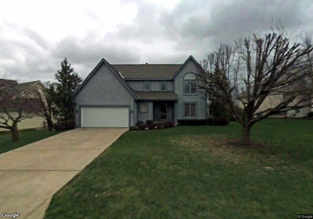
615 NW Brookhaven Dr Lees Summit, MO 64081
Estimated Value: $426,902 - $523,000
4
Beds
3
Baths
2,380
Sq Ft
$203/Sq Ft
Est. Value
About This Home
This home is located at 615 NW Brookhaven Dr, Lees Summit, MO 64081 and is currently estimated at $481,976, approximately $202 per square foot. 615 NW Brookhaven Dr is a home located in Jackson County with nearby schools including Cedar Creek Elementary School, Pleasant Lea Middle School, and Lee's Summit Senior High School.
Ownership History
Date
Name
Owned For
Owner Type
Purchase Details
Closed on
May 15, 2020
Sold by
Campo Paul A and Campo Sharon K
Bought by
Pramannik Sudhir and Pramannik Swasti
Current Estimated Value
Home Financials for this Owner
Home Financials are based on the most recent Mortgage that was taken out on this home.
Original Mortgage
$265,109
Outstanding Balance
$234,923
Interest Rate
3.3%
Mortgage Type
FHA
Estimated Equity
$247,053
Purchase Details
Closed on
Sep 4, 2007
Sold by
Campo Paul Anthony and Campo Sharon Kay
Bought by
Campo Paul A and Campo Sharon K
Purchase Details
Closed on
Jun 13, 2000
Sold by
Duncan David W and Duncan Brenda B
Bought by
Campo Paul Anthony and Campo Sharon Kay
Home Financials for this Owner
Home Financials are based on the most recent Mortgage that was taken out on this home.
Original Mortgage
$202,980
Interest Rate
8.66%
Mortgage Type
VA
Create a Home Valuation Report for This Property
The Home Valuation Report is an in-depth analysis detailing your home's value as well as a comparison with similar homes in the area
Home Values in the Area
Average Home Value in this Area
Purchase History
| Date | Buyer | Sale Price | Title Company |
|---|---|---|---|
| Pramannik Sudhir | -- | Coffelt Land Title Llc | |
| Campo Paul A | -- | None Available | |
| Campo Paul Anthony | -- | Heart Of America Title Inc |
Source: Public Records
Mortgage History
| Date | Status | Borrower | Loan Amount |
|---|---|---|---|
| Open | Pramannik Sudhir | $265,109 | |
| Previous Owner | Campo Paul Anthony | $202,980 |
Source: Public Records
Tax History Compared to Growth
Tax History
| Year | Tax Paid | Tax Assessment Tax Assessment Total Assessment is a certain percentage of the fair market value that is determined by local assessors to be the total taxable value of land and additions on the property. | Land | Improvement |
|---|---|---|---|---|
| 2025 | $4,124 | $63,321 | $11,419 | $51,902 |
| 2024 | $3,596 | $57,118 | $8,352 | $48,766 |
| 2023 | $3,596 | $50,160 | $8,073 | $42,087 |
| 2022 | $3,945 | $47,880 | $7,980 | $39,900 |
| 2021 | $3,945 | $47,880 | $7,980 | $39,900 |
| 2020 | $3,982 | $47,853 | $7,980 | $39,873 |
| 2019 | $3,873 | $47,853 | $7,980 | $39,873 |
| 2018 | $3,548 | $40,684 | $4,638 | $36,046 |
| 2017 | $3,405 | $40,684 | $4,638 | $36,046 |
| 2016 | $3,405 | $38,646 | $4,693 | $33,953 |
| 2014 | $3,365 | $37,434 | $4,383 | $33,051 |
Source: Public Records
Map
Nearby Homes
- 130 NW Ambersham Dr
- 505 NW Ambersham Dr
- 2209 NW Wellington Ct
- 2257 NW Summerfield Dr
- 2007 NW Chipman Rd
- 813 NW High Point Dr
- 2122 NW Ashurst Dr
- 2110 NW Ashurst Dr
- 2503 NW Windwood Dr
- 2501 NW Shady Bend Ln
- 2090 NW O'Brien Rd
- 2086 NW O'Brien Rd
- 361 NW Patch Ct
- 2436 NW Valley View Dr
- Monterey Plan at Reserve at Woodside Ridge
- Oakleigh Plan at Reserve at Woodside Ridge
- Ashland Plan at Reserve at Woodside Ridge
- Bentley Plan at Reserve at Woodside Ridge
- Mariah Plan at Reserve at Woodside Ridge
- Oakshire Plan at Reserve at Woodside Ridge
- 607 NW Brookhaven Dr
- 616 NW Brookhaven Dr
- 612 NW Brookhaven Dr
- 621 NW Brookhaven Dr
- 608 NW Brookhaven Dr
- 528 NW Ambersham Dr
- 629 NW Brookhaven Dr
- 604 NW Brookhaven Dr
- 620 NW Brookhaven Cir
- 601 NW Brookhaven Dr
- 628 NW Brookhaven Dr
- 624 NW Brookhaven Cir
- 532 NW Ambersham Dr
- 632 NW Brookhaven Dr
- 600 NW Brookhaven Dr
- 529 NW Ambersham Dr
- 525 NW Ambersham Dr
- 102 NW Ambersham Dr
- 101 NW Ambersham Dr
- 122 NW Ambersham Dr