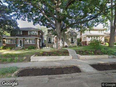
616 Cedar Lake Rd S Minneapolis, MN 55405
Bryn Mawr NeighborhoodEstimated Value: $526,886 - $594,000
3
Beds
3
Baths
1,338
Sq Ft
$413/Sq Ft
Est. Value
About This Home
This home is located at 616 Cedar Lake Rd S, Minneapolis, MN 55405 and is currently estimated at $552,722, approximately $413 per square foot. 616 Cedar Lake Rd S is a home located in Hennepin County with nearby schools including Bryn Mawr Elementary School, Anwatin Middle School, and North Community High School.
Ownership History
Date
Name
Owned For
Owner Type
Purchase Details
Closed on
Aug 31, 2016
Sold by
Holm Jacob A and Holm Diane E
Bought by
Lewis Milana and Blewitt Matthew
Current Estimated Value
Home Financials for this Owner
Home Financials are based on the most recent Mortgage that was taken out on this home.
Original Mortgage
$417,000
Interest Rate
3.45%
Mortgage Type
Construction
Purchase Details
Closed on
Jan 3, 2011
Sold by
Joan K Flynn Revocable Trust
Bought by
Holm Jacob A and Holm Diane E
Create a Home Valuation Report for This Property
The Home Valuation Report is an in-depth analysis detailing your home's value as well as a comparison with similar homes in the area
Home Values in the Area
Average Home Value in this Area
Purchase History
| Date | Buyer | Sale Price | Title Company |
|---|---|---|---|
| Lewis Milana | $402,000 | Liberty Title Inc | |
| Holm Jacob A | $217,000 | -- |
Source: Public Records
Mortgage History
| Date | Status | Borrower | Loan Amount |
|---|---|---|---|
| Open | Lewis Milana | $415,000 | |
| Closed | Lewis Milana | $417,000 |
Source: Public Records
Tax History Compared to Growth
Tax History
| Year | Tax Paid | Tax Assessment Tax Assessment Total Assessment is a certain percentage of the fair market value that is determined by local assessors to be the total taxable value of land and additions on the property. | Land | Improvement |
|---|---|---|---|---|
| 2023 | $6,357 | $489,000 | $179,000 | $310,000 |
| 2022 | $5,990 | $467,000 | $163,000 | $304,000 |
| 2021 | $5,364 | $434,000 | $133,000 | $301,000 |
| 2020 | $5,686 | $403,500 | $112,500 | $291,000 |
| 2019 | $5,855 | $395,500 | $95,200 | $300,300 |
| 2018 | $5,360 | $395,500 | $95,200 | $300,300 |
| 2017 | $4,832 | $323,000 | $86,500 | $236,500 |
| 2016 | $4,689 | $297,000 | $86,500 | $210,500 |
| 2015 | $4,600 | $278,000 | $86,500 | $191,500 |
| 2014 | -- | $245,000 | $77,000 | $168,000 |
Source: Public Records
Map
Nearby Homes
- 428 Sheridan Ave S
- 437 Upton Ave S
- 720 Cedar Lake Rd S
- 2323 Laurel Ave
- 601 Queen Ave S
- 1045 Thomas Ave S
- 241 Queen Ave S
- 1058 Cedar View Dr
- 1112 Vincent Ave S
- 632 Morgan Ave S
- 8 Queen Ave S
- 2110 Hawthorne Ave
- 1700 Kenwood Pkwy
- 1600 Kenwood Pkwy
- 1911 Laurel Ave
- 1128 Kenwood Pkwy Unit 1
- 1448 Lakeview Ave S
- 2111 2nd Ave N
- 1967 Sheridan Ave S
- 1984 Kenwood Pkwy
- 616 Cedar Lake Rd S
- 612 Cedar Lake Rd S
- 620 Cedar Lake Rd S
- 608 Cedar Lake Rd S
- 624 Cedar Lake Rd S
- 453 Thomas Ave S
- 451 Thomas Ave S
- 604 Cedar Lake Rd S
- 628 Cedar Lake Rd S
- 447 Thomas Ave S
- 444 Sheridan Ave S
- 613 Cedar Lake Rd S
- 617 Cedar Lake Rd S
- 609 Cedar Lake Rd S
- 445 Thomas Ave S
- 621 Cedar Lake Rd S
- 605 Cedar Lake Rd S
- 440 Sheridan Ave S
- 625 Cedar Lake Rd S
- 456 Thomas Ave S