Estimated Value: $206,000 - $282,479
2
Beds
2
Baths
1,538
Sq Ft
$165/Sq Ft
Est. Value
About This Home
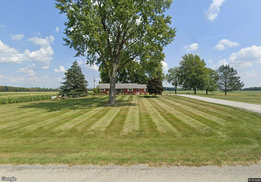
This home is located at 6160 Sandy Point Rd, Lima, OH 45807 and is currently estimated at $253,620, approximately $164 per square foot. 6160 Sandy Point Rd is a home located in Allen County with nearby schools including Elida Elementary School, Elida Middle School, and Elida High School.
Ownership History
Date
Name
Owned For
Owner Type
Purchase Details
Closed on
Oct 18, 2016
Sold by
Micha Wayne T and Micha Paula D
Bought by
Micha Wayne T and Micha Paula D
Current Estimated Value
Home Financials for this Owner
Home Financials are based on the most recent Mortgage that was taken out on this home.
Original Mortgage
$10,000
Interest Rate
3.48%
Mortgage Type
Credit Line Revolving
Purchase Details
Closed on
Mar 10, 1998
Sold by
Born Dorothy
Bought by
Micha Wayne
Home Financials for this Owner
Home Financials are based on the most recent Mortgage that was taken out on this home.
Original Mortgage
$80,000
Interest Rate
7.08%
Mortgage Type
New Conventional
Create a Home Valuation Report for This Property
The Home Valuation Report is an in-depth analysis detailing your home's value as well as a comparison with similar homes in the area
Purchase History
| Date | Buyer | Sale Price | Title Company |
|---|---|---|---|
| Micha Wayne T | -- | None Available | |
| Micha Wayne | $70,000 | -- |
Source: Public Records
Mortgage History
| Date | Status | Borrower | Loan Amount |
|---|---|---|---|
| Previous Owner | Micha Wayne T | $10,000 | |
| Previous Owner | Micha Wayne | $80,000 |
Source: Public Records
Tax History
| Year | Tax Paid | Tax Assessment Tax Assessment Total Assessment is a certain percentage of the fair market value that is determined by local assessors to be the total taxable value of land and additions on the property. | Land | Improvement |
|---|---|---|---|---|
| 2024 | $2,922 | $82,430 | $21,700 | $60,730 |
| 2023 | $2,270 | $58,880 | $15,510 | $43,370 |
| 2022 | $2,295 | $58,880 | $15,510 | $43,370 |
| 2021 | $2,308 | $58,880 | $15,510 | $43,370 |
| 2020 | $2,209 | $53,980 | $14,040 | $39,940 |
| 2019 | $2,209 | $53,980 | $14,040 | $39,940 |
| 2018 | $2,231 | $53,980 | $14,040 | $39,940 |
| 2017 | $1,786 | $46,770 | $13,480 | $33,290 |
| 2016 | $1,924 | $46,770 | $13,480 | $33,290 |
| 2015 | $1,923 | $46,770 | $13,480 | $33,290 |
| 2014 | $1,865 | $44,670 | $11,380 | $33,290 |
| 2013 | $1,772 | $44,670 | $11,380 | $33,290 |
Source: Public Records
Map
Nearby Homes
- 8170 Sandy Point Rd
- 0 Fraunfelter Unit 307817
- 0 N Eastown Rd Unit 1034495
- 715 Wildwood Ave
- 114 Roger St
- 0000 Diller Rd
- 4250 Diller Rd
- 4387 N West St
- 5643 Clover Ridge Dr
- 4910 Amaryllis St
- 0 Alix Dr
- 2561 Baty Rd
- 2877 Whippoorwill Ave
- 2568 Susan Ann Dr
- 0 Thorndyke Dr
- 5031 Daisy Ln
- 3137 Thorndyke Dr
- 2718 Carolyn Dr
- 1743 Sherry Lee Dr
- 2630 Carolyn Dr
- 6235 Sandy Point Rd
- 6262 Sandy Point Rd
- 6350 Sandy Point Rd
- 6015 Sandy Point Rd
- 6380 Sandy Point Rd
- 5770 Sandy Point Rd
- 3770 Bussert Rd
- 3108 W State Rd
- 3825 Bussert Rd
- 3000 W State Rd
- 3245 W State Rd
- 3255 W State Rd
- 3307 W State Rd
- 2990 W State Rd
- 3875 Bussert Rd
- 3095 W State Rd
- 3949 Bussert Rd
- 3033 W Lincoln Hwy
Your Personal Tour Guide
Ask me questions while you tour the home.