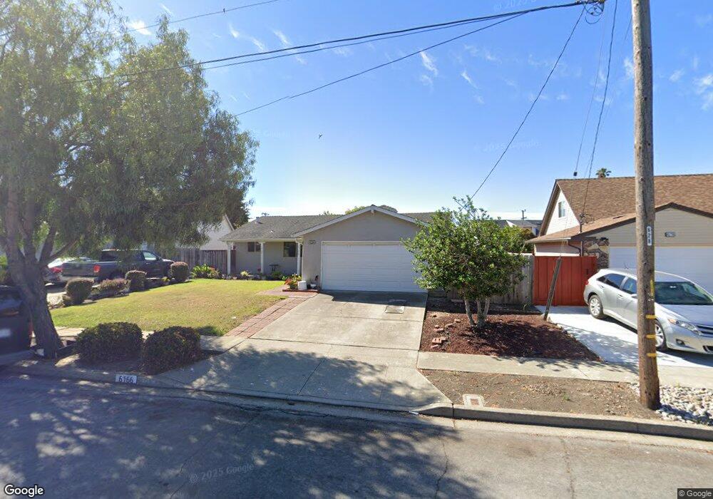
6166 Bennington Dr Newark, CA 94560
Estimated Value: $1,151,000 - $1,223,000
3
Beds
2
Baths
1,232
Sq Ft
$967/Sq Ft
Est. Value
About This Home
This home is located at 6166 Bennington Dr, Newark, CA 94560 and is currently estimated at $1,190,969, approximately $966 per square foot. 6166 Bennington Dr is a home located in Alameda County with nearby schools including Coyote Hills Elementary School, Newark Junior High School, and Newark Memorial High School.
Ownership History
Date
Name
Owned For
Owner Type
Purchase Details
Closed on
Apr 5, 2012
Sold by
Taylor Shelia M
Bought by
Taylor Shelia M and The Taylor 2010 Trust
Current Estimated Value
Home Financials for this Owner
Home Financials are based on the most recent Mortgage that was taken out on this home.
Original Mortgage
$150,000
Interest Rate
3.86%
Mortgage Type
New Conventional
Purchase Details
Closed on
Sep 1, 2010
Sold by
Taylor Shelia M
Bought by
Taylor Shelia M and Taylor 2010 Trust
Create a Home Valuation Report for This Property
The Home Valuation Report is an in-depth analysis detailing your home's value as well as a comparison with similar homes in the area
Home Values in the Area
Average Home Value in this Area
Purchase History
| Date | Buyer | Sale Price | Title Company |
|---|---|---|---|
| Taylor Shelia M | -- | First American Title Company | |
| Taylor Shelia M | -- | First American Title Company | |
| Taylor Shelia M | -- | None Available |
Source: Public Records
Mortgage History
| Date | Status | Borrower | Loan Amount |
|---|---|---|---|
| Closed | Taylor Shelia M | $150,000 |
Source: Public Records
Tax History
| Year | Tax Paid | Tax Assessment Tax Assessment Total Assessment is a certain percentage of the fair market value that is determined by local assessors to be the total taxable value of land and additions on the property. | Land | Improvement |
|---|---|---|---|---|
| 2025 | $3,882 | $276,588 | $160,778 | $122,810 |
| 2024 | $3,882 | $271,028 | $157,626 | $120,402 |
| 2023 | $3,762 | $272,576 | $154,535 | $118,041 |
| 2022 | $3,693 | $260,232 | $151,505 | $115,727 |
| 2021 | $3,570 | $252,052 | $148,535 | $110,517 |
| 2020 | $3,465 | $256,396 | $147,012 | $109,384 |
| 2019 | $3,418 | $251,370 | $144,130 | $107,240 |
| 2018 | $3,362 | $246,441 | $141,304 | $105,137 |
| 2017 | $3,275 | $241,610 | $138,534 | $103,076 |
| 2016 | $3,228 | $236,873 | $135,818 | $101,055 |
| 2015 | $3,216 | $233,317 | $133,779 | $99,538 |
| 2014 | $3,123 | $228,747 | $131,159 | $97,588 |
Source: Public Records
Map
Nearby Homes
- 6252 Bennington Dr
- 6048 Bellhaven Ave
- 36465 Hafner St
- 6328 Zulmida Ave
- 36605 Hafner St
- 36057 Dalewood Dr
- 6364 Noel Ave
- 5912 Mayhews Landing Rd
- 6169 Thornton Ave Unit B
- 36637 Burdick St
- 5585 Fernwood Dr
- 35952 Rosewood Dr
- 6245 Thornton Ave
- 36188 Fig Tree Ln
- 36184 Toulouse St
- 36563 Beutke Dr
- 5311 Port Sailwood Dr
- 37029 Olive St
- 5298 Sussex Place
- 35421 Cleremont Dr
- 6154 Bennington Dr
- 6178 Bennington Dr
- 6261 Bellhaven Ave
- 6273 Bellhaven Ave
- 6146 Bennington Dr
- 6257 Bellhaven Ave
- 6186 Bennington Dr
- 6165 Bennington Dr
- 6201 Bellhaven Ave
- 6281 Bellhaven Ave
- 6153 Bennington Dr
- 6198 Bennington Dr
- 6138 Bennington Dr
- 6181 Bennington Dr
- 6145 Bennington Dr
- 6173 Bellhaven Ave
- 36384 Christine St
- 36396 Christine St
- 6212 Bennington Dr
- 6137 Bennington Dr
Your Personal Tour Guide
Ask me questions while you tour the home.