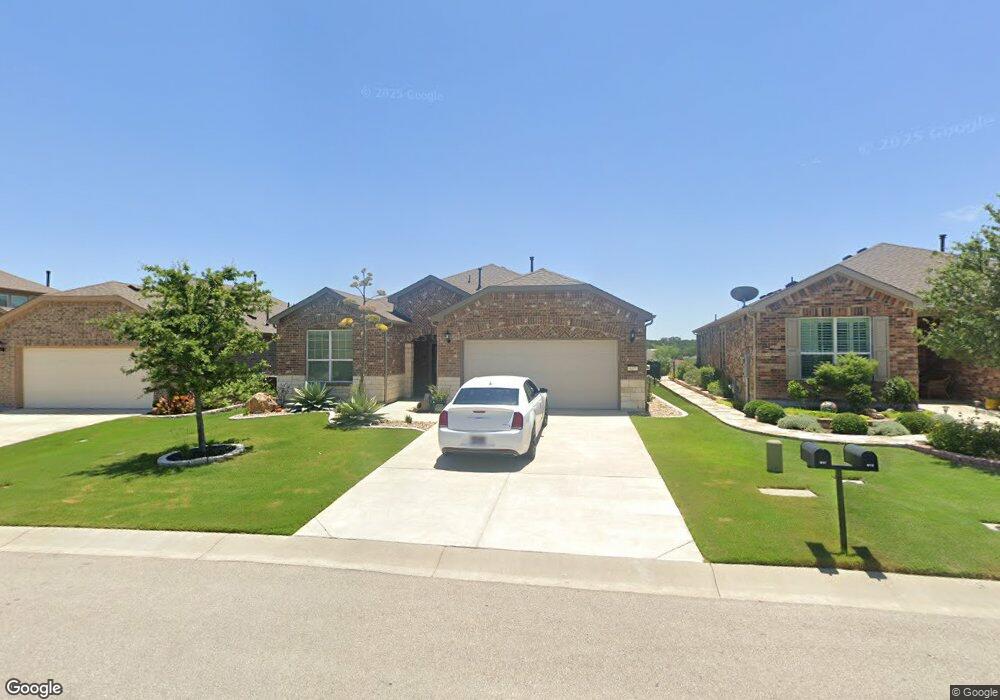
617 Mangrum Hill Rd Georgetown, TX 78633
Sun City NeighborhoodEstimated Value: $387,538 - $461,000
--
Bed
--
Bath
1,715
Sq Ft
$248/Sq Ft
Est. Value
About This Home
This home is located at 617 Mangrum Hill Rd, Georgetown, TX 78633 and is currently estimated at $424,885, approximately $247 per square foot. 617 Mangrum Hill Rd is a home.
Ownership History
Date
Name
Owned For
Owner Type
Purchase Details
Closed on
Sep 15, 2021
Sold by
Stickrod John M and Stickrod Linda K
Bought by
Stickrod John M and Stickrod Linda K
Current Estimated Value
Purchase Details
Closed on
Feb 2, 2016
Sold by
Del Webb Texas Limited Partnership
Bought by
Stickrod John M and Stickrod Linda K
Home Financials for this Owner
Home Financials are based on the most recent Mortgage that was taken out on this home.
Original Mortgage
$138,706
Outstanding Balance
$110,717
Interest Rate
3.99%
Mortgage Type
New Conventional
Estimated Equity
$314,168
Create a Home Valuation Report for This Property
The Home Valuation Report is an in-depth analysis detailing your home's value as well as a comparison with similar homes in the area
Home Values in the Area
Average Home Value in this Area
Purchase History
| Date | Buyer | Sale Price | Title Company |
|---|---|---|---|
| Stickrod John M | -- | None Available | |
| Stickrod John M | -- | Attorney |
Source: Public Records
Mortgage History
| Date | Status | Borrower | Loan Amount |
|---|---|---|---|
| Open | Stickrod John M | $138,706 |
Source: Public Records
Tax History Compared to Growth
Tax History
| Year | Tax Paid | Tax Assessment Tax Assessment Total Assessment is a certain percentage of the fair market value that is determined by local assessors to be the total taxable value of land and additions on the property. | Land | Improvement |
|---|---|---|---|---|
| 2025 | $3,374 | $404,363 | $84,000 | $320,363 |
| 2024 | $3,374 | $416,038 | $90,000 | $326,038 |
| 2023 | $3,284 | $402,915 | $0 | $0 |
| 2022 | $8,749 | $445,659 | $80,000 | $365,659 |
| 2021 | $7,272 | $332,987 | $65,000 | $267,987 |
| 2020 | $6,782 | $305,806 | $57,150 | $248,656 |
| 2019 | $7,446 | $325,449 | $55,640 | $269,809 |
| 2018 | $5,319 | $324,711 | $55,640 | $269,071 |
| 2017 | $7,263 | $314,471 | $52,000 | $262,471 |
| 2016 | $3,473 | $165,238 | $29,564 | $135,674 |
Source: Public Records
Map
Nearby Homes
- 608 Kite Ridge St
- 706 Kite Ridge St
- 226 Fairway Ridge Rd
- 523 McKittrick Ridge Rd
- 100 Landmark Inn Ct
- 130 Old Blue Mountain Ln
- 914 Dome Peak Ln
- 204 Cathedral Mountain Pass
- Delta Plan at Parmer Ranch
- Somerset Plan at Parmer Ranch
- Zavalla Plan at Parmer Ranch
- Hart Plan at Parmer Ranch
- Asherton Plan at Parmer Ranch
- Wichita Plan at Parmer Ranch
- Hideaway Plan at Parmer Ranch
- Gallatin Plan at Parmer Ranch
- Haskell Plan at Parmer Ranch
- Willis Plan at Parmer Ranch
- Troy Plan at Parmer Ranch
- Schertz Plan at Parmer Ranch
- 615 Mangrum Hill Rd
- 619 Mangrum Hill Rd
- 613 Mangrum Hill Rd
- 621 Mangrum Hill Rd
- 611 Mangrum Hill Rd
- 614 Mangrum Hill Rd
- 623 Mangrum Hill Rd
- 616 Mangrum Hill Rd
- 612 Mangrum Hill Rd
- 307 Fairway Ridge Rd
- 305 Fairway Ridge Rd
- 609 Mangrum Hill Rd
- 303 Fairway Ridge Rd
- 610 Mangrum Hill Rd
- 618 Mangrum Hill Rd
- 309 Fairway Ridge Rd
- 301 Fairway Ridge Rd
- 608 Mangrum Hill Rd
- 311 Fairway Ridge Rd
- 607 Mangrum Hill Rd