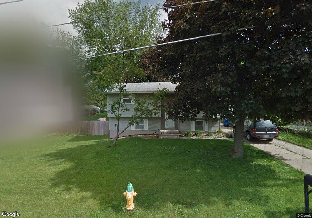
617 Maxwelton Dr Des Moines, IA 50315
Watrous Heights NeighborhoodEstimated Value: $224,000 - $228,000
3
Beds
2
Baths
978
Sq Ft
$231/Sq Ft
Est. Value
About This Home
This home is located at 617 Maxwelton Dr, Des Moines, IA 50315 and is currently estimated at $225,910, approximately $230 per square foot. 617 Maxwelton Dr is a home located in Polk County with nearby schools including South Union Elementary School, Brody Middle School, and Lincoln High School.
Ownership History
Date
Name
Owned For
Owner Type
Purchase Details
Closed on
Sep 2, 2025
Sold by
Polk County
Bought by
Queck Capital Management Llc
Current Estimated Value
Purchase Details
Closed on
Jun 15, 2021
Sold by
Barry David J and Barry Jamie L
Bought by
Depot Properties Llc
Purchase Details
Closed on
Jun 27, 2005
Sold by
Stotts Dean Ralph and Stotts Jerry Charles
Bought by
Barry David J
Create a Home Valuation Report for This Property
The Home Valuation Report is an in-depth analysis detailing your home's value as well as a comparison with similar homes in the area
Home Values in the Area
Average Home Value in this Area
Purchase History
| Date | Buyer | Sale Price | Title Company |
|---|---|---|---|
| Queck Capital Management Llc | $905,500 | None Listed On Document | |
| Depot Properties Llc | -- | None Available | |
| Barry David J | $69,500 | -- |
Source: Public Records
Tax History Compared to Growth
Tax History
| Year | Tax Paid | Tax Assessment Tax Assessment Total Assessment is a certain percentage of the fair market value that is determined by local assessors to be the total taxable value of land and additions on the property. | Land | Improvement |
|---|---|---|---|---|
| 2025 | $3,920 | $225,200 | $37,000 | $188,200 |
| 2024 | $3,920 | $199,300 | $32,200 | $167,100 |
| 2023 | $3,712 | $199,300 | $32,200 | $167,100 |
| 2022 | $3,684 | $157,500 | $26,500 | $131,000 |
| 2021 | $3,690 | $157,500 | $26,500 | $131,000 |
| 2020 | $3,834 | $147,900 | $24,800 | $123,100 |
| 2019 | $3,556 | $147,900 | $24,800 | $123,100 |
| 2018 | $3,520 | $132,300 | $21,700 | $110,600 |
| 2017 | $3,370 | $132,300 | $21,700 | $110,600 |
| 2016 | $2,678 | $124,600 | $20,100 | $104,500 |
| 2015 | $2,678 | $124,600 | $20,100 | $104,500 |
| 2014 | $2,522 | $126,600 | $20,000 | $106,600 |
Source: Public Records
Map
Nearby Homes
- 518 Maxwelton Dr
- 515 Emma Ave
- 612 Emma Ave
- 4204 SW 7th St
- . Herold Ave
- 606 Marion St
- 930 Emma Ave
- 304 Herold Ave
- 936 Mckinley Ave Unit 14
- 115 Mckinley Ave
- 3903 SW 9th St
- 1109 Herold Ave
- 1116 Herold Ave
- 212 Titus Ave
- 520 Hackley Ave
- 1204 Elder Ln
- 1203 Herold Ave
- 299 Hackley Ave
- 1207 Emma Ave
- 102 E Emma Ave
- 619 Maxwelton Dr
- 611 Maxwelton Dr
- 612 Philip St
- 608 Philip St
- 700 Philip St
- 707 Maxwelton Dr
- 612 Maxwelton Dr
- 603 Maxwelton Dr
- 604 Philip St
- 616 Maxwelton Dr
- 608 Maxwelton Dr
- 702 Maxwelton Dr
- 706 Philip St
- 600 Philip St
- 601 Maxwelton Dr
- 706 Maxwelton Dr
- 709 Maxwelton Dr
- 602 Maxwelton Dr
- 4311 SW 7th St
- 524 Philip St