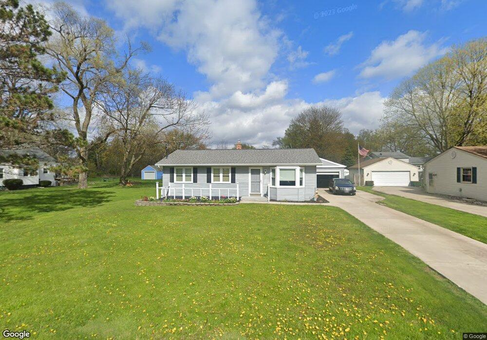
617 Stoll Rd Lansing, MI 48917
Estimated Value: $129,000 - $217,987
3
Beds
2
Baths
1,002
Sq Ft
$183/Sq Ft
Est. Value
About This Home
This home is located at 617 Stoll Rd, Lansing, MI 48917 and is currently estimated at $182,997, approximately $182 per square foot. 617 Stoll Rd is a home located in Eaton County with nearby schools including Waverly Senior High School, Greater Lansing Adventist School, and Montessori Childrens House.
Ownership History
Date
Name
Owned For
Owner Type
Purchase Details
Closed on
Jul 31, 2025
Sold by
Gonzales Robert Andrew
Bought by
Gonzales Robert Andrew and Gonzales Andrew Riley
Current Estimated Value
Purchase Details
Closed on
Mar 20, 2025
Sold by
Eaton County
Bought by
Freedom Mortgage Corporation
Create a Home Valuation Report for This Property
The Home Valuation Report is an in-depth analysis detailing your home's value as well as a comparison with similar homes in the area
Home Values in the Area
Average Home Value in this Area
Purchase History
| Date | Buyer | Sale Price | Title Company |
|---|---|---|---|
| Gonzales Robert Andrew | -- | Greater Lansing Title & Escrow | |
| Gonzales Robert Andrew | $127,000 | Greater Lansing Title & Escrow | |
| Gonzales Robert Andrew | $127,000 | Greater Lansing Title & Escrow | |
| Freedom Mortgage Corporation | $123,970 | None Listed On Document |
Source: Public Records
Tax History Compared to Growth
Tax History
| Year | Tax Paid | Tax Assessment Tax Assessment Total Assessment is a certain percentage of the fair market value that is determined by local assessors to be the total taxable value of land and additions on the property. | Land | Improvement |
|---|---|---|---|---|
| 2025 | $2,309 | $82,400 | $0 | $0 |
| 2024 | $1,315 | $80,900 | $0 | $0 |
| 2023 | $1,264 | $74,400 | $0 | $0 |
| 2022 | $2,013 | $64,100 | $0 | $0 |
| 2021 | $1,873 | $59,200 | $0 | $0 |
| 2020 | $1,967 | $54,600 | $0 | $0 |
| 2019 | $1,915 | $50,388 | $0 | $0 |
| 2018 | $1,884 | $49,800 | $0 | $0 |
| 2017 | $1,841 | $47,000 | $0 | $0 |
| 2016 | -- | $41,300 | $0 | $0 |
| 2015 | -- | $40,800 | $0 | $0 |
| 2014 | -- | $39,928 | $0 | $0 |
| 2013 | -- | $39,300 | $0 | $0 |
Source: Public Records
Map
Nearby Homes
- 4616 W St Joe Hwy
- 4819 Moultrie Cir
- 1018 Pickton Dr
- 916 Westover Cir
- 210 Park Meadows Dr Unit 25
- 1109 Boulder Ct Unit 46
- 918 Harvest Ln
- 1130 Vail Ct Unit 25
- 612 S Dibble Blvd
- 4220 Otis St
- 2517 W Michigan Ave
- 607 S Dibble Blvd
- 0 S Dibble Blvd
- 516 Hume Blvd
- 215 Winifred Ave Unit A & B
- 5525 W St Joe Hwy Unit A8
- 205 Renker Rd
- 5535 W St Joe Hwy Unit B12
- 5535 W St Joe Hwy Unit B3
- 5538 W St Joe Hwy
- 619 Stoll Rd
- 615 Stoll Rd
- 4636 W St Joe Hwy
- 4646 W St Joe Hwy
- 622 Stoll Rd
- 4628 W St Joe Hwy
- 535 Stoll Rd
- 610 Stoll Rd
- 4800 W St Joe Hwy
- 536 Stoll Rd
- 4802 W St Joe Hwy
- 530 Stoll Rd
- 4707 W St Joe Hwy
- 4802 W Saint Joe Hwy
- 4703 W St Joe Hwy
- 4711 W St Joe Hwy
- 4703 W St Joseph Hwy
- 4711 W St Joe Hwy
- 4711 W St Joseph Hwy
- 4804 W St Joe Hwy