Estimated Value: $373,698 - $411,000
4
Beds
3
Baths
2,320
Sq Ft
$167/Sq Ft
Est. Value
About This Home
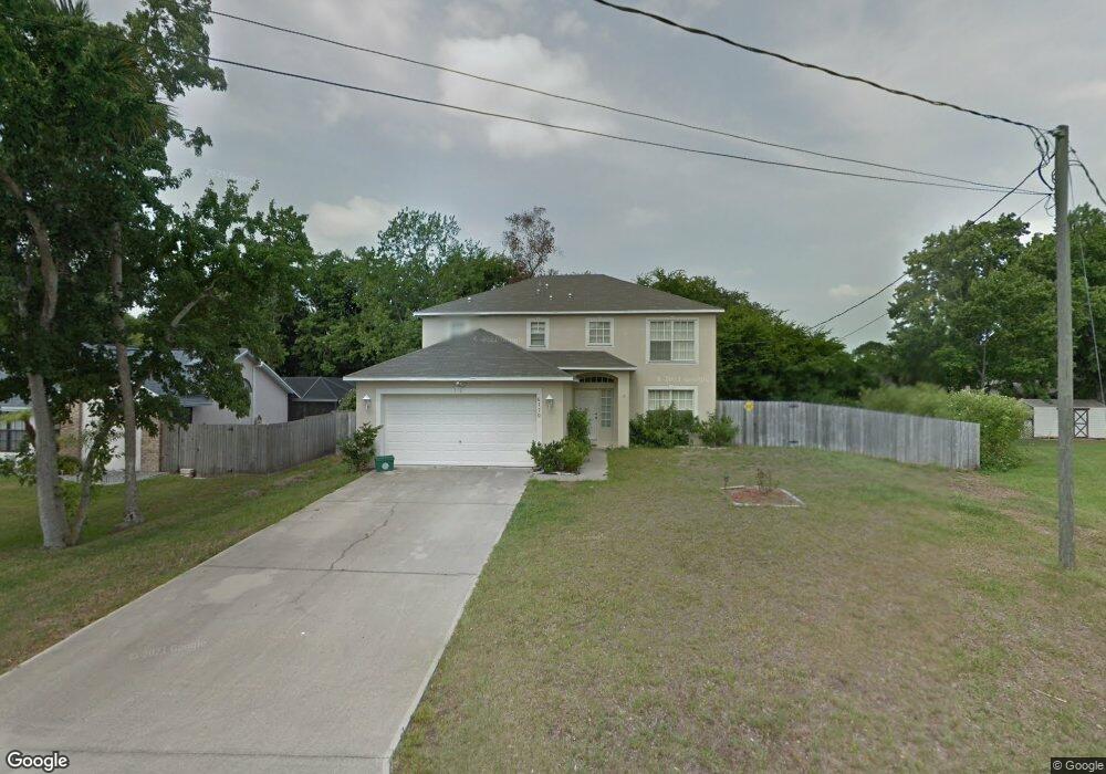
This home is located at 6170 Sunflower Dr, Cocoa, FL 32927 and is currently estimated at $386,925, approximately $166 per square foot. 6170 Sunflower Dr is a home located in Brevard County with nearby schools including Challenger 7 Elementary School, Space Coast Junior/Senior High School, and Sculptor Charter School.
Ownership History
Date
Name
Owned For
Owner Type
Purchase Details
Closed on
Mar 1, 2006
Sold by
Maronda Homes Inc Of Florida
Bought by
Gibbs Stephen A
Current Estimated Value
Home Financials for this Owner
Home Financials are based on the most recent Mortgage that was taken out on this home.
Original Mortgage
$61,780
Outstanding Balance
$34,667
Interest Rate
6.05%
Estimated Equity
$352,258
Purchase Details
Closed on
Dec 15, 2003
Sold by
Jackson James H
Bought by
Lleva E V
Create a Home Valuation Report for This Property
The Home Valuation Report is an in-depth analysis detailing your home's value as well as a comparison with similar homes in the area
Home Values in the Area
Average Home Value in this Area
Purchase History
| Date | Buyer | Sale Price | Title Company |
|---|---|---|---|
| Gibbs Stephen A | $193,200 | Adams Title Inc | |
| Lleva E V | $15,000 | The Title Station Inc |
Source: Public Records
Mortgage History
| Date | Status | Borrower | Loan Amount |
|---|---|---|---|
| Open | Gibbs Stephen A | $61,780 |
Source: Public Records
Tax History
| Year | Tax Paid | Tax Assessment Tax Assessment Total Assessment is a certain percentage of the fair market value that is determined by local assessors to be the total taxable value of land and additions on the property. | Land | Improvement |
|---|---|---|---|---|
| 2025 | $1,914 | $132,620 | -- | -- |
| 2024 | $1,871 | $128,890 | -- | -- |
| 2023 | $1,871 | $125,140 | $0 | $0 |
| 2022 | $1,752 | $121,500 | $0 | $0 |
| 2021 | $1,760 | $117,970 | $0 | $0 |
| 2020 | $1,672 | $116,350 | $0 | $0 |
| 2019 | $1,609 | $113,740 | $0 | $0 |
| 2018 | $1,603 | $111,620 | $0 | $0 |
| 2017 | $1,598 | $109,330 | $0 | $0 |
| 2016 | $1,607 | $107,090 | $18,000 | $89,090 |
| 2015 | $1,632 | $106,350 | $15,000 | $91,350 |
| 2014 | $1,636 | $105,510 | $11,000 | $94,510 |
Source: Public Records
Map
Nearby Homes
- 4975 Fay Blvd
- 6210 Stillwater Ave
- 5265 Fay Blvd
- 6162 Rena Ave
- 6094 Cardiff Ave
- 6375 Cable Ave
- 6310 Depot Ave
- 6398 Cable Ave
- 5215 Holden Rd
- 5220 Holden Rd
- 0000 Grissom Pkwy
- 5221 Carrick Rd
- 6020 Cannon Ave
- 5914 Stillwater Ave
- 5950 Ackard Ave
- 4905 Bridge Rd
- 00 Unknown
- 4590 Ponds Dr
- 4852 Alfred St
- 6620 Grissom Pkwy
- 6164 Sunflower Dr
- 6176 Sunflower Dr
- 6235 Grissom Pkwy
- 6215 Grissom Pkwy
- 6175 Sunflower Dr
- 6158 Sunflower Dr
- 6182 Sunflower Dr
- 6245 Grissom Pkwy
- 6205 Grissom Pkwy
- 6163 Sunflower Dr
- 6181 Sunflower Dr
- 6188 Sunflower Dr
- 6152 Sunflower Dr
- 6157 Sunflower Dr
- 6185 Grissom Pkwy
- 4935 Fay Blvd
- 4985 Fay Blvd
- 6180 Stillwater Ave
- 6194 Sunflower Dr
- 4915 Fay Blvd
Your Personal Tour Guide
Ask me questions while you tour the home.