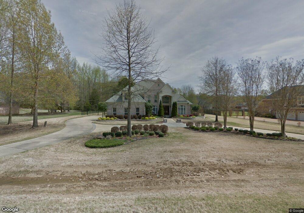
6178 Autumn Point Olive Branch, MS 38654
Pleasant Hill NeighborhoodEstimated Value: $452,000 - $557,000
4
Beds
4
Baths
4,271
Sq Ft
$123/Sq Ft
Est. Value
About This Home
This home is located at 6178 Autumn Point, Olive Branch, MS 38654 and is currently estimated at $525,119, approximately $122 per square foot. 6178 Autumn Point is a home located in DeSoto County with nearby schools including Pleasant Hill Elementary School, DeSoto Central Middle School, and DeSoto Central High School.
Ownership History
Date
Name
Owned For
Owner Type
Purchase Details
Closed on
Dec 4, 2008
Sold by
Calhoun Robert G and Calhoun Patricia A
Bought by
Williams Rickey R and Williams Christine M
Current Estimated Value
Home Financials for this Owner
Home Financials are based on the most recent Mortgage that was taken out on this home.
Original Mortgage
$285,000
Outstanding Balance
$184,315
Interest Rate
5.95%
Mortgage Type
Purchase Money Mortgage
Estimated Equity
$340,804
Create a Home Valuation Report for This Property
The Home Valuation Report is an in-depth analysis detailing your home's value as well as a comparison with similar homes in the area
Home Values in the Area
Average Home Value in this Area
Purchase History
| Date | Buyer | Sale Price | Title Company |
|---|---|---|---|
| Williams Rickey R | -- | Old Colonial Title |
Source: Public Records
Mortgage History
| Date | Status | Borrower | Loan Amount |
|---|---|---|---|
| Open | Williams Rickey R | $285,000 |
Source: Public Records
Tax History Compared to Growth
Tax History
| Year | Tax Paid | Tax Assessment Tax Assessment Total Assessment is a certain percentage of the fair market value that is determined by local assessors to be the total taxable value of land and additions on the property. | Land | Improvement |
|---|---|---|---|---|
| 2025 | $4,163 | $30,504 | $4,000 | $26,504 |
| 2024 | $3,140 | $30,504 | $4,000 | $26,504 |
| 2023 | $3,140 | $30,504 | $0 | $0 |
| 2022 | $3,140 | $30,504 | $4,000 | $26,504 |
| 2021 | $3,140 | $30,504 | $4,000 | $26,504 |
| 2020 | $3,140 | $30,504 | $4,000 | $26,504 |
| 2019 | $3,863 | $30,504 | $4,000 | $26,504 |
| 2017 | $3,780 | $55,478 | $29,739 | $25,739 |
| 2016 | $3,780 | $29,739 | $4,000 | $25,739 |
| 2015 | $4,080 | $55,478 | $29,739 | $25,739 |
| 2014 | $3,780 | $29,739 | $0 | $0 |
| 2013 | $3,765 | $29,739 | $0 | $0 |
Source: Public Records
Map
Nearby Homes
- 6375 Darren Dr
- 6628 Sundance Dr
- 6384 Acree Woods Dr
- 6502 Timber Oaks Dr
- 6760 Autumn Oaks Dr
- 6658 Indigo Lake Dr
- 6459 Cheyenne Dr
- 6923 Silver Cloud Cove
- 0 S Hamilton Cir
- 7056 Apache Dr
- 6934 Sunrise Loop W
- 6647 Renee Dr
- 6015 Callaway Cove
- 5217 Nail Rd
- 6650 Player Dr
- 6570 Masters Dr
- 6555 Masters Dr
- 6919 Oak Forest Dr
- 7501 Iron Loop
- 5045 Saint Andrews Cove
- 6158 Autumn Point
- 26 Autumn Point
- 6 Autumn Point
- 6237 Autumn Point
- 6175 Autumn Oaks Dr
- 6218 Autumn Point
- 6138 Autumn Point
- 6155 Autumn Oaks Dr
- 6175 Autumn Point
- 6177 Autumn Point
- 6197 Autumn Point
- 6157 Autumn Point
- 6215 Autumn Oaks Dr
- 6135 Autumn Oaks Dr
- 6195 Autumn Oaks Dr
- 6217 Autumn Point
- 6238 Autumn Point
- 6137 Autumn Point
- 6108 Autumn Point
- 6100 Autumn Point