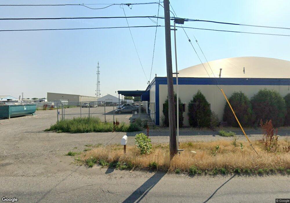
619 Daniel St Billings, MT 59101
East Central Billings Neighborhood
--
Bed
--
Bath
14,000
Sq Ft
0.8
Acres
About This Home
This home is located at 619 Daniel St, Billings, MT 59101. 619 Daniel St is a home located in Yellowstone County with nearby schools including Washington School, Lewis & Clark Junior High School, and Billings West High School.
Ownership History
Date
Name
Owned For
Owner Type
Purchase Details
Closed on
Jul 30, 2020
Sold by
Kirkness R D
Bought by
A & T Rentals Llc
Purchase Details
Closed on
May 22, 2013
Sold by
Leopard Bow Llc
Bought by
Kirkness R D
Home Financials for this Owner
Home Financials are based on the most recent Mortgage that was taken out on this home.
Original Mortgage
$422,700
Interest Rate
3.41%
Mortgage Type
Commercial
Create a Home Valuation Report for This Property
The Home Valuation Report is an in-depth analysis detailing your home's value as well as a comparison with similar homes in the area
Home Values in the Area
Average Home Value in this Area
Purchase History
| Date | Buyer | Sale Price | Title Company |
|---|---|---|---|
| A & T Rentals Llc | -- | Chicago Title | |
| Kirkness R D | -- | Chicago Title |
Source: Public Records
Mortgage History
| Date | Status | Borrower | Loan Amount |
|---|---|---|---|
| Previous Owner | Kirkness R D | $422,700 |
Source: Public Records
Tax History Compared to Growth
Tax History
| Year | Tax Paid | Tax Assessment Tax Assessment Total Assessment is a certain percentage of the fair market value that is determined by local assessors to be the total taxable value of land and additions on the property. | Land | Improvement |
|---|---|---|---|---|
| 2025 | $9,228 | $875,100 | $349,280 | $525,820 |
| 2024 | $9,228 | $640,700 | $262,174 | $378,526 |
| 2023 | $9,547 | $640,700 | $262,174 | $378,526 |
| 2022 | $8,174 | $618,400 | $0 | $0 |
| 2021 | $9,776 | $618,400 | $0 | $0 |
| 2020 | $8,952 | $535,400 | $0 | $0 |
| 2019 | $8,561 | $535,400 | $0 | $0 |
| 2018 | $8,749 | $541,800 | $0 | $0 |
| 2017 | $7,021 | $541,800 | $0 | $0 |
| 2016 | $7,840 | $502,922 | $0 | $0 |
| 2015 | $7,665 | $502,922 | $0 | $0 |
| 2014 | $6,992 | $338,257 | $0 | $0 |
Source: Public Records
Map
Nearby Homes
- 12 Macarthur Ave
- 19 Patton Ave
- 231 S 12th St W
- 2014 George St
- 141 S 12th St W
- 1219 Fairvale Dr
- 2016 Monad Rd
- 226 Moore Ln
- 240 Birchwood Dr
- 1212 Concord Dr
- 2109 George St
- 1205 Lynn Ave
- 669 S 22nd St W
- 126 Ardmore Dr
- 1231 Saint Johns Ave
- 1113 Lynn Ave
- 16 19th St W
- 1532 Howard Ave
- 2225 Rosebud Dr
- 28 19th St W
- 525 Daniel St
- 609 Charles St
- 609 Charles (Lease)
- 457 Daniel Street A Lease
- 457 Daniel St B-1 Lease
- 43 Macarthur Ave
- 6 Marshall Dr
- 41 Macarthur Ave
- 39 Macarthur Ave
- 5448 Laurel Rd
- 8 Marshall Dr
- 37 Macarthur Ave
- 39 Mac Arthur Ave
- 35 Macarthur Ave
- 10 Marshall Dr
- 33 Macarthur Ave
- 42 Macarthur Ave
- 40 Mac Arthur Ave
- 12 Marshall Dr
- 31 Macarthur Ave