
Seller's Agent in 2025
Eric Russell
RE/MAX
(740) 953-1134
51 in this area
149 Total Sales
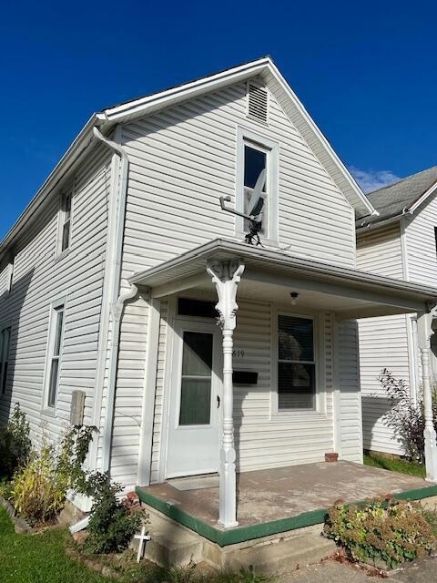
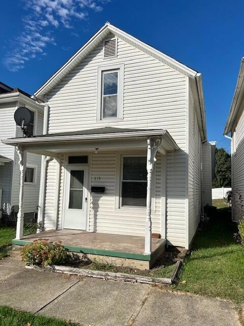
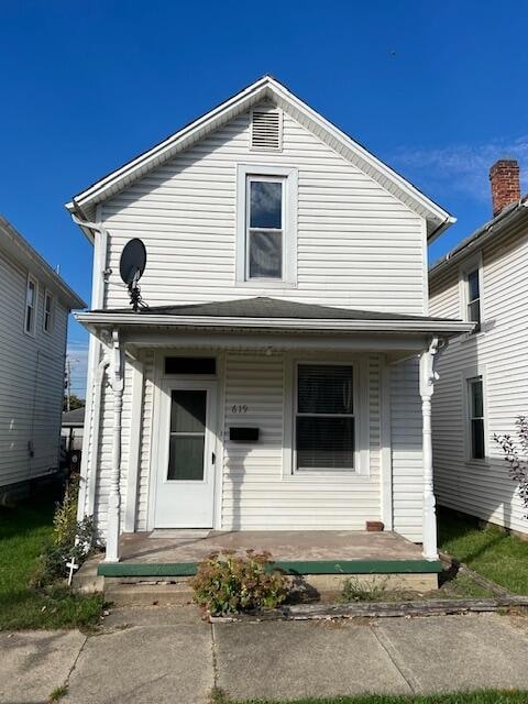
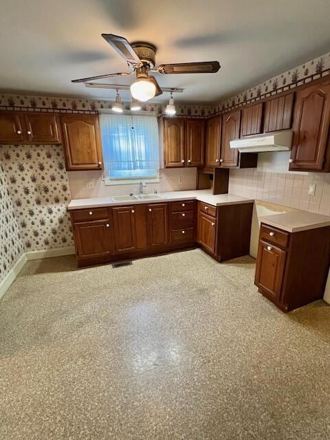
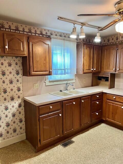
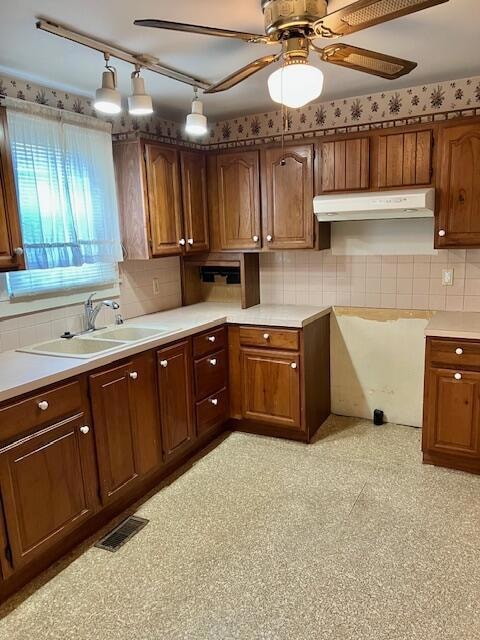
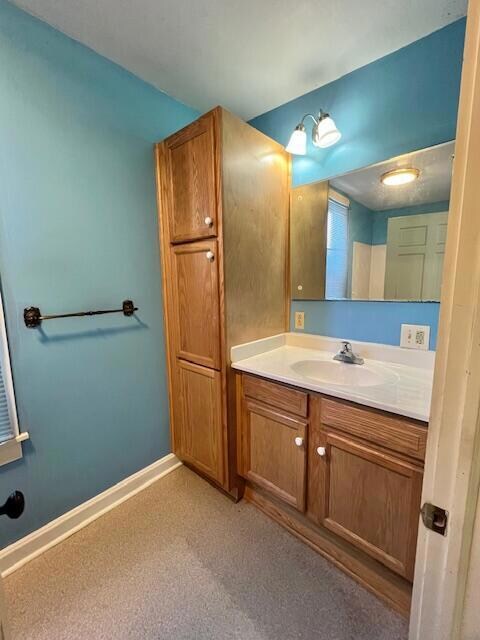
INVESTORS.....Looking to pick up another rental? Add new carpet and appliances and this one is ready to go! Well maintained, Great Kitchen with abundant cabinetry, Nice size Bathroom, Large rooms. Rear deck and alley access with off-street parking. Central location.
| Date | Type | Sale Price | Title Company |
|---|---|---|---|
| Warranty Deed | $125,000 | Valmer Land Title | |
| Deed | $33,000 | -- | |
| Deed | $25,000 | -- | |
| Deed | $34,000 | -- |
| Date | Event | Price | List to Sale | Price per Sq Ft |
|---|---|---|---|---|
| 11/07/2025 11/07/25 | Sold | $125,000 | -4.6% | $103 / Sq Ft |
| 10/28/2025 10/28/25 | Pending | -- | -- | -- |
| 10/18/2025 10/18/25 | For Sale | $131,000 | -- | $108 / Sq Ft |
| Year | Tax Paid | Tax Assessment Tax Assessment Total Assessment is a certain percentage of the fair market value that is determined by local assessors to be the total taxable value of land and additions on the property. | Land | Improvement |
|---|---|---|---|---|
| 2025 | $3,293 | $45,080 | $10,080 | $35,000 |
| 2024 | $3,293 | $36,630 | $4,860 | $31,770 |
| 2023 | $1,361 | $36,630 | $4,860 | $31,770 |
| 2022 | $1,369 | $36,630 | $4,860 | $31,770 |
| 2021 | $1,158 | $29,030 | $4,860 | $24,170 |
| 2020 | $1,164 | $29,030 | $4,860 | $24,170 |
| 2019 | $1,057 | $29,030 | $4,860 | $24,170 |
| 2018 | $768 | $21,620 | $4,860 | $16,760 |
| 2017 | $768 | $20,020 | $4,680 | $15,340 |
| 2016 | $749 | $20,020 | $4,680 | $15,340 |
| 2015 | $744 | $19,310 | $4,680 | $14,630 |
| 2014 | $710 | $19,310 | $4,680 | $14,630 |
| 2013 | $710 | $19,310 | $4,680 | $14,630 |
Seller's Agent in 2025
Eric Russell
RE/MAX
(740) 953-1134
51 in this area
149 Total Sales
Source: Columbus and Central Ohio Regional MLS
MLS Number: 225039647
APN: 05-33048-200
Disclaimer: Certain information contained herein is derived from information provided by parties other than Homes.com. All information provided is deemed reliable, but is not guaranteed to be accurate and should be independently verified.
![]() IDX information is provided exclusively for personal, non-commercial use, and may not be used for any purpose other than to identify prospective properties consumers may be interested in purchasing.
IDX information is provided exclusively for personal, non-commercial use, and may not be used for any purpose other than to identify prospective properties consumers may be interested in purchasing.
Information is deemed reliable but not guaranteed.
Ask me questions while you tour the home.