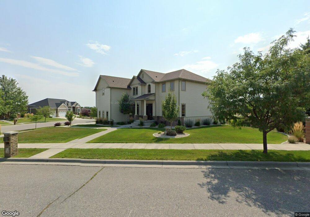
6190 Aviara Blvd Billings, MT 59106
West Shiloh NeighborhoodEstimated Value: $685,277 - $907,000
4
Beds
4
Baths
3,576
Sq Ft
$212/Sq Ft
Est. Value
About This Home
This home is located at 6190 Aviara Blvd, Billings, MT 59106 and is currently estimated at $758,319, approximately $212 per square foot. 6190 Aviara Blvd is a home located in Yellowstone County with nearby schools including Boulder School, Ben Steele Middle School, and Billings West High School.
Ownership History
Date
Name
Owned For
Owner Type
Purchase Details
Closed on
Apr 28, 2010
Sold by
Dan Fleury Construction Co
Bought by
Johnson Eric G and Johnson Catherine L
Current Estimated Value
Home Financials for this Owner
Home Financials are based on the most recent Mortgage that was taken out on this home.
Original Mortgage
$388,800
Outstanding Balance
$258,932
Interest Rate
4.92%
Mortgage Type
New Conventional
Estimated Equity
$499,387
Purchase Details
Closed on
Feb 13, 2009
Sold by
Aviara Inc
Bought by
Dan Fleury Construction Co
Create a Home Valuation Report for This Property
The Home Valuation Report is an in-depth analysis detailing your home's value as well as a comparison with similar homes in the area
Home Values in the Area
Average Home Value in this Area
Purchase History
| Date | Buyer | Sale Price | Title Company |
|---|---|---|---|
| Johnson Eric G | -- | None Available | |
| Dan Fleury Construction Co | -- | None Available |
Source: Public Records
Mortgage History
| Date | Status | Borrower | Loan Amount |
|---|---|---|---|
| Open | Johnson Eric G | $388,800 | |
| Closed | Johnson Eric G | $43,606 |
Source: Public Records
Tax History Compared to Growth
Tax History
| Year | Tax Paid | Tax Assessment Tax Assessment Total Assessment is a certain percentage of the fair market value that is determined by local assessors to be the total taxable value of land and additions on the property. | Land | Improvement |
|---|---|---|---|---|
| 2025 | $6,468 | $849,200 | $135,203 | $713,997 |
| 2024 | $6,468 | $677,000 | $117,020 | $559,980 |
| 2023 | $6,461 | $677,000 | $117,020 | $559,980 |
| 2022 | $5,428 | $496,500 | $0 | $0 |
| 2021 | $5,132 | $496,500 | $0 | $0 |
| 2020 | $5,021 | $465,000 | $0 | $0 |
| 2019 | $4,789 | $465,000 | $0 | $0 |
| 2018 | $5,039 | $482,600 | $0 | $0 |
| 2017 | $4,467 | $482,600 | $0 | $0 |
| 2016 | $4,765 | $475,900 | $0 | $0 |
| 2015 | $4,658 | $475,900 | $0 | $0 |
| 2014 | $5,081 | $278,621 | $0 | $0 |
Source: Public Records
Map
Nearby Homes
- 3671 Spalding Ave
- 6116 Sam Snead Trail
- 4703 Laila
- 3127 Falcon Cir
- Lot 8 Graphite Dr
- 5810 Sam Snead Trail
- 6433 Southern Bluffs Ln
- 1226 Buffalo Crossing Dr
- 3070 Western Bluffs Blvd
- 3980 Trailwood Dr
- 6389 Signal Peak Ave
- 3976 Woodcreek Dr
- 2923 Eagle Butte Trail
- 3027 Golden Acres Dr
- 3965 Woodcreek Dr
- 6325 Beckville Ln
- 3111 Amelia Cir
- 6307 Absaloka Ln
- 6424 Southern Bluffs Ln
- 3035 Arnold Palmer Dr
- 3536 Dunlop Ave
- 6193 Aviara Blvd
- 3587 Dunlop Ave
- 3533 Dunlop Ave
- 6167 Aviara Blvd
- 3530 Dunlop Ave
- 3678 Spalding Ave
- 6141 Aviara Blvd
- 6130 Aviara Blvd
- 3670 Spalding Ave
- 6123 Aviara Blvd
- 3525 Dunlop Ave
- 3524 Dunlop Ave
- 3640 Spalding Ave
- 3534 Spalding Ave
- 3425 Dunlop Ave
- 3513 Dunlop Ave
- 3524 Spalding Ave
- 3686 Spalding Ave
- 3654 Spalding Ave