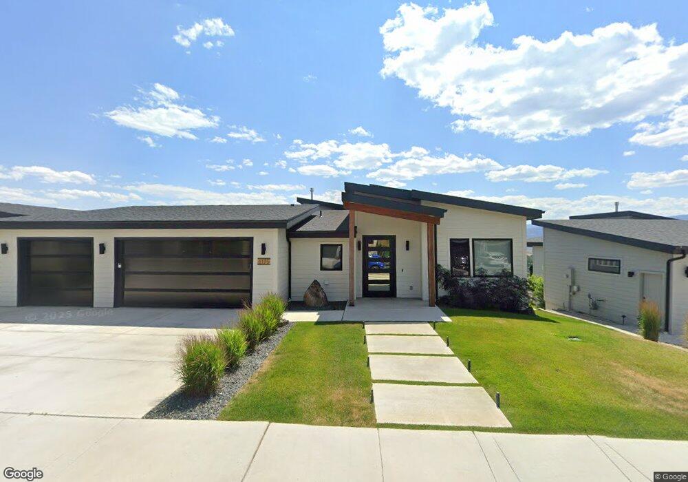
6195 Macarthur Dr Unit Lot 36a Missoula, MT 59808
Estimated Value: $860,000 - $1,010,072
4
Beds
4
Baths
1,895
Sq Ft
$481/Sq Ft
Est. Value
About This Home
This home is located at 6195 Macarthur Dr Unit Lot 36a, Missoula, MT 59808 and is currently estimated at $911,768, approximately $481 per square foot. 6195 Macarthur Dr Unit Lot 36a is a home located in Missoula County with nearby schools including De Smet Elementary School, DeSmet Junior High School, and Big Sky High School.
Ownership History
Date
Name
Owned For
Owner Type
Purchase Details
Closed on
May 12, 2023
Sold by
Joyce Brian
Bought by
Robinson Douglas and Loberg Cheryl
Current Estimated Value
Home Financials for this Owner
Home Financials are based on the most recent Mortgage that was taken out on this home.
Original Mortgage
$780,000
Outstanding Balance
$755,134
Interest Rate
5.63%
Mortgage Type
New Conventional
Estimated Equity
$156,634
Purchase Details
Closed on
Feb 1, 2021
Sold by
Circle H Investments Llc
Bought by
Joyce Brian
Home Financials for this Owner
Home Financials are based on the most recent Mortgage that was taken out on this home.
Original Mortgage
$614,583
Interest Rate
2.6%
Mortgage Type
New Conventional
Create a Home Valuation Report for This Property
The Home Valuation Report is an in-depth analysis detailing your home's value as well as a comparison with similar homes in the area
Home Values in the Area
Average Home Value in this Area
Purchase History
| Date | Buyer | Sale Price | Title Company |
|---|---|---|---|
| Robinson Douglas | -- | Fidelity National Title | |
| Robinson Douglas | -- | Fidelity National Title | |
| Joyce Brian | -- | Stewart Title |
Source: Public Records
Mortgage History
| Date | Status | Borrower | Loan Amount |
|---|---|---|---|
| Open | Robinson Douglas | $780,000 | |
| Closed | Robinson Douglas | $780,000 | |
| Previous Owner | Joyce Brian | $614,583 |
Source: Public Records
Tax History Compared to Growth
Tax History
| Year | Tax Paid | Tax Assessment Tax Assessment Total Assessment is a certain percentage of the fair market value that is determined by local assessors to be the total taxable value of land and additions on the property. | Land | Improvement |
|---|---|---|---|---|
| 2025 | $6,770 | $936,800 | $108,949 | $827,851 |
| 2024 | $7,209 | $696,600 | $47,575 | $649,025 |
| 2023 | $6,468 | $686,700 | $47,575 | $639,125 |
| 2022 | $6,055 | $556,900 | $0 | $0 |
| 2021 | $5,131 | $500,199 | $0 | $0 |
| 2020 | $576 | $55,084 | $0 | $0 |
| 2019 | $5 | $8 | $0 | $0 |
| 2018 | $5 | $2 | $0 | $0 |
| 2017 | $1 | $2 | $0 | $0 |
| 2016 | $199 | $20,275 | $0 | $0 |
| 2015 | $186 | $20,275 | $0 | $0 |
| 2014 | $312 | $19,264 | $0 | $0 |
Source: Public Records
Map
Nearby Homes
- 6036 Macarthur Dr
- 1030 Chief Joseph Cluster
- 6601 Goodan Ln
- 7310 Broken Bow Cluster
- 7260 Moon Dancer Cluster
- Nhn Butler Creek Rd
- 7376 Broken Bow Cluster
- 6328 Buena Vista Loop E
- 8925 La Valle Creek Rd
- 401 Expressway
- 5700 Airway Blvd
- 4864 Bordeaux Blvd
- 4724 Canyon Creek Blvd
- 4736 Sonoma St
- 4826 Storehouse Way
- 10248 Covenant Dr
- 4824 Storehouse Way
- 4433 Bordeaux Blvd
- 4411 Bordeaux Blvd Unit B
- Ukn W Broadway St
- 6195 Macarthur Dr
- 6213 Macarthur Dr
- 6159 Macarthur Dr
- 6159 Macarthur Dr Unit Lot 36c
- 6141 Macarthur Dr Unit Lot 37a
- 6249 Macarthur Dr Unit Lot 35a
- 6198 Macarthur Dr
- 6216 Macarthur Dr
- 6216 Macarthur Dr Unit Lot 39c
- 6162 Macarthur Dr
- 6162 Macarthur Dr Unit Lot 40c
- 6105 Macarthur Dr
- 6105 Macarthur Dr Unit Lot 37c
- 6252 Macarthur Dr
- 6252 Macarthur Dr Unit Lot 39a
- 6267 Macarthur Dr
- 6267 Macarthur Dr Unit Lot 34c
- 6144 Macarthur Dr
- 6303 Macarthur Dr
- 6303 Macarthur Dr Unit Lot 34a