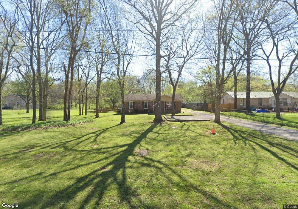
6196 Buckeye Valley Rd Murfreesboro, TN 37129
Estimated Value: $216,000 - $323,000
--
Bed
2
Baths
1,200
Sq Ft
$220/Sq Ft
Est. Value
About This Home
This home is located at 6196 Buckeye Valley Rd, Murfreesboro, TN 37129 and is currently estimated at $264,154, approximately $220 per square foot. 6196 Buckeye Valley Rd is a home located in Rutherford County with nearby schools including Wilson Elementary School, Siegel Middle School, and Siegel High School.
Ownership History
Date
Name
Owned For
Owner Type
Purchase Details
Closed on
Dec 5, 2012
Sold by
Ayers Stephen D
Bought by
Taylor Ricky Darrel
Current Estimated Value
Home Financials for this Owner
Home Financials are based on the most recent Mortgage that was taken out on this home.
Original Mortgage
$49,500
Outstanding Balance
$34,392
Interest Rate
3.43%
Mortgage Type
Commercial
Estimated Equity
$229,762
Purchase Details
Closed on
Jun 20, 2012
Sold by
Mabe Richard D
Bought by
Ayers Stephen D
Purchase Details
Closed on
May 13, 2004
Sold by
Eckerson and Mona
Bought by
Mabe Richard D and Mabe Toni L
Home Financials for this Owner
Home Financials are based on the most recent Mortgage that was taken out on this home.
Original Mortgage
$73,600
Interest Rate
5.49%
Create a Home Valuation Report for This Property
The Home Valuation Report is an in-depth analysis detailing your home's value as well as a comparison with similar homes in the area
Home Values in the Area
Average Home Value in this Area
Purchase History
| Date | Buyer | Sale Price | Title Company |
|---|---|---|---|
| Taylor Ricky Darrel | $66,000 | -- | |
| Ayers Stephen D | $47,780 | -- | |
| Mabe Richard D | $92,000 | -- |
Source: Public Records
Mortgage History
| Date | Status | Borrower | Loan Amount |
|---|---|---|---|
| Open | Taylor Ricky Darrel | $49,500 | |
| Previous Owner | Mabe Richard D | $73,600 | |
| Previous Owner | Mabe Richard D | $18,400 |
Source: Public Records
Tax History Compared to Growth
Tax History
| Year | Tax Paid | Tax Assessment Tax Assessment Total Assessment is a certain percentage of the fair market value that is determined by local assessors to be the total taxable value of land and additions on the property. | Land | Improvement |
|---|---|---|---|---|
| 2025 | $954 | $50,825 | $7,750 | $43,075 |
| 2024 | $954 | $50,825 | $7,750 | $43,075 |
| 2023 | $954 | $50,825 | $7,750 | $43,075 |
| 2022 | $821 | $50,825 | $7,750 | $43,075 |
| 2021 | $699 | $31,500 | $4,750 | $26,750 |
| 2020 | $699 | $31,500 | $4,750 | $26,750 |
| 2019 | $699 | $31,500 | $4,750 | $26,750 |
| 2018 | $661 | $31,500 | $0 | $0 |
| 2017 | $605 | $22,575 | $0 | $0 |
| 2016 | $605 | $22,575 | $0 | $0 |
| 2015 | $605 | $22,575 | $0 | $0 |
| 2014 | $561 | $22,575 | $0 | $0 |
| 2013 | -- | $21,550 | $0 | $0 |
Source: Public Records
Map
Nearby Homes
- 6257 E Buckeye Bottom Rd
- 6031 Buckeye Valley Rd
- 0 W Buckeye Bottom Rd Unit RTC2993710
- 0 W Buckeye Bottom Rd Unit RTC2993704
- 0 Buckeye Bottom Rd Unit RTC2653088
- 3351 Shacklett Rd
- 4408 Alpine Way
- 4360 Oswin Dr
- 4356 Oswin Dr
- 4352 Oswin Dr
- 4348 Oswin Dr
- 4436 Alpine Way
- 4344 Oswin Dr
- 4340 Oswin Dr
- 4336 Oswin Dr
- 4324 Oswin Dr
- 4320 Oswin Dr
- 4920 Leybourne Ln
- 4928 Leybourne Ln
- 4926 Leybourne Ln
- 6158 Buckeye Valley Rd
- 6216 Buckeye Valley Rd
- 6161 E Buckeye Bottom Rd
- 6221 Buckeye Valley Rd
- 6139 E Buckeye Bottom Rd
- 6197 Buckeye Valley Rd
- 6157 Buckeye Valley Rd
- 6021 Buckeye Valley Rd
- 6271 Buckeye Valley Rd
- 6298 Buckeye Valley Rd
- 6305 E Buckeye Bottom Rd
- 6103 E Buckeye Bottom Rd
- 6069 E Buckeye Bottom Rd
- 6310 E Buckeye Bottom Rd
- 6258 E Buckeye Bottom Rd
- 6188 E Buckeye Bottom Rd
- 6336 E Buckeye Bottom Rd
- 6236 E Buckeye Bottom Rd
- 6240 E Buckeye Bottom Rd
- 4750 Sulphur Springs Rd