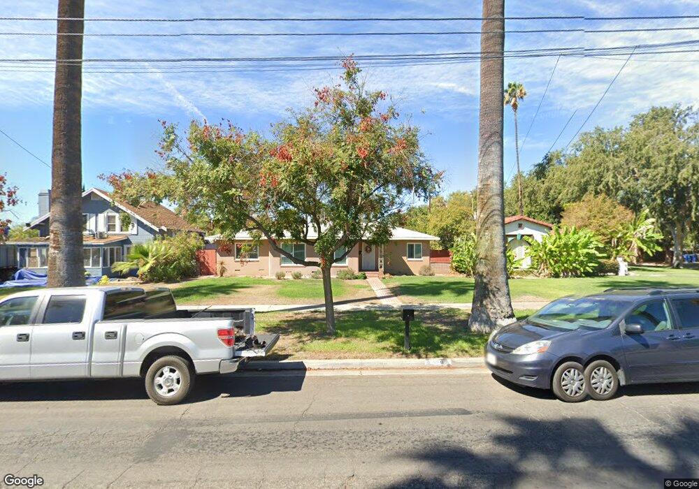
6197 Palm Ave Riverside, CA 92506
Magnolia Center NeighborhoodEstimated Value: $670,000 - $731,000
3
Beds
3
Baths
2,086
Sq Ft
$334/Sq Ft
Est. Value
About This Home
This home is located at 6197 Palm Ave, Riverside, CA 92506 and is currently estimated at $696,642, approximately $333 per square foot. 6197 Palm Ave is a home located in Riverside County with nearby schools including Magnolia Elementary School, Sierra Middle School, and Ramona High School.
Ownership History
Date
Name
Owned For
Owner Type
Purchase Details
Closed on
May 31, 2002
Sold by
Lowe Hazel J
Bought by
Marvin L & Hazel J Lowe Family Trust
Current Estimated Value
Purchase Details
Closed on
Mar 4, 2002
Sold by
Bank Of America Na
Bought by
Lowe Hazel
Purchase Details
Closed on
Aug 24, 2001
Sold by
Atchison Ethel H
Bought by
Bank Of America Na
Purchase Details
Closed on
Nov 20, 1997
Sold by
Atchison Ethel H
Bought by
Atchison Ethel H
Create a Home Valuation Report for This Property
The Home Valuation Report is an in-depth analysis detailing your home's value as well as a comparison with similar homes in the area
Home Values in the Area
Average Home Value in this Area
Purchase History
| Date | Buyer | Sale Price | Title Company |
|---|---|---|---|
| Marvin L & Hazel J Lowe Family Trust | -- | -- | |
| Lowe Hazel | -- | -- | |
| Bank Of America Na | -- | -- | |
| Atchison Ethel H | -- | -- |
Source: Public Records
Tax History
| Year | Tax Paid | Tax Assessment Tax Assessment Total Assessment is a certain percentage of the fair market value that is determined by local assessors to be the total taxable value of land and additions on the property. | Land | Improvement |
|---|---|---|---|---|
| 2025 | $3,394 | $310,205 | $73,852 | $236,353 |
| 2023 | $8,817 | $298,161 | $70,985 | $227,176 |
| 2022 | $8,755 | $292,316 | $69,594 | $222,722 |
| 2021 | $13,318 | $286,585 | $68,230 | $218,355 |
| 2020 | $13,249 | $283,648 | $67,531 | $216,117 |
| 2019 | $13,188 | $278,087 | $66,207 | $211,880 |
| 2018 | $13,121 | $272,635 | $64,909 | $207,726 |
| 2017 | $7,704 | $267,290 | $63,637 | $203,653 |
| 2016 | $2,883 | $262,050 | $62,390 | $199,660 |
| 2015 | $2,842 | $258,115 | $61,453 | $196,662 |
| 2014 | $2,815 | $253,060 | $60,250 | $192,810 |
Source: Public Records
Map
Nearby Homes
- 4660 Cover St
- 4593 Merrill Ave
- 4538 Merrill Ave
- 6176 Wiehe Ave
- 6240 Wiehe Ave
- 4427 Sunnyside Dr
- 4423 Maplewood Place
- 4329 Central Ave
- 4815 Jurupa Ave
- 4831 Jurupa Ave
- 4693 Central Ave
- 4390 Edgewood Place
- 4061 Maplewood Place
- 5654 Tower Rd
- 4939 Plumtree Ct
- 4866 Sunnyside Dr
- 5847 Meadowbrook Ln
- 5604 Tower Rd
- 4685 Rosewood Place
- 6044 Elenor St
Your Personal Tour Guide
Ask me questions while you tour the home.