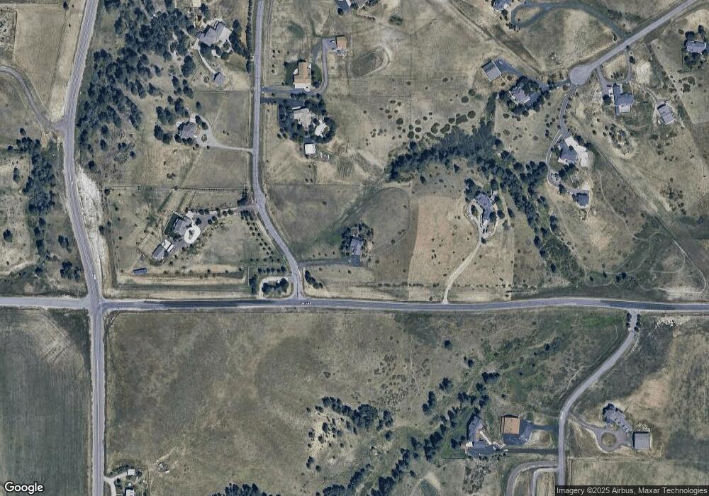
62 Amanda Pines Dr Parker, CO 80138
Estimated Value: $959,000 - $1,371,000
4
Beds
3
Baths
3,092
Sq Ft
$362/Sq Ft
Est. Value
About This Home
This home is located at 62 Amanda Pines Dr, Parker, CO 80138 and is currently estimated at $1,118,588, approximately $361 per square foot. 62 Amanda Pines Dr is a home located in Elbert County with nearby schools including Pine Lane Elementary School, Sierra Middle School, and Chaparral High School.
Ownership History
Date
Name
Owned For
Owner Type
Purchase Details
Closed on
Oct 28, 2004
Sold by
Stuart Charles Gordon and Stuart Mary Jo
Bought by
Moroni Robert J and Moroni Barbara L
Current Estimated Value
Home Financials for this Owner
Home Financials are based on the most recent Mortgage that was taken out on this home.
Original Mortgage
$393,600
Outstanding Balance
$189,448
Interest Rate
5.25%
Mortgage Type
Unknown
Estimated Equity
$929,140
Purchase Details
Closed on
Jun 22, 2001
Sold by
Gutierrez Victor and Gutierrez Imelda
Bought by
Stuart Charles Gordon and Stuart Mary Jo
Home Financials for this Owner
Home Financials are based on the most recent Mortgage that was taken out on this home.
Original Mortgage
$390,000
Interest Rate
7.08%
Create a Home Valuation Report for This Property
The Home Valuation Report is an in-depth analysis detailing your home's value as well as a comparison with similar homes in the area
Home Values in the Area
Average Home Value in this Area
Purchase History
| Date | Buyer | Sale Price | Title Company |
|---|---|---|---|
| Moroni Robert J | $492,000 | -- | |
| Stuart Charles Gordon | $487,500 | -- |
Source: Public Records
Mortgage History
| Date | Status | Borrower | Loan Amount |
|---|---|---|---|
| Open | Moroni Robert J | $393,600 | |
| Previous Owner | Stuart Charles Gordon | $390,000 | |
| Closed | Moroni Robert J | $98,400 |
Source: Public Records
Tax History Compared to Growth
Tax History
| Year | Tax Paid | Tax Assessment Tax Assessment Total Assessment is a certain percentage of the fair market value that is determined by local assessors to be the total taxable value of land and additions on the property. | Land | Improvement |
|---|---|---|---|---|
| 2023 | $4,491 | $53,570 | $16,610 | $36,960 |
| 2022 | $3,743 | $44,800 | $18,070 | $26,730 |
| 2021 | $3,883 | $46,090 | $18,590 | $27,500 |
| 2020 | $3,770 | $44,870 | $11,440 | $33,430 |
| 2019 | $3,783 | $44,870 | $11,440 | $33,430 |
| 2018 | $3,632 | $42,550 | $11,520 | $31,030 |
| 2017 | $3,378 | $42,550 | $11,520 | $31,030 |
| 2016 | $2,920 | $35,830 | $13,930 | $21,900 |
| 2015 | $2,978 | $35,830 | $13,930 | $21,900 |
| 2014 | $2,978 | $33,520 | $13,610 | $19,910 |
Source: Public Records
Map
Nearby Homes
- 46465 Black Spruce Ln
- 12155 Boot Hill Dr
- 12189 Boot Hill Dr
- 44324 N Wrangle Ct Unit 4-5
- 10461 E Black Forest Dr
- Lot 7 Wrangle Ct Unit Lot 7
- Lot 6 Wrangle Ct Unit Lot 6
- 10776 Shadow Pines Ct
- 0 Wrangle Unit REC7383783
- 0 Wrangle Unit REC7377855
- 0 Wrangle Unit REC7101897
- 0 Wrangle Unit REC2190146
- 10874 Shadow Pines Rd
- 10631 Shadow Pines Rd Unit 8
- 10811 Shadow Pines Rd
- 10689 Shadow Pines Rd
- 8230 S White Crow St
- 8255 S Vandriver Way
- 13695 Emerald Lake St
- 2339 Elkhorn St
- 305 County Road 186
- 124 Amanda Pines Dr
- 31 Amanda Pines Dr
- 186 Amanda Pines Dr
- 93 Amanda Pines Dr
- 45925 Kitty Hawk Cir
- 46093 Black Spruce Ln
- 46062 Black Spruce Ln
- 248 Amanda Pines Dr
- 155 Amanda Pines Dr
- 46155 Black Spruce Ln
- 46124 Black Spruce Ln
- 217 Amanda Pines Dr
- 45844 County Road 1
- 45940 Kitty Hawk Cir
- 45855 Kitty Hawk Cir
- 310 Amanda Pines Dr
- 279 Amanda Pines Dr
- 558 Amanda Pines Dr
- 45720 Kitty Hawk Cir
