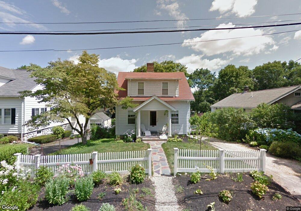
62 Farmcrest Ave Lexington, MA 02421
Follen Heights NeighborhoodEstimated Value: $981,020 - $1,201,000
2
Beds
1
Bath
1,224
Sq Ft
$881/Sq Ft
Est. Value
About This Home
This home is located at 62 Farmcrest Ave, Lexington, MA 02421 and is currently estimated at $1,078,005, approximately $880 per square foot. 62 Farmcrest Ave is a home located in Middlesex County with nearby schools including Bridge Elementary School, Jonas Clarke Middle School, and Lexington High School.
Ownership History
Date
Name
Owned For
Owner Type
Purchase Details
Closed on
Oct 27, 2015
Sold by
Cates William J and Thomas Walter A
Bought by
Hartshorn Heather L
Current Estimated Value
Home Financials for this Owner
Home Financials are based on the most recent Mortgage that was taken out on this home.
Original Mortgage
$347,000
Outstanding Balance
$209,668
Interest Rate
3.9%
Mortgage Type
New Conventional
Estimated Equity
$868,337
Purchase Details
Closed on
Jun 3, 2011
Sold by
Ulla V Lund T
Bought by
Cates William J and Hartshorn Heather L
Home Financials for this Owner
Home Financials are based on the most recent Mortgage that was taken out on this home.
Original Mortgage
$364,080
Interest Rate
4.85%
Mortgage Type
Purchase Money Mortgage
Create a Home Valuation Report for This Property
The Home Valuation Report is an in-depth analysis detailing your home's value as well as a comparison with similar homes in the area
Home Values in the Area
Average Home Value in this Area
Purchase History
| Date | Buyer | Sale Price | Title Company |
|---|---|---|---|
| Hartshorn Heather L | -- | -- | |
| Cates William J | $455,100 | -- |
Source: Public Records
Mortgage History
| Date | Status | Borrower | Loan Amount |
|---|---|---|---|
| Open | Hartshorn Heather L | $347,000 | |
| Previous Owner | Cates William J | $364,080 |
Source: Public Records
Tax History Compared to Growth
Tax History
| Year | Tax Paid | Tax Assessment Tax Assessment Total Assessment is a certain percentage of the fair market value that is determined by local assessors to be the total taxable value of land and additions on the property. | Land | Improvement |
|---|---|---|---|---|
| 2025 | $10,530 | $861,000 | $628,000 | $233,000 |
| 2024 | $9,972 | $814,000 | $598,000 | $216,000 |
| 2023 | $9,633 | $741,000 | $543,000 | $198,000 |
| 2022 | $9,274 | $672,000 | $494,000 | $178,000 |
| 2021 | $9,195 | $639,000 | $470,000 | $169,000 |
| 2020 | $8,908 | $634,000 | $470,000 | $164,000 |
| 2019 | $8,543 | $605,000 | $448,000 | $157,000 |
| 2018 | $8,122 | $568,000 | $427,000 | $141,000 |
| 2017 | $7,390 | $510,000 | $394,000 | $116,000 |
| 2016 | $7,183 | $492,000 | $375,000 | $117,000 |
| 2015 | $6,850 | $461,000 | $341,000 | $120,000 |
| 2014 | $6,669 | $430,000 | $303,000 | $127,000 |
Source: Public Records
Map
Nearby Homes
- 42 Grapevine Ave
- 21 Valleyfield St
- 69 Bridge St
- 70 Valleyfield St
- 375 Marrett Rd
- 17 Prospect Hill Rd
- 20 Loring Rd
- 383 Marrett Rd
- 48 Sherburne Rd
- 2 Marlboro Rd
- 34 Allen St
- 42 Winthrop Rd
- 1 Tricorne Rd
- 10 Eliot Rd
- 1 Beech Tree Ln
- 2 Percy Rd
- 20 Marrett Rd
- 32 Forest St
- 1437 Massachusetts Ave
- 36 Independence Ave
- 64 Farmcrest Ave
- 58 Farmcrest Ave
- 248 Marrett Rd
- 250 Marrett Rd
- 68 Farmcrest Ave
- 54 Farmcrest Ave
- 252 Marrett Rd
- 59 Farmcrest Ave
- 63 Farmcrest Ave
- 55 Farmcrest Ave
- 67 Farmcrest Ave
- 52 Farmcrest Ave
- 260 Marrett Rd
- 51 Farmcrest Ave
- 71 Farmcrest Ave
- 262 Marrett Rd
- 46 Farmcrest Ave
- 20 Hilltop Ave
- 18 Hilltop Ave
- 22 Hilltop Ave