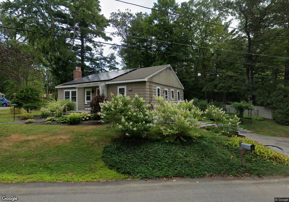
62 Muster Rd Conway, NH 03818
Estimated Value: $316,000 - $366,000
3
Beds
1
Bath
1,271
Sq Ft
$274/Sq Ft
Est. Value
About This Home
This home is located at 62 Muster Rd, Conway, NH 03818 and is currently estimated at $348,733, approximately $274 per square foot. 62 Muster Rd is a home located in Carroll County with nearby schools including A. Crosby Kennett Middle School, Kennett High School, and Robert Frost Charter School.
Create a Home Valuation Report for This Property
The Home Valuation Report is an in-depth analysis detailing your home's value as well as a comparison with similar homes in the area
Home Values in the Area
Average Home Value in this Area
Tax History Compared to Growth
Tax History
| Year | Tax Paid | Tax Assessment Tax Assessment Total Assessment is a certain percentage of the fair market value that is determined by local assessors to be the total taxable value of land and additions on the property. | Land | Improvement |
|---|---|---|---|---|
| 2024 | $4,347 | $338,300 | $102,100 | $236,200 |
| 2023 | $3,943 | $330,800 | $102,100 | $228,700 |
| 2022 | $3,489 | $179,300 | $59,200 | $120,100 |
| 2021 | $2,930 | $179,300 | $59,200 | $120,100 |
| 2020 | $3,292 | $179,300 | $59,200 | $120,100 |
| 2019 | $3,105 | $179,300 | $59,200 | $120,100 |
| 2018 | $3,378 | $155,400 | $59,200 | $96,200 |
| 2017 | $3,105 | $155,400 | $59,200 | $96,200 |
| 2016 | $3,001 | $155,400 | $59,200 | $96,200 |
| 2015 | $2,967 | $155,400 | $59,200 | $96,200 |
| 2014 | $2,931 | $155,400 | $59,200 | $96,200 |
| 2013 | $2,749 | $153,900 | $59,200 | $94,700 |
Source: Public Records
Map
Nearby Homes
- 0 W Side Rd Unit 54 5049810
- 20 Washington St
- 6 Main St
- 9 E Side Rd
- 115 Swift Valley Rd
- 58 Wilder St
- 515 W Side Rd
- 196 E Main St Unit 5 (old 103)
- 40 Butternut Ln
- 123 Oxbow Ln
- 237 Eaton Rd
- 77 Kennett St
- 27 Firelite Rd
- 65 Westwind Dr
- 66 Lamplighter's Dr
- 74 Lamplighter's Dr
- 39 Vista View Rd Unit D1
- 15 Trailer Ave
- 64 Grandview Rd
- 68 Grandview Rd
- 142 Hillside Ave
- 52 Muster Rd
- 147 Hillside Ave
- 174 Hillside Ave
- 47 Hillside Ave
- 45 Muster Rd
- 92 Hillside Ave
- 38 Muster Rd
- 159 Hillside Ave
- 190 Hillside Ave
- 125 Hillside Ave
- 171 Hillside Ave
- 119 Hillside Ave
- 68 Hillside Ave
- 187 Hillside Ave
- 113 Hillside Ave
- 30 Muster Rd
- 193 Hillside Ave
- 27 Muster Rd
- 105 Hillside Ave