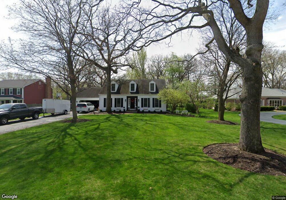
62 Orchard Ave Oswego, IL 60543
North Oswego NeighborhoodEstimated Value: $425,000 - $455,000
3
Beds
2
Baths
2,171
Sq Ft
$201/Sq Ft
Est. Value
About This Home
This home is located at 62 Orchard Ave, Oswego, IL 60543 and is currently estimated at $435,948, approximately $200 per square foot. 62 Orchard Ave is a home located in Kendall County with nearby schools including Old Post Elementary School, Thompson Jr. High School, and Oswego High School.
Ownership History
Date
Name
Owned For
Owner Type
Purchase Details
Closed on
Dec 30, 2008
Sold by
Johnson Jack T and Johnson Sandra Ann
Bought by
Johnson Sandra A
Current Estimated Value
Purchase Details
Closed on
Dec 1, 1994
Bought by
Johnson Jack T and Sandra Ann
Purchase Details
Closed on
Aug 1, 1987
Create a Home Valuation Report for This Property
The Home Valuation Report is an in-depth analysis detailing your home's value as well as a comparison with similar homes in the area
Home Values in the Area
Average Home Value in this Area
Purchase History
| Date | Buyer | Sale Price | Title Company |
|---|---|---|---|
| Johnson Sandra A | -- | None Available | |
| Johnson Jack T | $230,000 | -- | |
| -- | $165,000 | -- |
Source: Public Records
Mortgage History
| Date | Status | Borrower | Loan Amount |
|---|---|---|---|
| Closed | Johnson Jack T | -- |
Source: Public Records
Tax History Compared to Growth
Tax History
| Year | Tax Paid | Tax Assessment Tax Assessment Total Assessment is a certain percentage of the fair market value that is determined by local assessors to be the total taxable value of land and additions on the property. | Land | Improvement |
|---|---|---|---|---|
| 2024 | $9,772 | $132,429 | $25,155 | $107,274 |
| 2023 | $8,801 | $119,305 | $22,662 | $96,643 |
| 2022 | $8,801 | $108,459 | $20,602 | $87,857 |
| 2021 | $8,006 | $104,288 | $19,810 | $84,478 |
| 2020 | $8,085 | $96,563 | $18,343 | $78,220 |
| 2019 | $7,722 | $91,446 | $18,343 | $73,103 |
| 2018 | $7,936 | $89,390 | $17,931 | $71,459 |
| 2017 | $8,036 | $89,390 | $17,931 | $71,459 |
| 2016 | $7,883 | $86,787 | $17,409 | $69,378 |
| 2015 | $8,082 | $85,086 | $17,068 | $68,018 |
| 2014 | -- | $82,608 | $16,571 | $66,037 |
| 2013 | -- | $83,442 | $16,738 | $66,704 |
Source: Public Records
Map
Nearby Homes
- 3 Orchard Rd
- 123 Orchard Rd
- 2 Orchard Rd
- 1451 Vintage Dr
- 22 Sherwick Rd
- 170 Chicago Rd
- 156 River Mist Dr
- 141 River Mist Dr
- 2110 State Route 31
- 55 Garfield St
- 34 N Adams St
- 101 Bell Ct
- 420 Chesterfield Ct Unit 420
- 9 Cebold Dr
- 177 Franklin St
- 4 Circle Ct
- 621 Mansfield Way
- 613 Murdock Place
- 388 Danforth Dr
- 423 Hathaway Ln
- 206 Orchard Ave
- 34 Oakwood Dr
- 129 Orchard Ave
- 26 Oakwood Dr
- 208 Orchard Ave
- 3 Sherwood Dr
- 5 Orchard Ave
- 1 Partridge Square Unit 1
- 48 Oakwood Dr
- 7 Sherwood Dr
- 2 Partridge Square
- 14 Oakwood Dr
- 40 Orchard Ave
- 211 Orchard Ave Unit 1
- 210 Orchard Ave
- 4 Partridge Square
- 25 Oakwood Dr
- 3 Partridge Square
- 47 Oakwood Dr
- 54 Oakwood Dr