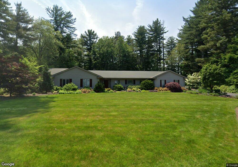
62 Prynne Ridge Rd Longmeadow, MA 01106
Estimated Value: $899,000 - $978,000
3
Beds
2
Baths
3,269
Sq Ft
$288/Sq Ft
Est. Value
About This Home
This home is located at 62 Prynne Ridge Rd, Longmeadow, MA 01106 and is currently estimated at $940,327, approximately $287 per square foot. 62 Prynne Ridge Rd is a home located in Hampden County with nearby schools including Wolf Swamp Road School, Glenbrook Middle School, and Longmeadow High School.
Ownership History
Date
Name
Owned For
Owner Type
Purchase Details
Closed on
Dec 15, 2011
Sold by
Solomon Ret
Bought by
Quartz David W and Raffio Nancy
Current Estimated Value
Home Financials for this Owner
Home Financials are based on the most recent Mortgage that was taken out on this home.
Original Mortgage
$250,000
Outstanding Balance
$44,078
Interest Rate
4.01%
Mortgage Type
Purchase Money Mortgage
Estimated Equity
$896,249
Purchase Details
Closed on
Apr 4, 2007
Sold by
Solomon Paul and Solomon Susan
Bought by
Solomon Susan and Solomon Paul
Home Financials for this Owner
Home Financials are based on the most recent Mortgage that was taken out on this home.
Original Mortgage
$496,000
Interest Rate
6.4%
Mortgage Type
Purchase Money Mortgage
Purchase Details
Closed on
Mar 16, 2007
Sold by
Fitzgerald Patricia D and Fitzgerald William M
Bought by
Solomon Paul and Solomon Susan
Home Financials for this Owner
Home Financials are based on the most recent Mortgage that was taken out on this home.
Original Mortgage
$496,000
Interest Rate
6.4%
Mortgage Type
Purchase Money Mortgage
Purchase Details
Closed on
Apr 16, 2003
Sold by
Sears Diane D
Bought by
Fitzgerald Patricia D and Fitzgerald William M
Home Financials for this Owner
Home Financials are based on the most recent Mortgage that was taken out on this home.
Original Mortgage
$350,000
Interest Rate
5.75%
Mortgage Type
Purchase Money Mortgage
Create a Home Valuation Report for This Property
The Home Valuation Report is an in-depth analysis detailing your home's value as well as a comparison with similar homes in the area
Home Values in the Area
Average Home Value in this Area
Purchase History
| Date | Buyer | Sale Price | Title Company |
|---|---|---|---|
| Quartz David W | $649,000 | -- | |
| Quartz David W | $649,000 | -- | |
| Solomon Susan | -- | -- | |
| Solomon Paul | $620,000 | -- | |
| Fitzgerald Patricia D | $472,875 | -- |
Source: Public Records
Mortgage History
| Date | Status | Borrower | Loan Amount |
|---|---|---|---|
| Open | Quartz David W | $250,000 | |
| Closed | Quartz David W | $250,000 | |
| Previous Owner | Solomon Paul | $496,000 | |
| Previous Owner | Fitzgerald Patricia D | $350,000 | |
| Previous Owner | Fitzgerald Patricia D | $90,000 |
Source: Public Records
Tax History Compared to Growth
Tax History
| Year | Tax Paid | Tax Assessment Tax Assessment Total Assessment is a certain percentage of the fair market value that is determined by local assessors to be the total taxable value of land and additions on the property. | Land | Improvement |
|---|---|---|---|---|
| 2025 | $17,878 | $846,500 | $254,200 | $592,300 |
| 2024 | $17,506 | $846,500 | $254,200 | $592,300 |
| 2023 | $17,240 | $752,200 | $216,700 | $535,500 |
| 2022 | $16,913 | $686,400 | $226,300 | $460,100 |
| 2021 | $16,450 | $664,900 | $224,800 | $440,100 |
| 2020 | $16,555 | $683,800 | $243,700 | $440,100 |
| 2019 | $15,627 | $648,700 | $243,700 | $405,000 |
| 2018 | $15,578 | $640,000 | $276,700 | $363,300 |
| 2017 | $15,091 | $640,000 | $276,700 | $363,300 |
| 2016 | $14,727 | $605,300 | $258,100 | $347,200 |
| 2015 | $14,233 | $602,600 | $255,400 | $347,200 |
Source: Public Records
Map
Nearby Homes
- 46 Prynne Ridge Rd
- 74 Prynne Ridge Rd
- 61 Prynne Ridge Rd
- 45 Prynne Ridge Rd
- 75 Prynne Ridge Rd
- 24 Prynne Ridge Rd
- 212 Prynnwood Rd
- 196 Prynnwood Rd
- 17 Prynne Ridge Rd
- 220 Prynnwood Rd
- 181 Prynnwood Rd
- 244 Overbrook Rd
- 195 Prynnwood Rd
- 209 Prynnwood Rd
- 165 Prynnwood Rd
- 225 Prynnwood Rd
- 132 Prynnwood Rd
- 232 Overbrook Rd
- 153 Prynnwood Rd