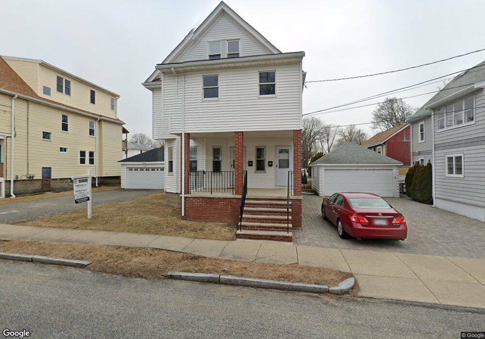
62 Rawson Rd Arlington, MA 02474
East Arlington NeighborhoodEstimated Value: $787,000 - $908,000
3
Beds
3
Baths
1,305
Sq Ft
$638/Sq Ft
Est. Value
About This Home
This home is located at 62 Rawson Rd, Arlington, MA 02474 and is currently estimated at $832,315, approximately $637 per square foot. 62 Rawson Rd is a home located in Middlesex County with nearby schools including Thompson School, Ottoson Middle School, and Arlington High School.
Ownership History
Date
Name
Owned For
Owner Type
Purchase Details
Closed on
May 19, 2022
Sold by
Northcreek Corp
Bought by
Stepansky Ellen R
Current Estimated Value
Home Financials for this Owner
Home Financials are based on the most recent Mortgage that was taken out on this home.
Original Mortgage
$625,000
Outstanding Balance
$588,968
Interest Rate
4.72%
Mortgage Type
Purchase Money Mortgage
Estimated Equity
$243,347
Purchase Details
Closed on
Jul 20, 2021
Sold by
Schiavone Anthony and Schiavone Barbara
Bought by
Northcreek Corp
Home Financials for this Owner
Home Financials are based on the most recent Mortgage that was taken out on this home.
Original Mortgage
$800,000
Interest Rate
2.96%
Mortgage Type
Purchase Money Mortgage
Purchase Details
Closed on
Oct 18, 1994
Sold by
Tocio Ronald F and Tocio Maureen E
Bought by
Schiavone Anthony and Craddock Barbara
Home Financials for this Owner
Home Financials are based on the most recent Mortgage that was taken out on this home.
Original Mortgage
$177,000
Interest Rate
8.43%
Mortgage Type
Purchase Money Mortgage
Create a Home Valuation Report for This Property
The Home Valuation Report is an in-depth analysis detailing your home's value as well as a comparison with similar homes in the area
Home Values in the Area
Average Home Value in this Area
Purchase History
| Date | Buyer | Sale Price | Title Company |
|---|---|---|---|
| Stepansky Ellen R | $705,000 | None Available | |
| Northcreek Corp | $900,000 | None Available | |
| Schiavone Anthony | $207,000 | -- | |
| Schiavone Anthony | $207,000 | -- |
Source: Public Records
Mortgage History
| Date | Status | Borrower | Loan Amount |
|---|---|---|---|
| Open | Stepansky Ellen R | $625,000 | |
| Previous Owner | Northcreek Corp | $800,000 | |
| Previous Owner | Schiavone Anthony | $175,000 | |
| Previous Owner | Schiavone Anthony | $177,000 |
Source: Public Records
Tax History Compared to Growth
Tax History
| Year | Tax Paid | Tax Assessment Tax Assessment Total Assessment is a certain percentage of the fair market value that is determined by local assessors to be the total taxable value of land and additions on the property. | Land | Improvement |
|---|---|---|---|---|
| 2025 | $7,345 | $682,000 | $0 | $682,000 |
| 2024 | $6,905 | $652,000 | $0 | $652,000 |
| 2023 | $9,974 | $889,700 | $445,900 | $443,800 |
| 2022 | $9,933 | $869,800 | $429,800 | $440,000 |
| 2021 | $9,647 | $850,700 | $429,800 | $420,900 |
| 2020 | $9,410 | $850,800 | $429,800 | $421,000 |
| 2019 | $8,864 | $787,200 | $456,700 | $330,500 |
| 2018 | $8,049 | $663,600 | $333,100 | $330,500 |
| 2017 | $7,550 | $601,100 | $290,100 | $311,000 |
| 2016 | $7,144 | $558,100 | $247,100 | $311,000 |
| 2015 | $7,055 | $520,700 | $241,800 | $278,900 |
Source: Public Records
Map
Nearby Homes
- 94 Rawson Rd Unit 94
- 29 Dartmouth St Unit 29
- 132 Rawson Rd Unit 132
- 42-44 Warren St Unit 42
- 41 Palmer St Unit 43
- 23 Yale Rd
- 167 Franklin St Unit 167
- 69 Arlington St
- 25-27 Adams St
- 6 Gordon Rd
- 166 Arlington St
- 31 Sharon St
- 0 Jerome St Unit 72734260
- 111 Sharon St Unit 1
- 18 Belknap St Unit 2
- 18 Belknap St Unit 1
- 12 Arizona Terrace Unit 2
- 97 Mystic St Unit B
- 230 Massachusetts Ave Unit 6
- 34 Hamilton Rd Unit 302
- 60 Rawson Rd
- 62 Rawson Rd Unit 2
- 60 Rawson Rd Unit 1
- 56 Rawson Rd Unit 56
- 56 Rawson Rd
- 56 Rawson Rd Unit 58
- 58 Rawson Rd
- 58 Rawson Rd Unit 58
- 66 Rawson Rd Unit 68
- 56-58 Rwason Rd
- 31 Park St
- 40 Cornell St Unit 1
- 40 Cornell St
- 72 Rawson Rd
- 72 Rawson Rd Unit 1
- 54 Rawson Rd
- 74 Rawson Rd Unit 76
- 74 Rawson Rd Unit 1
- 27 Park St
- 36 Cornell St