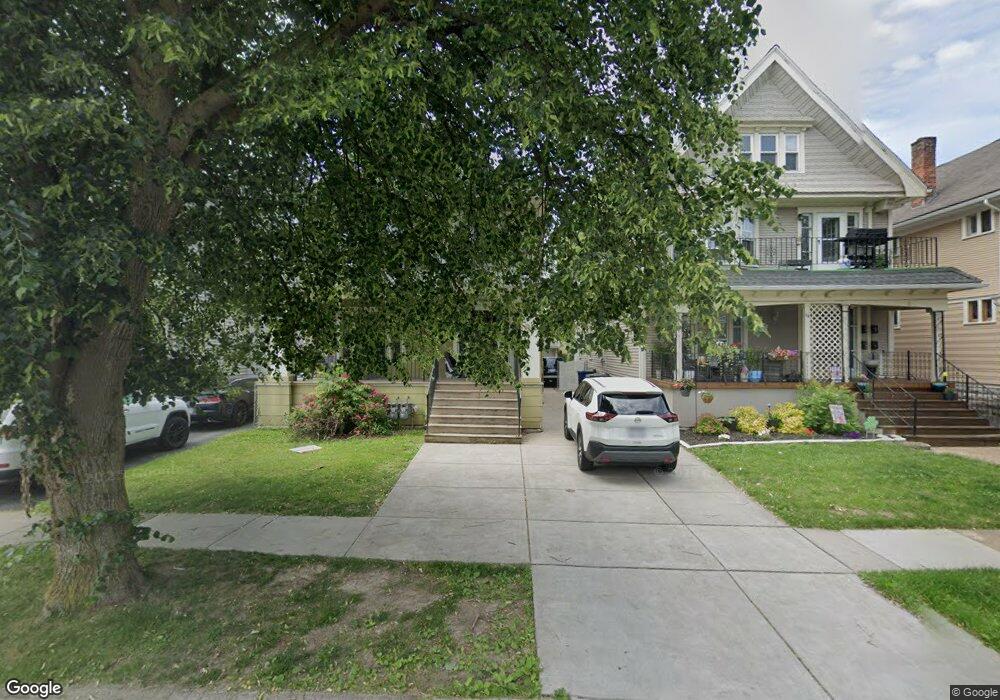
62 Roanoke Pkwy Buffalo, NY 14210
Seneca NeighborhoodEstimated Value: $189,000 - $208,000
6
Beds
2
Baths
2,552
Sq Ft
$78/Sq Ft
Est. Value
About This Home
This home is located at 62 Roanoke Pkwy, Buffalo, NY 14210 and is currently estimated at $199,984, approximately $78 per square foot. 62 Roanoke Pkwy is a home located in Erie County with nearby schools including South Buffalo Charter School and Mount Mercy Academy.
Ownership History
Date
Name
Owned For
Owner Type
Purchase Details
Closed on
Dec 15, 2020
Sold by
Rtdd2 Llc
Bought by
Jeco2 Llc
Current Estimated Value
Home Financials for this Owner
Home Financials are based on the most recent Mortgage that was taken out on this home.
Original Mortgage
$1,055,600
Outstanding Balance
$56,229
Interest Rate
2.7%
Mortgage Type
Purchase Money Mortgage
Estimated Equity
$143,755
Purchase Details
Closed on
Oct 2, 2015
Sold by
Parke Elziabeth and Danner Elizabeth A
Bought by
Rtdd2 Llc
Home Financials for this Owner
Home Financials are based on the most recent Mortgage that was taken out on this home.
Original Mortgage
$84,450
Interest Rate
3.95%
Mortgage Type
New Conventional
Purchase Details
Closed on
Aug 9, 2012
Sold by
Papke Elizabeth F and Papke K
Bought by
Papke Elizabeth As Life T Elizabeth As Life T
Purchase Details
Closed on
Aug 8, 1995
Create a Home Valuation Report for This Property
The Home Valuation Report is an in-depth analysis detailing your home's value as well as a comparison with similar homes in the area
Home Values in the Area
Average Home Value in this Area
Purchase History
| Date | Buyer | Sale Price | Title Company |
|---|---|---|---|
| Jeco2 Llc | $569,461 | None Available | |
| Rtdd2 Llc | $77,000 | None Available | |
| Papke Elizabeth As Life T Elizabeth As Life T | -- | -- | |
| -- | -- | -- |
Source: Public Records
Mortgage History
| Date | Status | Borrower | Loan Amount |
|---|---|---|---|
| Open | Jeco2 Llc | $1,055,600 | |
| Previous Owner | Rtdd2 Llc | $84,450 |
Source: Public Records
Tax History Compared to Growth
Tax History
| Year | Tax Paid | Tax Assessment Tax Assessment Total Assessment is a certain percentage of the fair market value that is determined by local assessors to be the total taxable value of land and additions on the property. | Land | Improvement |
|---|---|---|---|---|
| 2024 | $493 | $88,000 | $6,000 | $82,000 |
| 2023 | $446 | $88,000 | $6,000 | $82,000 |
| 2022 | $442 | $88,000 | $6,000 | $82,000 |
| 2021 | $442 | $88,000 | $6,000 | $82,000 |
| 2020 | $509 | $88,000 | $6,000 | $82,000 |
| 2019 | $1,813 | $66,100 | $4,600 | $61,500 |
| 2018 | $1,706 | $66,100 | $4,600 | $61,500 |
| 2017 | $393 | $66,100 | $4,600 | $61,500 |
| 2016 | $1,609 | $66,100 | $4,600 | $61,500 |
| 2015 | -- | $66,100 | $4,600 | $61,500 |
| 2014 | -- | $66,100 | $4,600 | $61,500 |
Source: Public Records
Map
Nearby Homes
- 62 Roanoke Pkwy Unit Upper
- 62 Roanoke Pkwy
- 64 Roanoke Pkwy
- 54 Roanoke Pkwy
- 68 Roanoke Pkwy
- 50 Roanoke Pkwy
- 59 Armin Place
- 61 Armin Place
- 72 Roanoke Pkwy
- 53 Armin Place
- 46 Roanoke Pkwy
- 46 Roanoke Pkwy Unit Upper
- 65 Armin Place
- 51 Armin Place
- 49 Armin Place
- 44 Roanoke Pkwy
- 44 Roanoke Pkwy Unit Lower
- 73 Armin Place
- 59 Roanoke Pkwy