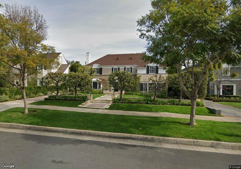
620 N Oakhurst Dr Beverly Hills, CA 90210
Estimated Value: $5,998,516 - $8,489,000
5
Beds
5
Baths
4,673
Sq Ft
$1,659/Sq Ft
Est. Value
About This Home
This home is located at 620 N Oakhurst Dr, Beverly Hills, CA 90210 and is currently estimated at $7,751,879, approximately $1,658 per square foot. 620 N Oakhurst Dr is a home located in Los Angeles County with nearby schools including Hawthorne Elementary School, Beverly Hills High School, and Gindi Maimonides Academy.
Ownership History
Date
Name
Owned For
Owner Type
Purchase Details
Closed on
Oct 23, 2001
Sold by
Toplitzky Ronald D and Toplitzky Holly H
Bought by
Toplitzky Ronald D
Current Estimated Value
Home Financials for this Owner
Home Financials are based on the most recent Mortgage that was taken out on this home.
Original Mortgage
$1,125,000
Interest Rate
6.12%
Create a Home Valuation Report for This Property
The Home Valuation Report is an in-depth analysis detailing your home's value as well as a comparison with similar homes in the area
Home Values in the Area
Average Home Value in this Area
Purchase History
| Date | Buyer | Sale Price | Title Company |
|---|---|---|---|
| Toplitzky Ronald D | -- | First American Title Co |
Source: Public Records
Mortgage History
| Date | Status | Borrower | Loan Amount |
|---|---|---|---|
| Closed | Toplitzky Ronald D | $1,125,000 |
Source: Public Records
Tax History Compared to Growth
Tax History
| Year | Tax Paid | Tax Assessment Tax Assessment Total Assessment is a certain percentage of the fair market value that is determined by local assessors to be the total taxable value of land and additions on the property. | Land | Improvement |
|---|---|---|---|---|
| 2025 | $29,834 | $2,501,876 | $1,688,945 | $812,931 |
| 2024 | $29,834 | $2,452,821 | $1,655,829 | $796,992 |
| 2023 | $29,300 | $2,404,727 | $1,623,362 | $781,365 |
| 2022 | $28,464 | $2,357,577 | $1,591,532 | $766,045 |
| 2021 | $27,622 | $2,311,351 | $1,560,326 | $751,025 |
| 2019 | $26,828 | $2,242,797 | $1,514,047 | $728,750 |
| 2018 | $25,726 | $2,198,821 | $1,484,360 | $714,461 |
| 2016 | $24,665 | $2,113,439 | $1,426,721 | $686,718 |
| 2015 | $23,614 | $2,081,694 | $1,405,291 | $676,403 |
| 2014 | $22,831 | $2,040,918 | $1,377,764 | $663,154 |
Source: Public Records
Map
Nearby Homes
- 634 N Sierra Dr
- 9061 Keith Ave Unit 103
- 9061 Keith Ave Unit 101
- 702 N Doheny Dr Unit TH12
- 702 N Doheny Dr Unit 103
- 702 N Doheny Dr Unit TH21
- 702 N Doheny Dr Unit TH-1
- 702 N Doheny Dr Unit TH4
- 603 N Doheny Dr Unit 2B
- 713 N Doheny Dr
- 818 N Doheny Dr Unit 607
- 624 N Arden Dr
- 9009 Lloyd Place
- 725 N Doheny Dr
- 866 N Doheny Dr
- 9033 Vista Grande St
- 458 N Oakhurst Dr Unit 102
- 906 N Doheny Dr Unit 309
- 906 N Doheny Dr Unit 311
- 906 N Doheny Dr Unit 304
- 622 N Oakhurst Dr
- 618 N Oakhurst Dr
- 616 N Oakhurst Dr
- 624 N Oakhurst Dr
- 625 N Doheny Dr
- 627 N Doheny Dr
- 623 N Doheny Dr
- 629 N Doheny Dr
- 621 N Doheny Dr
- 614 N Oakhurst Dr
- 626 N Oakhurst Dr
- 631 N Doheny Dr
- 619 N Doheny Dr
- 619 N Oakhurst Dr
- 621 N Oakhurst Dr
- 617 N Oakhurst Dr
- 633 N Doheny Dr
- 617 N Doheny Dr
- 623 N Oakhurst Dr
- 615 N Oakhurst Dr