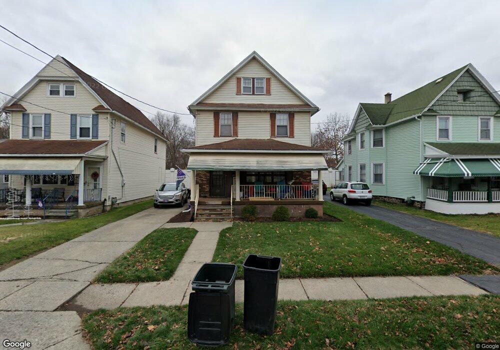
620 Race St Scranton, PA 18509
Providence NeighborhoodEstimated Value: $141,801 - $246,000
--
Bed
--
Bath
--
Sq Ft
5,271
Sq Ft Lot
About This Home
This home is located at 620 Race St, Scranton, PA 18509 and is currently estimated at $183,200. 620 Race St is a home located in Lackawanna County with nearby schools including Maybeury Elementary School, Pinchbeck Elementary School, and Robert Morris #27.
Ownership History
Date
Name
Owned For
Owner Type
Purchase Details
Closed on
Jun 10, 2011
Sold by
Reichle Robert J and Reichle Joseph G
Bought by
City Of Scranton
Current Estimated Value
Purchase Details
Closed on
Jun 17, 2010
Sold by
Theis George William and Theis Barbara A
Bought by
City Of Scranton
Purchase Details
Closed on
Mar 17, 2010
Sold by
The City Of Scranton
Bought by
Bailey Heather
Home Financials for this Owner
Home Financials are based on the most recent Mortgage that was taken out on this home.
Original Mortgage
$8,450
Interest Rate
4.94%
Mortgage Type
Unknown
Create a Home Valuation Report for This Property
The Home Valuation Report is an in-depth analysis detailing your home's value as well as a comparison with similar homes in the area
Home Values in the Area
Average Home Value in this Area
Purchase History
| Date | Buyer | Sale Price | Title Company |
|---|---|---|---|
| City Of Scranton | $169,000 | None Available | |
| City Of Scranton | $88,000 | None Available | |
| Bailey Heather | $55,200 | Fidelity National Title Ins |
Source: Public Records
Mortgage History
| Date | Status | Borrower | Loan Amount |
|---|---|---|---|
| Previous Owner | Bailey Heather | $8,450 | |
| Previous Owner | Bailey Heather | $44,160 |
Source: Public Records
Tax History Compared to Growth
Tax History
| Year | Tax Paid | Tax Assessment Tax Assessment Total Assessment is a certain percentage of the fair market value that is determined by local assessors to be the total taxable value of land and additions on the property. | Land | Improvement |
|---|---|---|---|---|
| 2025 | $2,987 | $9,000 | $1,900 | $7,100 |
| 2024 | $2,736 | $9,000 | $1,900 | $7,100 |
| 2023 | $2,736 | $9,000 | $1,900 | $7,100 |
| 2022 | $2,676 | $9,000 | $1,900 | $7,100 |
| 2021 | $2,676 | $9,000 | $1,900 | $7,100 |
| 2020 | $2,628 | $9,000 | $1,900 | $7,100 |
| 2019 | $2,474 | $9,000 | $1,900 | $7,100 |
| 2018 | $2,474 | $9,000 | $1,900 | $7,100 |
| 2017 | $2,432 | $9,000 | $1,900 | $7,100 |
| 2016 | $801 | $9,000 | $1,900 | $7,100 |
| 2015 | $1,513 | $9,000 | $1,900 | $7,100 |
| 2014 | -- | $9,000 | $1,900 | $7,100 |
Source: Public Records
Map
Nearby Homes
- 2129 Comegys Ave Unit L11
- 2106 Boulevard Ave
- 601 Dean St
- 2237 Boulevard Ave
- 2136 N Main Ave
- 35 Dean St
- 512 Electric St Unit 510-516
- 416 Electric St
- 1762-1764 Sanderson Ave
- 2089 N Main Ave
- 1747 Monsey Ave
- 119 Spring St
- 802 Sunset St
- 1021 Richmont St
- 2040 Edna Ave
- 2105 Belmont Terrace
- 121 Throop St
- 1732 Capouse Ave
- 1008 Fisk St
- 193 W Parker St