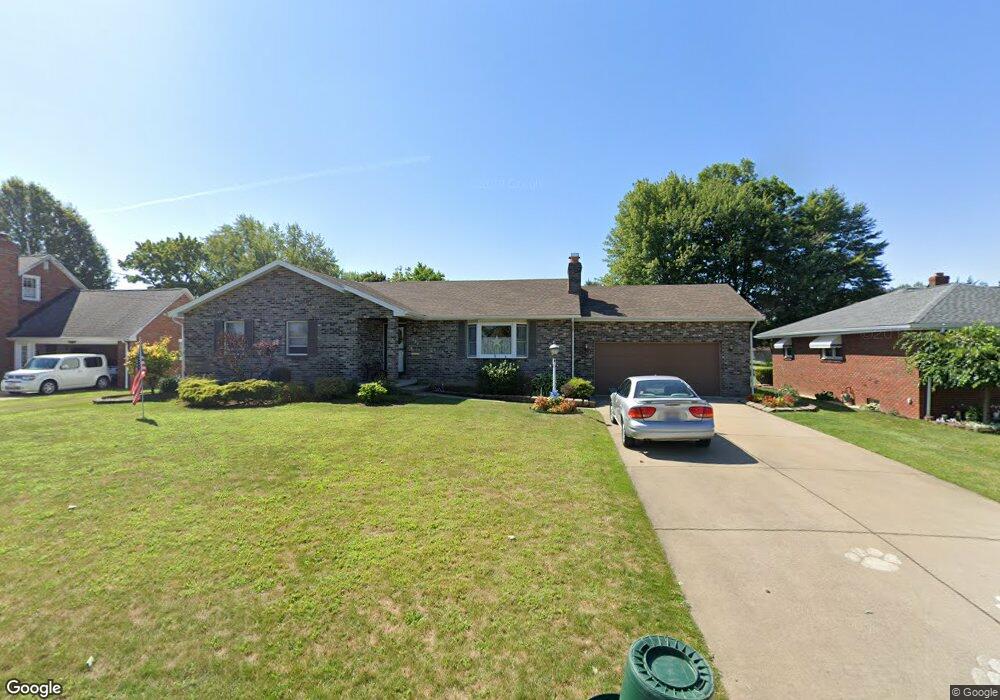
620 W Omar St Struthers, OH 44471
Estimated Value: $168,000 - $264,000
3
Beds
3
Baths
1,456
Sq Ft
$152/Sq Ft
Est. Value
About This Home
This home is located at 620 W Omar St, Struthers, OH 44471 and is currently estimated at $221,389, approximately $152 per square foot. 620 W Omar St is a home located in Mahoning County with nearby schools including Mckamy Elementary School, Carrollton Elementary School, and Lovett Elementary School.
Ownership History
Date
Name
Owned For
Owner Type
Purchase Details
Closed on
Jan 27, 2009
Sold by
Leenheer Ronald James and Leenheer Ronald J
Bought by
Leenheer Ronald J and Leenheer Victoria L
Current Estimated Value
Purchase Details
Closed on
May 8, 1996
Sold by
Mrofchak Mark J
Bought by
Leenheer Ronald
Home Financials for this Owner
Home Financials are based on the most recent Mortgage that was taken out on this home.
Original Mortgage
$84,400
Interest Rate
7.78%
Mortgage Type
Balloon
Purchase Details
Closed on
Aug 14, 1990
Bought by
Mrofchak Mark J and Mrofchak Faith D
Create a Home Valuation Report for This Property
The Home Valuation Report is an in-depth analysis detailing your home's value as well as a comparison with similar homes in the area
Home Values in the Area
Average Home Value in this Area
Purchase History
| Date | Buyer | Sale Price | Title Company |
|---|---|---|---|
| Leenheer Ronald J | -- | Attorney | |
| Leenheer Ronald | $108,000 | -- | |
| Mrofchak Mark J | $87,000 | -- |
Source: Public Records
Mortgage History
| Date | Status | Borrower | Loan Amount |
|---|---|---|---|
| Closed | Leenheer Ronald | $84,400 |
Source: Public Records
Tax History Compared to Growth
Tax History
| Year | Tax Paid | Tax Assessment Tax Assessment Total Assessment is a certain percentage of the fair market value that is determined by local assessors to be the total taxable value of land and additions on the property. | Land | Improvement |
|---|---|---|---|---|
| 2024 | $2,135 | $61,090 | $5,760 | $55,330 |
| 2023 | $2,499 | $61,090 | $5,760 | $55,330 |
| 2022 | $2,510 | $46,460 | $5,420 | $41,040 |
| 2021 | $2,487 | $46,460 | $5,420 | $41,040 |
| 2020 | $2,498 | $46,460 | $5,420 | $41,040 |
| 2019 | $2,389 | $40,400 | $4,710 | $35,690 |
| 2018 | $2,280 | $40,400 | $4,710 | $35,690 |
| 2017 | $2,277 | $40,400 | $4,710 | $35,690 |
| 2016 | $2,326 | $42,240 | $5,500 | $36,740 |
| 2015 | $2,272 | $42,240 | $5,500 | $36,740 |
| 2014 | $2,279 | $42,240 | $5,500 | $36,740 |
| 2013 | $2,118 | $42,240 | $5,500 | $36,740 |
Source: Public Records
Map
Nearby Homes
- 576 W Harvey St
- 2089 Shetland Ln
- 550 Brandon Ave
- 525 W Omar St
- 5710 Youngstown Poland Rd
- 1933 Brandon Ave
- 478 W Harvey St
- 1919 Wingate Rd
- 2296 Knollwood Ave
- 2128 Lyon Blvd
- 2021 Country Club Ave
- 2153 Lyon Blvd
- 0 Oles Ave
- 0 Woodlawn Ave
- 1913 Country Club Ave
- 1890 Mathews Rd
- 1830 Halbert Dr
- 1841 Wingate Rd
- 1828 Basil Ave
- 418 W Wilson St
- 628 W Omar St
- 616 W Omar St
- 610 W Omar St
- 623 W Omar St Unit 625
- 613 W Omar St
- 604 W Omar St
- 5137 Youngstown Poland Rd
- 5119 Youngstown Poland Rd
- 598 W Omar St
- 611 W Omar St
- 2086 W Manor Ave
- 2052 W Manor Ave
- 2042 W Manor Ave
- 2064 W Manor Ave
- 5129 Youngstown Poland Rd
- 599 W Omar St
- 592 W Omar St
- 5333 Youngstown Poland Rd
- 2076 W Manor Ave
- 620 W Harvey St