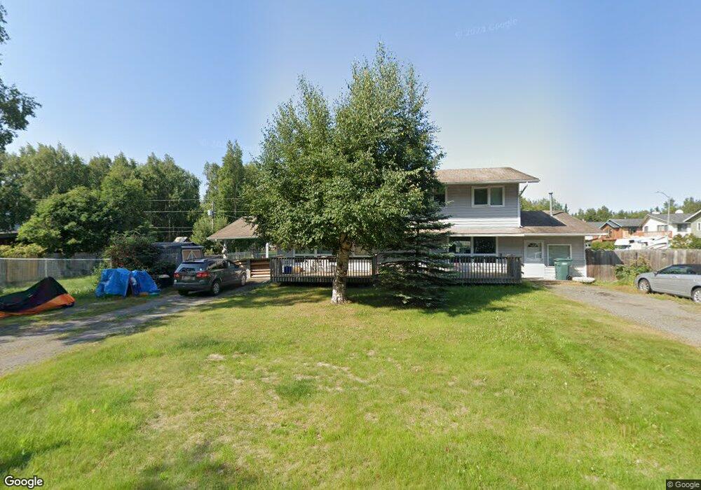
6200 Cranberry St Anchorage, AK 99502
Sand Lake NeighborhoodEstimated Value: $337,000 - $541,000
6
Beds
4
Baths
2,280
Sq Ft
$205/Sq Ft
Est. Value
About This Home
This home is located at 6200 Cranberry St, Anchorage, AK 99502 and is currently estimated at $467,818, approximately $205 per square foot. 6200 Cranberry St is a home located in Anchorage Municipality with nearby schools including Mears Middle School, Dimond High School, and Rilke Schule Charter School.
Ownership History
Date
Name
Owned For
Owner Type
Purchase Details
Closed on
Oct 10, 2003
Sold by
Hsi Leah
Bought by
Hsi Leah and Hsi Yuh Yin
Current Estimated Value
Purchase Details
Closed on
Oct 9, 2003
Sold by
Thornton Julia A
Bought by
Hsi Leah
Purchase Details
Closed on
Oct 2, 2003
Sold by
Thornton Julia A
Bought by
Hsi Leah
Purchase Details
Closed on
Jan 7, 2002
Sold by
Rosser Dorothy B and Irons Dorothy B
Bought by
Thornton William B and Thornton Julia A
Home Financials for this Owner
Home Financials are based on the most recent Mortgage that was taken out on this home.
Original Mortgage
$209,000
Interest Rate
7.01%
Create a Home Valuation Report for This Property
The Home Valuation Report is an in-depth analysis detailing your home's value as well as a comparison with similar homes in the area
Home Values in the Area
Average Home Value in this Area
Purchase History
| Date | Buyer | Sale Price | Title Company |
|---|---|---|---|
| Hsi Leah | -- | -- | |
| Hsi Leah | -- | -- | |
| Hsi Leah | -- | Alyeska Title Guaranty Agenc | |
| Thornton William B | -- | First American Title |
Source: Public Records
Mortgage History
| Date | Status | Borrower | Loan Amount |
|---|---|---|---|
| Previous Owner | Thornton William B | $209,000 |
Source: Public Records
Tax History Compared to Growth
Tax History
| Year | Tax Paid | Tax Assessment Tax Assessment Total Assessment is a certain percentage of the fair market value that is determined by local assessors to be the total taxable value of land and additions on the property. | Land | Improvement |
|---|---|---|---|---|
| 2025 | $7,078 | $455,100 | $126,400 | $328,700 |
| 2024 | $7,078 | $438,400 | $126,400 | $312,000 |
| 2023 | $6,812 | $400,000 | $126,400 | $273,600 |
| 2022 | $6,657 | $395,300 | $126,400 | $268,900 |
| 2021 | $6,626 | $367,700 | $126,400 | $241,300 |
| 2020 | $6,429 | $378,200 | $126,400 | $251,800 |
| 2019 | $6,102 | $373,000 | $126,400 | $246,600 |
| 2018 | $6,098 | $371,800 | $126,400 | $245,400 |
| 2017 | $5,955 | $380,300 | $126,400 | $253,900 |
| 2016 | $4,455 | $368,100 | $120,000 | $248,100 |
| 2015 | $4,455 | $340,500 | $106,100 | $234,400 |
| 2014 | $4,455 | $326,700 | $106,100 | $220,600 |
Source: Public Records
Map
Nearby Homes
- 3223 W 62nd Ave
- 6140 Collins Way
- 6017 Collins Way
- 6305 Blackberry St
- 6550 Imlach Dr
- 6631 Weimer Dr Unit F
- 6940 Colonial Ct
- 7020 Carline Cir
- 7085 Weimer Rd Unit 2
- 2630 W 72nd Ave
- 7068 Weimer Rd Unit 3
- 2815 W International Airport Rd Unit B104
- 2831 W International Airport Rd Unit F103
- 3727 W 74th Ave
- 4301 Seeley Cir
- 8525 Jewel Lake Rd
- 6040 Jewel Lake Rd
- L28 Blackberry St
- 7721 Lotus Dr
- 6841 Caravelle Dr
- 3103 W 62nd Ave
- 3109 W 62nd Ave
- 3115 W 62nd Ave
- 3130 W 62nd Ave
- 3121 W 62nd Ave
- 6250 Cranberry St
- 2741 W 62nd Ave Ave
- 2741 W 62nd Ave
- 3127 W 62nd Ave
- 3133 W 62nd Ave
- 3139 W 62nd Ave
- 6300 Connors Trail Cir
- 6241 Collins Way
- 3201 W 62nd Ave
- 6305 Connors Trail Cir
- 3207 W 62nd Ave
- 6231 Collins Way
- 6310 Connors Trail Cir
- 6310 Conners Trail
- 6251 Collins Way