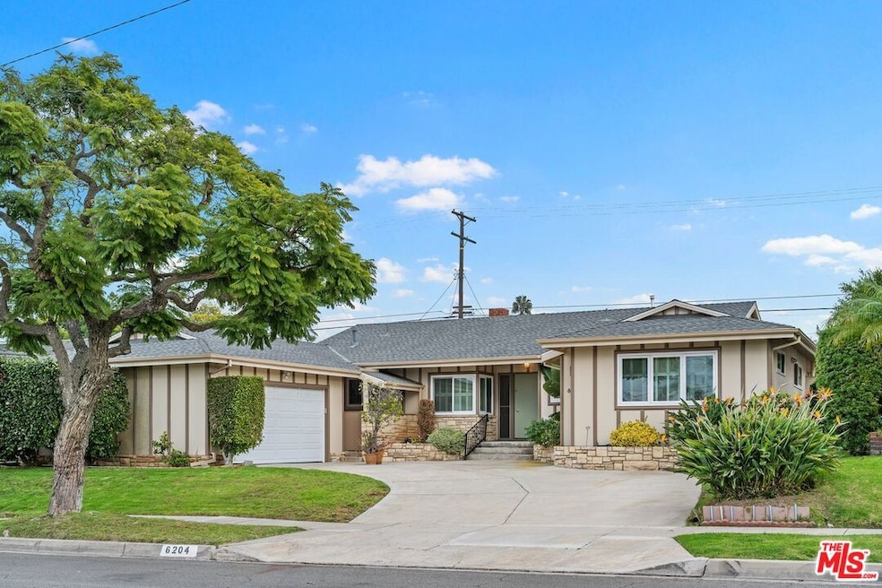
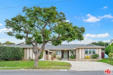
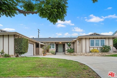
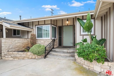
6204 S Corning Ave Los Angeles, CA 90056
Ladera Heights NeighborhoodHighlights
- Midcentury Modern Architecture
- Breakfast Area or Nook
- Central Heating and Cooling System
- Wood Flooring
- Laundry Room
- Family Room
About This Home
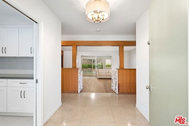
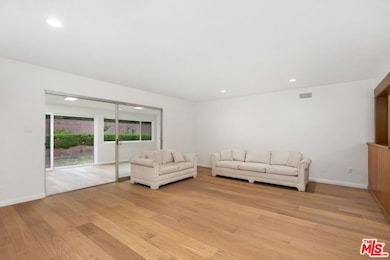
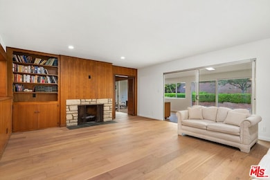
Welcome Home to 6204 S. Corning Avenue, a thoughtfully updated Mid-Century home located in the highly desirable Ladera Heights community. This timeless residence seamlessly blends classic architectural charm with today's modern comforts and conveniences. Step inside to discover a beautifully renovated interior featuring a bright and inviting kitchen with sleek quartz countertops, brand-new appliances, and a cheerful breakfast area perfect for morning coffee or casual dining. The warm and welcoming family room offers an ideal space to relax or gather with loved ones. A formal living room with its own fireplace provides an elegant setting for entertaining, while a spacious bonus room opens directly to the backyard, ideal for indoor-outdoor living and weekend get-togethers. The large primary bedroom offers a serene retreat, complemented by generously sized secondary bedrooms that provide plenty of space for family, guests, or a home office. Each bathroom has been beautifully upgraded with stylish finishes and modern fixtures. Additional highlights include new central heating and air conditioning, a new roof, and upgraded plumbing ensuring peace of mind and comfort for years to come. Combining Mid-Century charm with contemporary style, this move-in-ready home is a true gem in Ladera Heights!
Home Details
Home Type
- Single Family
Est. Annual Taxes
- $2,736
Year Built
- Built in 1956
Lot Details
- 8,708 Sq Ft Lot
- Lot Dimensions are 75x116
- Property is zoned LCR1YY
Parking
- 2 Car Garage
Home Design
- Midcentury Modern Architecture
Interior Spaces
- 2,707 Sq Ft Home
- 1-Story Property
- Family Room
- Living Room with Fireplace
- Laundry Room
Kitchen
- Breakfast Area or Nook
- Oven or Range
- Microwave
- Dishwasher
- Disposal
Flooring
- Wood
- Laminate
- Tile
- Terrazzo
Bedrooms and Bathrooms
- 3 Bedrooms
Utilities
- Central Heating and Cooling System
Listing and Financial Details
- Security Deposit $7,000
- Tenant pays for gas, electricity, water
- 12 Month Lease Term
- Assessor Parcel Number 4101-010-006
Map
Source: The MLS
MLS Number: 25614327
APN: 4101-010-006
Disclaimer: Certain information contained herein is derived from information provided by parties other than Homes.com. All information provided is deemed reliable, but is not guaranteed to be accurate and should be independently verified.
![]() © 2025 The MLS™ - Combined L.A. Westside MLS (CLAW). All rights reserved. Based on information from The MLS™ - Combined L.A. Westside MLS (CLAW). All data, including all measurements and calculations of area, is obtained from various sources and has not been, and will not be, verified by broker or MLS. All information should be independently reviewed and verified for accuracy. Properties may or may not be listed by the office/agent presenting the information.
© 2025 The MLS™ - Combined L.A. Westside MLS (CLAW). All rights reserved. Based on information from The MLS™ - Combined L.A. Westside MLS (CLAW). All data, including all measurements and calculations of area, is obtained from various sources and has not been, and will not be, verified by broker or MLS. All information should be independently reviewed and verified for accuracy. Properties may or may not be listed by the office/agent presenting the information.
IDX information is provided exclusively for personal, non-commercial use, and may not be used for any purpose other than to identify prospective properties consumers may be interested in purchasing.
Information is deemed reliable but not guaranteed.
- 6210 S Corning Ave
- 5328 W 62nd St
- 5949 S Garth Ave
- 5544 W 63rd St
- 6415 Bradley Place
- 6514 S Copperwood Ave
- 5810 S Halm Ave
- 6601 Springpark Ave Unit 14
- 5376 Fairview Blvd Unit 209
- 5300 Fairview Blvd Unit 25
- 6116 Wooster Ave
- 5348 W 57th St
- 6505 S Halm Ave
- 6430 S Sherbourne Dr
- 6130 Flores Ave
- 6000 Canterbury Dr Unit D309
- 6771 Springpark Ave Unit 106A
- 6719 Radlock Ave
- 5901 Canterbury Dr Unit 5
- 5625 Cambridge Way Unit 301
- 6624 Springpark Ave Unit 5A
- 5341 W Slauson Ave
- 5727 S Corning Ave Unit 5727
- 5320 W 57th St
- 5402 W 57th St
- 6427 S Halm Ave
- 5150 W Slauson Ave
- 5604 S Chariton Ave
- 5625 Sumner Way Unit 206
- 5625 Sumner Way Unit 212
- 6050 Canterbury Dr Unit F205
- 5651 N Sumner Way Unit 209
- 5651 Sumner Way Unit 115
- 5651 Sumner Way Unit 209
- 5651 Sumner Way Unit 310
- 6000-6060 Buckingham Pkwy
- 7008 Flight Ave Unit 7008 flight ave
- 7077 Alvern St
- 5401 Alvern Cir Unit Suite D
- 7026 Flight Ave Unit 7026
