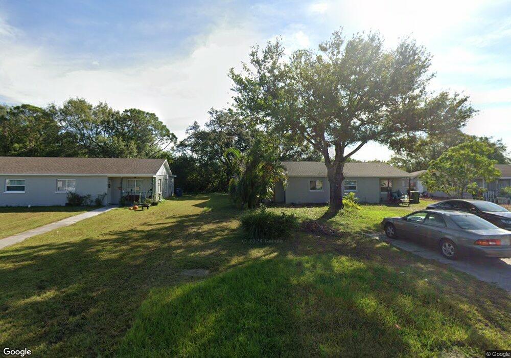
6205 12th Street Ct E Bradenton, FL 34203
Oneco NeighborhoodEstimated Value: $199,857 - $291,000
3
Beds
2
Baths
1,018
Sq Ft
$244/Sq Ft
Est. Value
About This Home
This home is located at 6205 12th Street Ct E, Bradenton, FL 34203 and is currently estimated at $247,964, approximately $243 per square foot. 6205 12th Street Ct E is a home with nearby schools including Blanche H. Daughtrey Elementary School, W. D. Sugg Middle School, and Bayshore High School.
Ownership History
Date
Name
Owned For
Owner Type
Purchase Details
Closed on
Nov 28, 2023
Sold by
J Powell Enterprises Llc
Bought by
Bradenton Duplexes Llc
Current Estimated Value
Purchase Details
Closed on
Apr 21, 2022
Sold by
Torres Usa Llc
Bought by
J Powell Enterprises Llc
Purchase Details
Closed on
Mar 10, 2014
Sold by
Invest P I Llc
Bought by
Torres Usa Llc
Purchase Details
Closed on
Nov 1, 2013
Sold by
Cb Florida Cre Holdings Llc
Bought by
Desoto Holdings Inc
Create a Home Valuation Report for This Property
The Home Valuation Report is an in-depth analysis detailing your home's value as well as a comparison with similar homes in the area
Home Values in the Area
Average Home Value in this Area
Purchase History
| Date | Buyer | Sale Price | Title Company |
|---|---|---|---|
| Bradenton Duplexes Llc | -- | None Listed On Document | |
| J Powell Enterprises Llc | $198,000 | Tampa Bay Title | |
| Torres Usa Llc | $40,000 | Attorney | |
| Desoto Holdings Inc | $726,000 | Attorney |
Source: Public Records
Tax History
| Year | Tax Paid | Tax Assessment Tax Assessment Total Assessment is a certain percentage of the fair market value that is determined by local assessors to be the total taxable value of land and additions on the property. | Land | Improvement |
|---|---|---|---|---|
| 2025 | $2,093 | $127,737 | $17,850 | $109,887 |
| 2024 | $2,093 | $132,019 | $17,850 | $114,169 |
| 2023 | $2,125 | $132,019 | $17,850 | $114,169 |
| 2022 | $1,429 | $112,442 | $17,500 | $94,942 |
| 2021 | $1,175 | $83,960 | $17,500 | $66,460 |
| 2020 | $1,117 | $75,063 | $15,000 | $60,063 |
| 2019 | $1,046 | $70,140 | $10,000 | $60,140 |
| 2018 | $824 | $44,000 | $10,000 | $34,000 |
| 2017 | $787 | $44,000 | $0 | $0 |
| 2016 | $797 | $44,000 | $0 | $0 |
Source: Public Records
Map
Nearby Homes
- 917 Winter Garden Dr
- 711 64th Avenue Dr E
- 603 61st Avenue Terrace E
- 722 65th Ave E
- 5803 9th Street Ct E
- 5723 12th St E
- 343 Avocado St Unit 85
- 331 Avocado St Unit 73
- 6515 15th St E Unit F11
- 6515 15th St E Unit E4
- 6515 15th St E Unit C05
- 6515 15th St E Unit L14
- 6515 15th St E Unit C18
- 6515 15th St E Unit G14
- 6515 15th St E
- 6515 15th St E Unit G17
- 6515 15th St E Unit G18
- 6515 15th St E Unit C02
- 6515 15th St E Unit J11
- 6515 15th St E Unit L-21
- 6203 12th Street Ct E
- 6207 12th Street Ct E
- 6201 12th Street Ct E
- 6209 12th Street Ct E
- 1211 62nd Ave E
- 6211 12th Street Ct E
- 1209 62nd Ave E
- 1207 62nd Ave E
- 6206 12th Street Ct E
- 1205 62nd Ave E
- 6215 12th Street Ct E
- 1203 62nd Ave E
- 1201 62nd Ave E
- 6216 12th Street Ct E
- 6210 12th St E
- 6221 12th Street Ct E
- 6212 12th St E
- 6216 12th St E
- 6214 12th St E
- 6214 12th St E
Your Personal Tour Guide
Ask me questions while you tour the home.