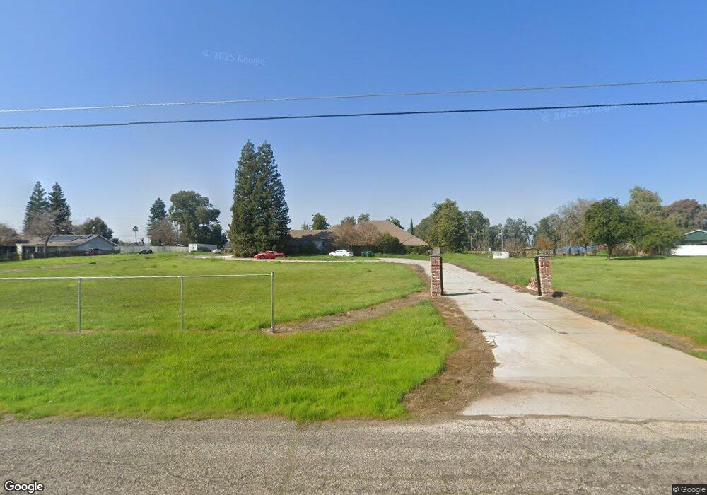
6207 Amber Ave Clovis, CA 93619
Estimated Value: $847,000 - $1,019,000
4
Beds
3
Baths
3,197
Sq Ft
$286/Sq Ft
Est. Value
About This Home
This home is located at 6207 Amber Ave, Clovis, CA 93619 and is currently estimated at $913,327, approximately $285 per square foot. 6207 Amber Ave is a home located in Fresno County with nearby schools including Cedarwood Elementary School, Clark Intermediate School, and Clovis High School.
Ownership History
Date
Name
Owned For
Owner Type
Purchase Details
Closed on
Nov 10, 2020
Sold by
Griesner Charlene and Griesner Ray O
Bought by
Griesner Charlene and Griesner Ray O
Current Estimated Value
Home Financials for this Owner
Home Financials are based on the most recent Mortgage that was taken out on this home.
Original Mortgage
$400,500
Interest Rate
2.8%
Mortgage Type
New Conventional
Create a Home Valuation Report for This Property
The Home Valuation Report is an in-depth analysis detailing your home's value as well as a comparison with similar homes in the area
Purchase History
| Date | Buyer | Sale Price | Title Company |
|---|---|---|---|
| Griesner Charlene | -- | Chicago Title Company |
Source: Public Records
Mortgage History
| Date | Status | Borrower | Loan Amount |
|---|---|---|---|
| Closed | Griesner Charlene | $400,500 |
Source: Public Records
Tax History
| Year | Tax Paid | Tax Assessment Tax Assessment Total Assessment is a certain percentage of the fair market value that is determined by local assessors to be the total taxable value of land and additions on the property. | Land | Improvement |
|---|---|---|---|---|
| 2025 | $4,771 | $411,919 | $87,838 | $324,081 |
| 2023 | $4,586 | $395,926 | $84,428 | $311,498 |
| 2022 | $4,524 | $388,164 | $82,773 | $305,391 |
| 2021 | $4,395 | $380,553 | $81,150 | $299,403 |
| 2020 | $4,377 | $376,651 | $80,318 | $296,333 |
| 2019 | $4,290 | $369,267 | $78,744 | $290,523 |
| 2018 | $4,195 | $362,027 | $77,200 | $284,827 |
| 2017 | $4,122 | $354,930 | $75,687 | $279,243 |
| 2016 | $3,980 | $347,971 | $74,203 | $273,768 |
| 2015 | $3,918 | $342,745 | $73,089 | $269,656 |
| 2014 | $3,844 | $336,032 | $71,658 | $264,374 |
Source: Public Records
Map
Nearby Homes
- 11640 E Sierra Ave
- 11236 E Herndon Ave
- 6560 N Bethel Ave
- 10595 E San Felipe Ave
- 4793 N Emerald Peak Dr
- 4769 N Emerald Peak Dr
- 10464 E Herndon Ave
- 4674 N Arrow Ridge Way
- 10588 E Fieldstone Ave
- 4626 N Arrow Ridge Way
- 10455 E Greenbury Way
- 11735 E Santa Ana Ave
- 10952 E Promontory Way
- 12009 E Shaw Ave
- 12000 E Shaw Ave
- 12789 E Herndon Ave
- 9321 E Bullard Ave
- 4588 N Mccall Ave
- 10819 E Fountain View
- 4249 N Waterside Dr
- 6153 Amber Ave
- 6265 Amber Ave
- 6208 Amber Ave
- 6154 Amber Ave
- 6089 Amber Ave
- 6268 N Del Rey Ave
- 6266 Amber Ave
- 6210 N Del Rey Ave
- 6329 Amber Ave
- 6330 Amber Ave
- 6332 N Del Rey Ave
- 6102 N Del Rey Ave
- 6156 N Del Rey Ave
- 11186 E Bullard Ave
- 6392 Amber Ave
- 6155 N Indianola Ave
- 6391 Amber Ave
- 6394 N Del Rey Ave
- 6032 Amber Ave
- 6074 N Del Rey Ave
Your Personal Tour Guide
Ask me questions while you tour the home.