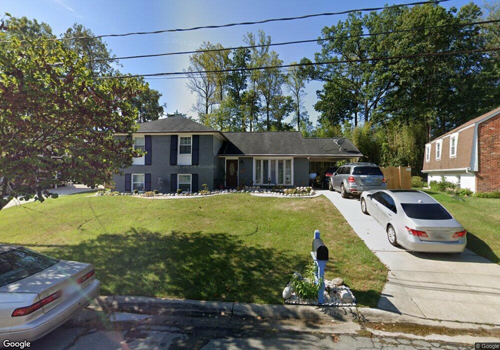
6209 Roblynn Rd Laurel, MD 20707
West Laurel NeighborhoodEstimated Value: $499,000 - $583,000
--
Bed
3
Baths
2,388
Sq Ft
$226/Sq Ft
Est. Value
About This Home
This home is located at 6209 Roblynn Rd, Laurel, MD 20707 and is currently estimated at $540,653, approximately $226 per square foot. 6209 Roblynn Rd is a home located in Prince George's County with nearby schools including Bond Mill Elementary, Martin Luther King Jr. Middle School, and Laurel High School.
Ownership History
Date
Name
Owned For
Owner Type
Purchase Details
Closed on
Oct 12, 2023
Sold by
Kawesa Hilda E
Bought by
Bangura David Bala and Bangura Joshua B
Current Estimated Value
Purchase Details
Closed on
Dec 19, 2002
Sold by
Baker Family Revocable Trust
Bought by
Hunter Hilda N
Purchase Details
Closed on
Oct 23, 2001
Sold by
Baker Donald E and Baker Leslie C
Bought by
Baker Family Revocable Trust
Create a Home Valuation Report for This Property
The Home Valuation Report is an in-depth analysis detailing your home's value as well as a comparison with similar homes in the area
Home Values in the Area
Average Home Value in this Area
Purchase History
| Date | Buyer | Sale Price | Title Company |
|---|---|---|---|
| Bangura David Bala | -- | None Listed On Document | |
| Bangura David Bala | -- | None Listed On Document | |
| Hunter Hilda N | $240,000 | -- | |
| Baker Family Revocable Trust | -- | -- |
Source: Public Records
Tax History Compared to Growth
Tax History
| Year | Tax Paid | Tax Assessment Tax Assessment Total Assessment is a certain percentage of the fair market value that is determined by local assessors to be the total taxable value of land and additions on the property. | Land | Improvement |
|---|---|---|---|---|
| 2025 | $5,377 | $442,300 | $126,400 | $315,900 |
| 2024 | $5,377 | $415,433 | $0 | $0 |
| 2023 | $5,159 | $388,567 | $0 | $0 |
| 2022 | $4,892 | $361,700 | $101,400 | $260,300 |
| 2021 | $4,739 | $357,033 | $0 | $0 |
| 2020 | $4,690 | $352,367 | $0 | $0 |
| 2019 | $4,617 | $347,700 | $100,700 | $247,000 |
| 2018 | $4,487 | $336,033 | $0 | $0 |
| 2017 | $4,382 | $324,367 | $0 | $0 |
| 2016 | -- | $312,700 | $0 | $0 |
| 2015 | $3,742 | $301,967 | $0 | $0 |
| 2014 | $3,742 | $291,233 | $0 | $0 |
Source: Public Records
Map
Nearby Homes
- 6003 Windham Rd
- 15622 Bond Mill Rd
- 6403 Park Hall Dr
- 6802 Niles Dr
- 16106 Julie Ln
- 7019 Redmiles Rd
- 6918 Scotch Dr
- 7019 Fitzpatrick Dr
- Dorchester IV Plan at Cole's Manor
- Tidewater Plan at Cole's Manor
- Stratton Plan at Cole's Manor
- Adrienne's Honneur II Plan at Cole's Manor
- Mount Vernon IV Villa 2 Plan at Cole's Manor
- Federal Hill II Plan at Cole's Manor
- 7209 Brooklyn Bridge Rd
- 7105 Split Rail Ln
- 15712 Dorset Rd Unit T3
- 15708 Dorset Rd Unit 203
- 15708 Dorset Rd Unit 304
- 7323 Split Rail Ln
- 6211 Roblynn Rd
- 6207 Roblynn Rd
- 16014 Jerald Rd
- 16012 Jerald Rd
- 16016 Jerald Rd
- 6213 Roblynn Rd
- 6210 Roblynn Rd
- 16010 Jerald Rd
- 6205 Roblynn Rd
- 16018 Jerald Rd
- 6212 Roblynn Rd
- 16008 Jerald Rd
- 16020 Jerald Rd
- 6203 Roblynn Rd
- 6200 Roblynn Rd
- 16006 Jerald Rd
- 6214 Roblynn Rd
- 16100 Roblynn Ct
- 6107 Goodman Rd
- 6103 Goodman Rd