Estimated Value: $537,055 - $564,000
4
Beds
4
Baths
1,850
Sq Ft
$299/Sq Ft
Est. Value
About This Home
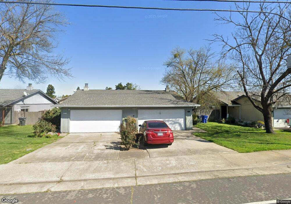
This home is located at 621 Carol Dr, Galt, CA 95632 and is currently estimated at $552,352, approximately $298 per square foot. 621 Carol Dr is a home located in Sacramento County with nearby schools including River Oaks Elementary School, Robert L. McCaffrey Middle School, and Galt High School.
Ownership History
Date
Name
Owned For
Owner Type
Purchase Details
Closed on
Jun 25, 2009
Sold by
Esparza Armando and Esparza Rosario
Bought by
Gutierrez Torres Armando Esparza and Gutierrez De Esparza Rosario
Current Estimated Value
Purchase Details
Closed on
Apr 21, 2004
Sold by
Garcia Ricardo and Garcia Martha
Bought by
Esparza Armando and Esparza Rosario
Purchase Details
Closed on
Jul 17, 2002
Sold by
Henkens Robert A and Henkens Margaret M
Bought by
Garcia Ricardo and Garcia Martha
Home Financials for this Owner
Home Financials are based on the most recent Mortgage that was taken out on this home.
Original Mortgage
$184,395
Interest Rate
6.7%
Mortgage Type
FHA
Create a Home Valuation Report for This Property
The Home Valuation Report is an in-depth analysis detailing your home's value as well as a comparison with similar homes in the area
Home Values in the Area
Average Home Value in this Area
Purchase History
| Date | Buyer | Sale Price | Title Company |
|---|---|---|---|
| Gutierrez Torres Armando Esparza | -- | None Available | |
| Esparza Armando | $350,000 | Old Republic Title Company | |
| Garcia Ricardo | $187,000 | North American Title Co |
Source: Public Records
Mortgage History
| Date | Status | Borrower | Loan Amount |
|---|---|---|---|
| Previous Owner | Garcia Ricardo | $184,395 |
Source: Public Records
Tax History Compared to Growth
Tax History
| Year | Tax Paid | Tax Assessment Tax Assessment Total Assessment is a certain percentage of the fair market value that is determined by local assessors to be the total taxable value of land and additions on the property. | Land | Improvement |
|---|---|---|---|---|
| 2025 | $5,476 | $497,606 | $159,229 | $338,377 |
| 2024 | $5,476 | $487,850 | $156,107 | $331,743 |
| 2023 | $5,384 | $478,286 | $153,047 | $325,239 |
| 2022 | $5,167 | $468,909 | $150,047 | $318,862 |
| 2021 | $5,173 | $459,715 | $147,105 | $312,610 |
| 2020 | $5,130 | $455,002 | $145,597 | $309,405 |
| 2019 | $5,003 | $446,082 | $142,743 | $303,339 |
| 2018 | $4,995 | $437,337 | $139,945 | $297,392 |
| 2017 | $4,417 | $394,615 | $126,275 | $268,340 |
| 2016 | $3,935 | $358,742 | $114,796 | $243,946 |
| 2015 | $3,606 | $335,273 | $107,286 | $227,987 |
| 2014 | $3,305 | $302,048 | $96,654 | $205,394 |
Source: Public Records
Map
Nearby Homes
- 650 Nathaniel Ave
- 604 Pringle Ave Unit 94
- 604 Pringle Ave Unit 99
- 604 Pringle Ave Unit 121
- 604 Pringle Ave Unit 87
- 605 Pringle Ave Unit 41
- 605 Pringle Ave Unit 9
- 409 N Lincoln Way
- 809 Ashboro Ln
- 820 N Lincoln Way Unit 73
- 820 N Lincoln Way Unit 42
- 820 N Lincoln Way Unit 78
- 10183 Pringle Ave
- 933 Colson Ct
- 350 Palin Ave
- 0 Pringle Ave Unit 225089282
- 0 Pringle Ave Unit 225119777
- 663 Canyon Creek Way
- 956 Trafalgar Cir
- 326 Oak Ave