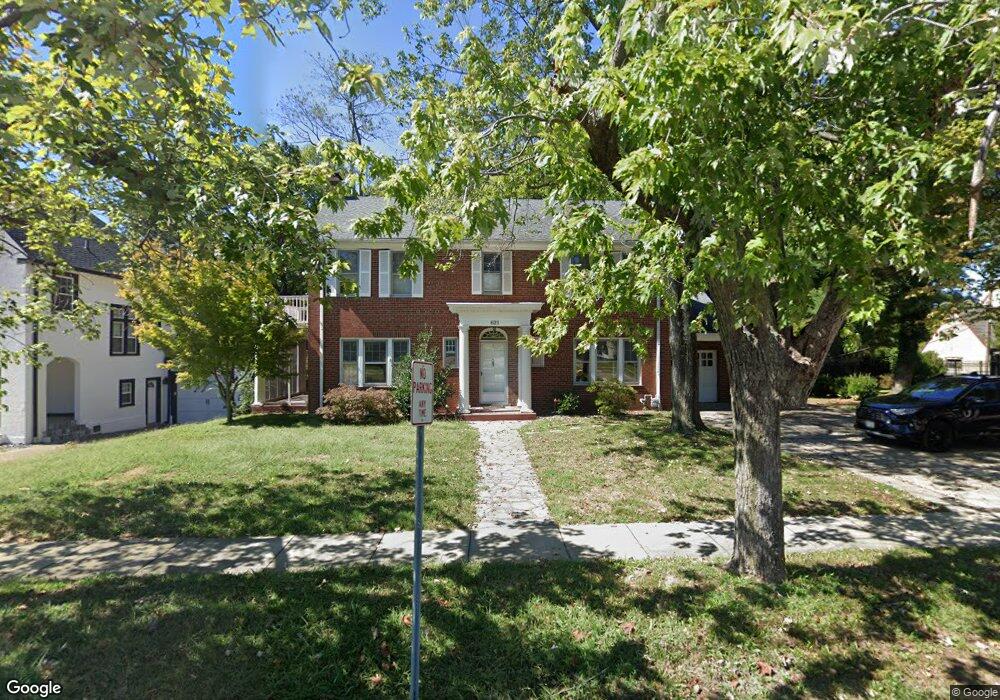
621 Henderson Ave Cape Girardeau, MO 63701
Estimated Value: $336,000 - $363,210
4
Beds
5
Baths
3,523
Sq Ft
$98/Sq Ft
Est. Value
About This Home
This home is located at 621 Henderson Ave, Cape Girardeau, MO 63701 and is currently estimated at $346,303, approximately $98 per square foot. 621 Henderson Ave is a home located in Cape Girardeau County with nearby schools including Franklin Elementary School, Central Middle School, and Central Junior High School.
Ownership History
Date
Name
Owned For
Owner Type
Purchase Details
Closed on
Nov 22, 2024
Sold by
Upchurch Talmage B and Upchurch Shawnna
Bought by
Lewis Earl G and Lewis Andrea
Current Estimated Value
Purchase Details
Closed on
Sep 20, 2011
Sold by
Hahs T Ronald and Hahs Beverly K
Bought by
Upchurch Talmage B and Upchurch Shawnna
Home Financials for this Owner
Home Financials are based on the most recent Mortgage that was taken out on this home.
Original Mortgage
$238,500
Interest Rate
4.28%
Mortgage Type
FHA
Create a Home Valuation Report for This Property
The Home Valuation Report is an in-depth analysis detailing your home's value as well as a comparison with similar homes in the area
Home Values in the Area
Average Home Value in this Area
Purchase History
| Date | Buyer | Sale Price | Title Company |
|---|---|---|---|
| Lewis Earl G | -- | None Listed On Document | |
| Lewis Earl G | -- | None Listed On Document | |
| Upchurch Talmage B | -- | Abstract And Title Co Inc |
Source: Public Records
Mortgage History
| Date | Status | Borrower | Loan Amount |
|---|---|---|---|
| Previous Owner | Upchurch Talmage B | $238,500 |
Source: Public Records
Tax History Compared to Growth
Tax History
| Year | Tax Paid | Tax Assessment Tax Assessment Total Assessment is a certain percentage of the fair market value that is determined by local assessors to be the total taxable value of land and additions on the property. | Land | Improvement |
|---|---|---|---|---|
| 2025 | $26 | $51,800 | $3,700 | $48,100 |
| 2024 | $26 | $49,340 | $3,530 | $45,810 |
| 2023 | $2,564 | $49,340 | $3,530 | $45,810 |
| 2022 | $2,364 | $45,470 | $3,250 | $42,220 |
| 2021 | $2,364 | $45,470 | $3,250 | $42,220 |
| 2020 | $2,371 | $45,470 | $3,250 | $42,220 |
| 2019 | $2,367 | $45,470 | $0 | $0 |
| 2018 | $2,363 | $45,470 | $0 | $0 |
| 2017 | $2,369 | $45,470 | $0 | $0 |
| 2016 | $2,225 | $42,880 | $0 | $0 |
| 2015 | $2,226 | $42,880 | $0 | $0 |
| 2014 | $2,238 | $42,880 | $0 | $0 |
Source: Public Records
Map
Nearby Homes
- 381 N Park Ave
- 374 N Park Ave
- 242 Orange Bowl Dr
- 1014 N Henderson Ave
- 715 Terrace Dr
- 1401 Bessie St
- 733 Watkins Dr
- 344 N Ellis St
- 325 N Sprigg St
- 424 Marie St
- 1742 Dunklin St
- 701 Penny Ave
- 63 N Hanover St
- 448 N Frederick St
- 1419 Themis St
- 519 & 521 N Middle St
- 502 and 515
- 423 N Sunset Blvd
- 12 N West End Blvd
- 455 Mason St
- 615 N Henderson St
- 1201 Hillcrest Dr
- 1211 Hillcrest Dr
- 603 N Henderson Ave
- 1220 Rockwood Dr
- 1225 Hillcrest Dr
- 610 Highland Dr
- 636 Highland Dr
- 1208 Hillcrest Dr
- 1217 Rockwood Dr
- 1222 Hillcrest Dr
- 646 Highland Dr
- 22 Highland Dr
- 2 Highland Dr
- 656 Highland Dr
- 633 Highland Dr
- 313 The Highlands
- 315 The Highlands
- 317 The Highlands