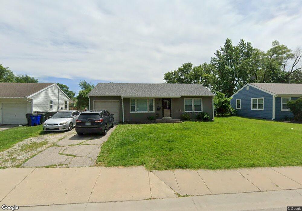
621 W Poor St Olathe, KS 66061
Estimated Value: $210,000 - $213,000
2
Beds
1
Bath
968
Sq Ft
$218/Sq Ft
Est. Value
About This Home
This home is located at 621 W Poor St, Olathe, KS 66061 and is currently estimated at $211,322, approximately $218 per square foot. 621 W Poor St is a home located in Johnson County with nearby schools including Westview Elementary School, Oregon Trail Middle School, and Olathe West High School.
Ownership History
Date
Name
Owned For
Owner Type
Purchase Details
Closed on
Mar 24, 2006
Sold by
Upshaw Herbert M and Upshaw Shannon C
Bought by
Sidwell Kyle
Current Estimated Value
Home Financials for this Owner
Home Financials are based on the most recent Mortgage that was taken out on this home.
Original Mortgage
$20,500
Outstanding Balance
$11,678
Interest Rate
6.21%
Mortgage Type
Credit Line Revolving
Estimated Equity
$199,644
Purchase Details
Closed on
Oct 15, 2003
Sold by
Midwest Property Options Llc
Bought by
Upshaw Herbert M and Upshaw Shannon C
Home Financials for this Owner
Home Financials are based on the most recent Mortgage that was taken out on this home.
Original Mortgage
$83,300
Interest Rate
5.93%
Mortgage Type
Purchase Money Mortgage
Purchase Details
Closed on
Jul 16, 2003
Sold by
Trussell Jay
Bought by
Midwest Property Options Llc
Purchase Details
Closed on
Mar 29, 2003
Sold by
Chance John and Chance Margaret
Bought by
The Chance Poor 621 Land Trust
Create a Home Valuation Report for This Property
The Home Valuation Report is an in-depth analysis detailing your home's value as well as a comparison with similar homes in the area
Home Values in the Area
Average Home Value in this Area
Purchase History
| Date | Buyer | Sale Price | Title Company |
|---|---|---|---|
| Sidwell Kyle | -- | Kansas City Title | |
| Upshaw Herbert M | -- | Coffelt Land Title Inc | |
| Midwest Property Options Llc | -- | -- | |
| The Chance Poor 621 Land Trust | -- | -- |
Source: Public Records
Mortgage History
| Date | Status | Borrower | Loan Amount |
|---|---|---|---|
| Open | Sidwell Kyle | $20,500 | |
| Open | Sidwell Kyle | $82,000 | |
| Previous Owner | Upshaw Herbert M | $83,300 |
Source: Public Records
Tax History Compared to Growth
Tax History
| Year | Tax Paid | Tax Assessment Tax Assessment Total Assessment is a certain percentage of the fair market value that is determined by local assessors to be the total taxable value of land and additions on the property. | Land | Improvement |
|---|---|---|---|---|
| 2024 | $1,943 | $18,170 | $3,917 | $14,253 |
| 2023 | $1,867 | $16,779 | $3,917 | $12,862 |
| 2022 | $1,703 | $14,916 | $3,563 | $11,353 |
| 2021 | $1,817 | $14,904 | $3,238 | $11,666 |
| 2020 | $1,727 | $14,053 | $2,945 | $11,108 |
| 2019 | $1,625 | $13,156 | $2,558 | $10,598 |
| 2018 | $1,486 | $11,971 | $2,324 | $9,647 |
| 2017 | $1,218 | $9,775 | $2,324 | $7,451 |
| 2016 | $1,132 | $9,338 | $2,324 | $7,014 |
| 2015 | $1,030 | $8,533 | $2,324 | $6,209 |
| 2013 | -- | $7,624 | $2,117 | $5,507 |
Source: Public Records
Map
Nearby Homes
- 812 S Troost St
- 617 S Grant St
- 706 S Kansas Ave
- 1106 W Sheridan St
- 721 S Chestnut St
- 600 W Elm St
- 1200 W Sheridan St
- 573 W Loula St
- 109 E Cedar St
- 335 S Water St
- 531 S Oscar St
- 507 W Park St
- 515 E Sheridan St
- 401 S Harrison St
- 321 S Wabash Cir
- 336 E Park St
- 1604 W Cedar St
- 1545 W Park St
- 821 E Wabash St
- 1425 W Poplar St
- 617 W Poor St
- 625 W Poor St
- 613 W Poor St
- 620 W Dennis Ave
- 629 W Poor St
- 616 W Dennis Ave
- 624 W Dennis Ave
- 612 W Dennis Ave
- 620 W Poor St
- 609 W Poor St
- 628 W Dennis Ave
- 616 W Poor St
- 624 W Poor St
- 701 W Poor St
- 608 W Dennis Ave
- 612 W Poor St
- 700 W Dennis Ave
- 605 W Poor St
- 705 W Poor St
- 608 W Poor St