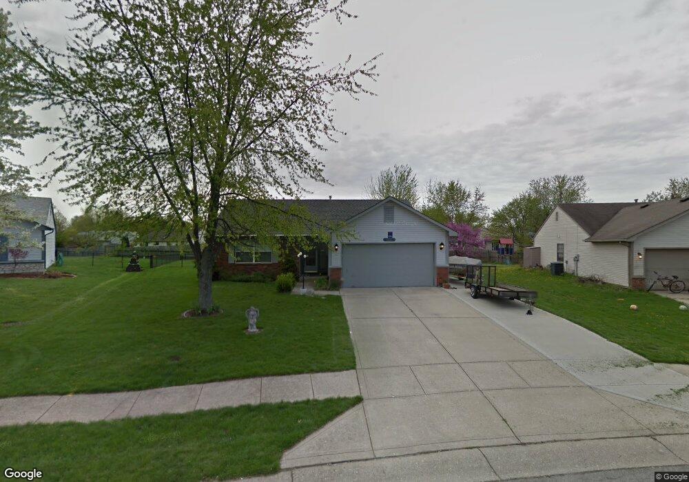
6217 Carrie Cir Indianapolis, IN 46237
South Franklin NeighborhoodEstimated Value: $247,000 - $259,000
3
Beds
2
Baths
1,244
Sq Ft
$204/Sq Ft
Est. Value
About This Home
This home is located at 6217 Carrie Cir, Indianapolis, IN 46237 and is currently estimated at $253,837, approximately $204 per square foot. 6217 Carrie Cir is a home located in Marion County with nearby schools including Franklin Central High School, Curtis Wilson Primary School and Academy, and Southport Presbyterian Christian School.
Ownership History
Date
Name
Owned For
Owner Type
Purchase Details
Closed on
Jun 20, 2008
Sold by
Dewees Angela C
Bought by
Smith Paul E and Smith Linda L
Current Estimated Value
Home Financials for this Owner
Home Financials are based on the most recent Mortgage that was taken out on this home.
Original Mortgage
$86,400
Interest Rate
5.94%
Mortgage Type
Purchase Money Mortgage
Create a Home Valuation Report for This Property
The Home Valuation Report is an in-depth analysis detailing your home's value as well as a comparison with similar homes in the area
Home Values in the Area
Average Home Value in this Area
Purchase History
| Date | Buyer | Sale Price | Title Company |
|---|---|---|---|
| Smith Paul E | -- | Chicago Title Greenwood |
Source: Public Records
Mortgage History
| Date | Status | Borrower | Loan Amount |
|---|---|---|---|
| Previous Owner | Smith Paul E | $86,400 |
Source: Public Records
Tax History Compared to Growth
Tax History
| Year | Tax Paid | Tax Assessment Tax Assessment Total Assessment is a certain percentage of the fair market value that is determined by local assessors to be the total taxable value of land and additions on the property. | Land | Improvement |
|---|---|---|---|---|
| 2024 | $2,125 | $217,900 | $22,800 | $195,100 |
| 2023 | $2,125 | $201,600 | $22,800 | $178,800 |
| 2022 | $2,006 | $189,800 | $22,800 | $167,000 |
| 2021 | $1,765 | $166,000 | $22,800 | $143,200 |
| 2020 | $1,587 | $148,400 | $22,800 | $125,600 |
| 2019 | $1,481 | $138,000 | $20,000 | $118,000 |
| 2018 | $1,326 | $122,800 | $20,000 | $102,800 |
| 2017 | $1,245 | $114,900 | $20,000 | $94,900 |
| 2016 | $1,242 | $114,800 | $20,000 | $94,800 |
| 2014 | $1,158 | $110,600 | $20,000 | $90,600 |
| 2013 | $1,029 | $100,300 | $20,000 | $80,300 |
Source: Public Records
Map
Nearby Homes
- 7628 Combs Rd
- 7140 Combs Rd
- 6540 Cougar Ct
- 7104 Combs Rd
- 6625 Wolverine Way
- 7829 Janel Dr
- 7225 Henderickson Ln
- 6315 Jakes Place
- 6943 Highland Ridge Ct
- 6956 Highland Ridge Ct
- 7216 Henderickson Ln
- 7115 Henderickson Ln
- 6040 E Southport Rd
- 6633 Muirfield Way
- 5719 Autumn Breeze Ln
- 6238 E Southport Rd
- 7843 Almond Dr
- 5859 Edelle Dr
- 8600 Combs Rd
- 7640 Gordon Way
- 6209 Carrie Cir
- 6225 Carrie Cir
- 6252 Glenshire Ln
- 6244 Glenshire Ln
- 6233 Carrie Cir
- 6201 Carrie Cir
- 6260 Glenshire Ln
- 6236 Glenshire Ln
- 6210 Carrie Cir
- 6268 Glenshire Ln
- 6228 Glenshire Ln
- 6241 Carrie Cir
- 7315 Carrie Dr
- 6230 Carrie Cir
- 7410 Southern Lakes Dr
- 6278 Glenshire Ln
- 6220 Glenshire Ln
- 6220 Glenshire Ln
- 7323 Carrie Dr
- 6249 Carrie Cir