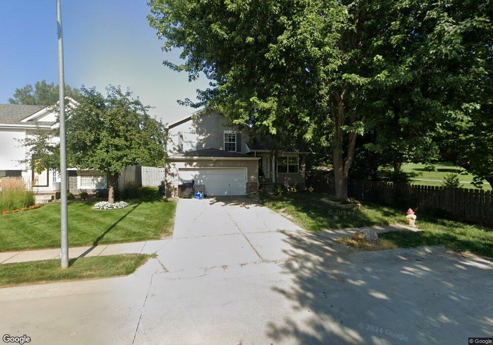
6218 N 131st Ave Omaha, NE 68164
Standing Bear NeighborhoodEstimated Value: $273,736 - $288,000
3
Beds
2
Baths
1,344
Sq Ft
$208/Sq Ft
Est. Value
About This Home
This home is located at 6218 N 131st Ave, Omaha, NE 68164 and is currently estimated at $280,184, approximately $208 per square foot. 6218 N 131st Ave is a home located in Douglas County with nearby schools including Prairie Wind Elementary School, Alfonza W. Davis Middle School, and St Vincent De Paul School.
Ownership History
Date
Name
Owned For
Owner Type
Purchase Details
Closed on
Dec 9, 2005
Sold by
Sidonik Cameo
Bought by
Witthuhn Jennifer
Current Estimated Value
Purchase Details
Closed on
Jun 3, 2002
Sold by
Hearthstone Homes Inc
Bought by
Sidoruk Boris Kendall and Sidoruk Cameo C
Home Financials for this Owner
Home Financials are based on the most recent Mortgage that was taken out on this home.
Original Mortgage
$125,200
Interest Rate
6.82%
Mortgage Type
FHA
Create a Home Valuation Report for This Property
The Home Valuation Report is an in-depth analysis detailing your home's value as well as a comparison with similar homes in the area
Home Values in the Area
Average Home Value in this Area
Purchase History
| Date | Buyer | Sale Price | Title Company |
|---|---|---|---|
| Witthuhn Jennifer | $139,000 | -- | |
| Sidoruk Boris Kendall | $128,000 | -- |
Source: Public Records
Mortgage History
| Date | Status | Borrower | Loan Amount |
|---|---|---|---|
| Previous Owner | Sidoruk Boris Kendall | $125,200 |
Source: Public Records
Tax History Compared to Growth
Tax History
| Year | Tax Paid | Tax Assessment Tax Assessment Total Assessment is a certain percentage of the fair market value that is determined by local assessors to be the total taxable value of land and additions on the property. | Land | Improvement |
|---|---|---|---|---|
| 2025 | $4,102 | $219,200 | $22,000 | $197,200 |
| 2024 | $4,790 | $219,200 | $22,000 | $197,200 |
| 2023 | $4,790 | $204,000 | $22,000 | $182,000 |
| 2022 | $4,914 | $204,000 | $22,000 | $182,000 |
| 2021 | $4,356 | $179,200 | $22,000 | $157,200 |
| 2020 | $3,958 | $161,400 | $22,000 | $139,400 |
| 2019 | $3,526 | $143,900 | $22,000 | $121,900 |
| 2018 | $3,531 | $143,900 | $22,000 | $121,900 |
| 2017 | $3,354 | $130,000 | $22,000 | $108,000 |
| 2016 | $3,309 | $128,600 | $12,000 | $116,600 |
| 2015 | $3,251 | $128,600 | $12,000 | $116,600 |
| 2014 | $3,251 | $128,600 | $12,000 | $116,600 |
Source: Public Records
Map
Nearby Homes
- 6201 N 132nd St
- 12904 Curtis Ave
- Hamilton Plan at Westbrook Hills
- Fremont Plan at Westbrook Hills
- 13502 Whitmore St
- Edmon Plan at Westbrook Hills
- 13521 Whitmore St
- 13611 Whitmore St
- 13615 Whitmore St
- 13623 Whitmore St
- 13627 Whitmore St
- 13601 Read St
- 13631 Whitmore St
- 13618 Whitmore St
- 13626 Whitmore St
- 12805 Ogden St
- 13630 Whitmore St
- 13634 Whitmore St
- 13638 Whitmore St
- 13701 Vane St
- 6214 N 131st Ave
- 6210 N 131st Ave
- 6206 N 131st Ave
- 6213 N 131st Ave
- 6209 N 131st Ave
- 6202 N 131st Ave
- 6205 N 131st Ave
- 6121 N 132nd St
- 6201 N 131st Ave
- N N 131st Ave
- 6212 N 131st St
- 6208 N 131st St
- 6216 N 131st St
- 6204 N 131st St
- 6306 N 131st St
- 6302 N 131st St
- 6310 N 131st St
- 6314 N 131st St
- 6320 N 131st St
- 6408 N 131st St