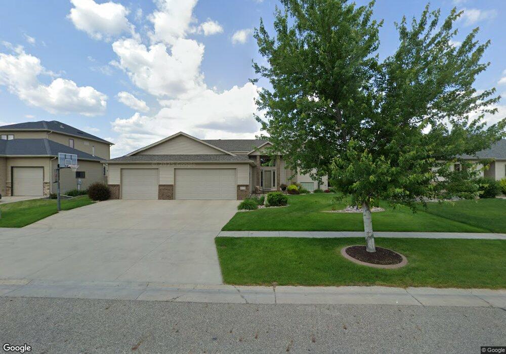
622 18th Ave E West Fargo, ND 58078
Charleswood NeighborhoodEstimated Value: $418,000
5
Beds
3
Baths
1,522
Sq Ft
$275/Sq Ft
Est. Value
About This Home
This home is located at 622 18th Ave E, West Fargo, ND 58078 and is currently estimated at $418,000, approximately $274 per square foot. 622 18th Ave E is a home located in Cass County with nearby schools including South Elementary School, Cheney Middle School, and West Fargo High School.
Ownership History
Date
Name
Owned For
Owner Type
Purchase Details
Closed on
Oct 7, 2008
Sold by
Klein Construction Co Inc
Bought by
Heise Christopher A and Heise Monica J
Current Estimated Value
Home Financials for this Owner
Home Financials are based on the most recent Mortgage that was taken out on this home.
Original Mortgage
$160,000
Outstanding Balance
$104,647
Interest Rate
6.43%
Mortgage Type
New Conventional
Estimated Equity
$313,353
Purchase Details
Closed on
Oct 3, 2008
Sold by
Charleswood Inc
Bought by
Klein Construction Co Inc
Home Financials for this Owner
Home Financials are based on the most recent Mortgage that was taken out on this home.
Original Mortgage
$160,000
Outstanding Balance
$104,647
Interest Rate
6.43%
Mortgage Type
New Conventional
Estimated Equity
$313,353
Create a Home Valuation Report for This Property
The Home Valuation Report is an in-depth analysis detailing your home's value as well as a comparison with similar homes in the area
Home Values in the Area
Average Home Value in this Area
Purchase History
| Date | Buyer | Sale Price | Title Company |
|---|---|---|---|
| Heise Christopher A | -- | -- | |
| Klein Construction Co Inc | -- | -- |
Source: Public Records
Mortgage History
| Date | Status | Borrower | Loan Amount |
|---|---|---|---|
| Open | Heise Christopher A | $160,000 |
Source: Public Records
Tax History
| Year | Tax Paid | Tax Assessment Tax Assessment Total Assessment is a certain percentage of the fair market value that is determined by local assessors to be the total taxable value of land and additions on the property. | Land | Improvement |
|---|---|---|---|---|
| 2024 | $5,897 | $226,850 | $38,100 | $188,750 |
| 2023 | $6,000 | $210,350 | $38,100 | $172,250 |
| 2022 | $6,094 | $204,700 | $38,100 | $166,600 |
| 2021 | $5,822 | $188,150 | $34,100 | $154,050 |
| 2020 | $5,547 | $184,250 | $34,100 | $150,150 |
| 2019 | $5,519 | $182,900 | $34,100 | $148,800 |
| 2018 | $5,263 | $181,350 | $34,100 | $147,250 |
| 2017 | $5,514 | $181,350 | $34,100 | $147,250 |
| 2016 | $5,099 | $181,150 | $34,100 | $147,050 |
| 2015 | $5,159 | $169,200 | $20,500 | $148,700 |
| 2014 | $4,926 | $158,150 | $20,500 | $137,650 |
| 2013 | $2,015 | $150,600 | $20,500 | $130,100 |
Source: Public Records
Map
Nearby Homes
- 1811 7th St E
- 1929 Pentland St
- 1827 7th St E
- 715 Northridge Way
- 1844 1st St
- 790 Lakeridge Dr
- 118 W Beaton Dr
- 722 14 1 2 Ave E
- 1264 Marlys Dr W
- 868 Lakeridge Place
- 1550 Sheyenne St
- 783 14 1 2 Ave E
- 306 13th Ave E
- 430 19th Ave W Unit A
- 1409 Heatherwood Ct
- 245 12th Ave E
- 602 12 1 2 Ave E Unit 5
- 1755 Huntington Dr
- 1829 13th St E
- 1884 Huntington Ln
- 628 18th Ave E
- 616 18th Ave E
- 621 17th Ave E
- 627 17th Ave E
- 615 17th Ave E
- 634 18th Ave E
- 610 18th Ave E
- 1808 Queensbury St
- 633 17th Ave E
- 609 17th Ave E
- 1711 6th St E
- 640 18th Ave E
- 1816 Queensbury St
- 639 17th Ave E
- 1892 6th St E
- 1807 Queensbury St
- 1715 6th St E
- 646 18th Ave E
- 1702 Princeton Ln
- 1815 Queensbury St
Your Personal Tour Guide
Ask me questions while you tour the home.