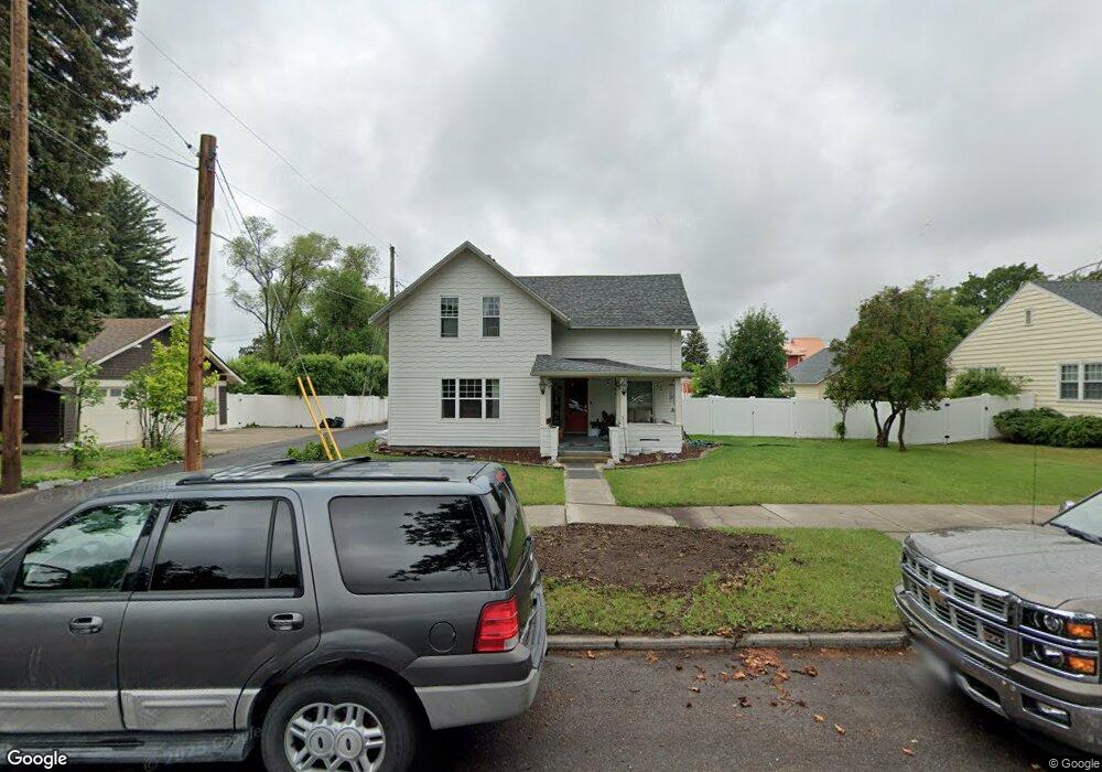
622 6th St E Kalispell, MT 59901
Estimated Value: $512,000 - $651,000
3
Beds
2
Baths
1,922
Sq Ft
$290/Sq Ft
Est. Value
About This Home
This home is located at 622 6th St E, Kalispell, MT 59901 and is currently estimated at $556,424, approximately $289 per square foot. 622 6th St E is a home located in Flathead County with nearby schools including Cornelius Hedges School, Kalispell Middle School, and Flathead High School.
Ownership History
Date
Name
Owned For
Owner Type
Purchase Details
Closed on
Oct 6, 2017
Sold by
Conner Patricia H
Bought by
Collingwood Patrice A
Current Estimated Value
Home Financials for this Owner
Home Financials are based on the most recent Mortgage that was taken out on this home.
Original Mortgage
$269,310
Outstanding Balance
$225,191
Interest Rate
3.86%
Mortgage Type
New Conventional
Estimated Equity
$331,233
Purchase Details
Closed on
Jun 6, 2013
Sold by
Walker Jennifer A
Bought by
Conner Patricia H
Home Financials for this Owner
Home Financials are based on the most recent Mortgage that was taken out on this home.
Original Mortgage
$180,000
Interest Rate
3.37%
Mortgage Type
New Conventional
Purchase Details
Closed on
Feb 9, 2006
Sold by
Walker Craig
Bought by
Walker Jennifer A
Create a Home Valuation Report for This Property
The Home Valuation Report is an in-depth analysis detailing your home's value as well as a comparison with similar homes in the area
Purchase History
| Date | Buyer | Sale Price | Title Company |
|---|---|---|---|
| Collingwood Patrice A | -- | Insured Titles | |
| Conner Patricia H | -- | Atec | |
| Walker Jennifer A | -- | None Available |
Source: Public Records
Mortgage History
| Date | Status | Borrower | Loan Amount |
|---|---|---|---|
| Open | Collingwood Patrice A | $269,310 | |
| Previous Owner | Conner Patricia H | $180,000 |
Source: Public Records
Tax History
| Year | Tax Paid | Tax Assessment Tax Assessment Total Assessment is a certain percentage of the fair market value that is determined by local assessors to be the total taxable value of land and additions on the property. | Land | Improvement |
|---|---|---|---|---|
| 2025 | $2,769 | $521,200 | $0 | $0 |
| 2024 | $3,857 | $495,300 | $0 | $0 |
| 2023 | $4,376 | $495,300 | $0 | $0 |
| 2022 | $3,705 | $307,600 | $0 | $0 |
| 2021 | $3,310 | $307,600 | $0 | $0 |
| 2020 | $3,533 | $276,600 | $0 | $0 |
| 2019 | $3,686 | $276,600 | $0 | $0 |
| 2018 | $3,471 | $246,600 | $0 | $0 |
| 2017 | $3,477 | $246,600 | $0 | $0 |
| 2016 | $3,008 | $231,400 | $0 | $0 |
| 2015 | $3,001 | $231,400 | $0 | $0 |
| 2014 | $2,503 | $111,194 | $0 | $0 |
Source: Public Records
Map
Nearby Homes
- 442 4th Ave E
- 184 Lawrence Ln
- 1024 Woodland Ave
- 226 3rd Ave E
- 826 11th St E
- 776 1st Ave E
- 270 Caroline Rd
- 51 Selders Ln
- 100 Woodlands Way Unit W-205
- 100 Woodlands Way Unit S305
- 100 Woodlands Way Unit S312
- 100 Woodlands Way Unit W-204
- 100 Woodlands Way Unit P-408
- 100 Woodlands Way Unit P-205
- 100 Woodlands Way
- 100 Woodlands Way Unit P-307
- 100 Woodlands Way Unit P-406
- 100 Woodlands Way Unit S405
- 100 Woodlands Way Unit S-404
- 403 E Center St
Your Personal Tour Guide
Ask me questions while you tour the home.