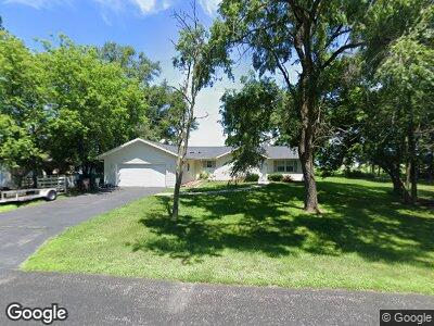
622 Powers St Palmyra, WI 53156
Estimated Value: $307,000 - $372,000
--
Bed
--
Bath
--
Sq Ft
0.29
Acres
About This Home
This home is located at 622 Powers St, Palmyra, WI 53156 and is currently estimated at $336,272. 622 Powers St is a home located in Jefferson County with nearby schools including Palmyra-Eagle High School.
Ownership History
Date
Name
Owned For
Owner Type
Purchase Details
Closed on
Mar 28, 2006
Sold by
Gross Paul J
Bought by
Ullrich Kevin D
Current Estimated Value
Home Financials for this Owner
Home Financials are based on the most recent Mortgage that was taken out on this home.
Original Mortgage
$33,150
Interest Rate
6.33%
Mortgage Type
Purchase Money Mortgage
Create a Home Valuation Report for This Property
The Home Valuation Report is an in-depth analysis detailing your home's value as well as a comparison with similar homes in the area
Home Values in the Area
Average Home Value in this Area
Purchase History
| Date | Buyer | Sale Price | Title Company |
|---|---|---|---|
| Ullrich Kevin D | $78,000 | None Available |
Source: Public Records
Mortgage History
| Date | Status | Borrower | Loan Amount |
|---|---|---|---|
| Open | Ullrich Kevin D | $50,000 | |
| Closed | Ullrich Kevin D | $17,000 | |
| Open | Ullrich Kevin D | $135,000 | |
| Closed | Ullrich Kevin D | $10,000 | |
| Closed | Ullrich Kevin D | $166,500 | |
| Closed | Ullrich Kevin D | $161,825 | |
| Closed | Ullrich Kevin D | $14,000 | |
| Closed | Ullrich Kevin D | $161,125 | |
| Closed | Ullrich Kevin D | $162,950 | |
| Closed | Ullrich Kevin D | $164,000 | |
| Closed | Ullrich Kevin D | $164,000 | |
| Closed | Ullrich Kevin D | $33,150 |
Source: Public Records
Tax History Compared to Growth
Tax History
| Year | Tax Paid | Tax Assessment Tax Assessment Total Assessment is a certain percentage of the fair market value that is determined by local assessors to be the total taxable value of land and additions on the property. | Land | Improvement |
|---|---|---|---|---|
| 2024 | $4,743 | $316,900 | $47,400 | $269,500 |
| 2023 | $4,198 | $187,300 | $27,200 | $160,100 |
| 2022 | $3,681 | $187,300 | $27,200 | $160,100 |
| 2021 | $3,939 | $187,300 | $27,200 | $160,100 |
| 2020 | $3,998 | $187,300 | $27,200 | $160,100 |
| 2019 | $3,806 | $187,300 | $27,200 | $160,100 |
| 2018 | $3,999 | $187,300 | $27,200 | $160,100 |
| 2017 | $4,068 | $187,300 | $27,200 | $160,100 |
| 2016 | $4,042 | $187,300 | $27,200 | $160,100 |
| 2015 | $3,971 | $192,700 | $30,600 | $162,100 |
| 2014 | $3,886 | $192,700 | $30,600 | $162,100 |
| 2013 | $3,822 | $192,700 | $30,600 | $162,100 |
Source: Public Records
Map
Nearby Homes
- 620 Powers St
- 212 E Wisconsin St
- 300 W Main
- 226 S 2nd St
- 507 E Main St
- 711 Brennan Rd
- W1335 N Blue Spring Lake Dr
- W1359 N Blue Spring Lake Dr
- W1260 S Shore Dr
- W1275 S Shore Dr
- N1754 Parkview Cir
- W5494 Whitetail Trail
- W4429 Little Prairie Rd
- N9566 Hilltop Dr
- W6098 U S 12
- 542 Anton Ct
- Lt2T Howard Rd
- Lot 2 & 3 Sherwood Forest Rd
- Lot 4 Sherwood Forest Rd
- Lot 3 Sherwood Forest Rd
