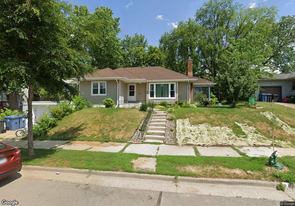
622 Sheridan Ave N Minneapolis, MN 55411
Willard-Hay NeighborhoodEstimated Value: $230,000 - $286,000
4
Beds
1
Bath
1,187
Sq Ft
$215/Sq Ft
Est. Value
About This Home
This home is located at 622 Sheridan Ave N, Minneapolis, MN 55411 and is currently estimated at $254,761, approximately $214 per square foot. 622 Sheridan Ave N is a home located in Hennepin County with nearby schools including Bryn Mawr Elementary School, Anwatin Middle School, and North Community High School.
Ownership History
Date
Name
Owned For
Owner Type
Purchase Details
Closed on
Mar 26, 2008
Sold by
Jpmorgan Chase Na
Bought by
Butler Janice M
Current Estimated Value
Purchase Details
Closed on
Dec 18, 2001
Sold by
Okanla Babatunde and Hawker Anita
Bought by
Okanla K Oluyenisi
Purchase Details
Closed on
Mar 30, 2001
Sold by
Thompson Harold W and Thompson Olufunmilayo T
Bought by
Okanla Babatunde
Purchase Details
Closed on
Jul 31, 2000
Sold by
The Chase Manhattan Bank
Bought by
Okanla Babatunde
Purchase Details
Closed on
May 27, 1997
Sold by
Carter Ella
Bought by
Carter Edgar
Create a Home Valuation Report for This Property
The Home Valuation Report is an in-depth analysis detailing your home's value as well as a comparison with similar homes in the area
Home Values in the Area
Average Home Value in this Area
Purchase History
| Date | Buyer | Sale Price | Title Company |
|---|---|---|---|
| Butler Janice M | $99,000 | -- | |
| Okanla K Oluyenisi | $146,000 | -- | |
| Okanla Babatunde | $130,000 | -- | |
| Okanla Babatunde | $67,000 | -- | |
| Carter Edgar | $62,000 | -- |
Source: Public Records
Tax History Compared to Growth
Tax History
| Year | Tax Paid | Tax Assessment Tax Assessment Total Assessment is a certain percentage of the fair market value that is determined by local assessors to be the total taxable value of land and additions on the property. | Land | Improvement |
|---|---|---|---|---|
| 2024 | $3,554 | $261,000 | $24,000 | $237,000 |
| 2023 | $3,162 | $256,000 | $24,000 | $232,000 |
| 2022 | $2,992 | $237,000 | $17,000 | $220,000 |
| 2021 | $2,724 | $214,000 | $18,000 | $196,000 |
| 2020 | $2,652 | $201,000 | $15,300 | $185,700 |
| 2019 | $2,472 | $182,500 | $10,200 | $172,300 |
| 2018 | $2,197 | $166,000 | $10,200 | $155,800 |
| 2017 | $2,028 | $153,000 | $9,300 | $143,700 |
| 2016 | $1,969 | $145,500 | $9,300 | $136,200 |
| 2015 | $1,725 | $126,500 | $9,300 | $117,200 |
| 2014 | -- | $121,000 | $9,300 | $111,700 |
Source: Public Records
Map
Nearby Homes
- 723 Sheridan Ave N
- 819 Sheridan Ave N
- 701 Vincent Ave N
- 905 Queen Ave N
- 918 Queen Ave N
- 2224 4th Ave N
- 2713 Glenwood Ave
- 722 Newton Ave N
- 2108 Glenwood Ave
- 1214 Penn Ave N
- 426 Logan Ave N
- 1332 Upton Ave N
- 1336 Russell Ave N
- 8 Queen Ave S
- 1028 Knox Ave N
- 1030 Knox Ave N
- 20 Vincent Ave S
- 1400 Queen Ave N
- 226 Gramercy Ave
- 40 Penn Ave S
- 700 Sheridan Ave N
- 616 Sheridan Ave N
- 623 Russell Ave N
- 625 Russell Ave N
- 617 Russell Ave N
- 615 Russell Ave N
- 707 Russell Ave N
- 710 Sheridan Ave N
- 621 Sheridan Ave N
- 701 Sheridan Ave N
- 711 Russell Ave N
- 705 Sheridan Ave N
- 615 Sheridan Ave N
- 711 Sheridan Ave N
- 720 Sheridan Ave N
- 713 Russell Ave N
- 715 Sheridan Ave N
- 719 Russell Ave N
- 719 Sheridan Ave N
- 723 Russell Ave N