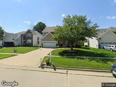
6230 Orchard Dr West Des Moines, IA 50266
Estimated Value: $394,555 - $569,000
4
Beds
2
Baths
3,637
Sq Ft
$124/Sq Ft
Est. Value
About This Home
This home is located at 6230 Orchard Dr, West Des Moines, IA 50266 and is currently estimated at $450,889, approximately $123 per square foot. 6230 Orchard Dr is a home located in Dallas County with nearby schools including Brookview Elementary School, South Middle School, and Prairieview Middle School.
Ownership History
Date
Name
Owned For
Owner Type
Purchase Details
Closed on
Aug 7, 2008
Sold by
Pesaru Ramgopal R and Sadhu Madhuri
Bought by
Saraswathi Rayasam Ravi and Saraswathi Bendpudi
Current Estimated Value
Home Financials for this Owner
Home Financials are based on the most recent Mortgage that was taken out on this home.
Original Mortgage
$239,400
Interest Rate
6.39%
Mortgage Type
New Conventional
Purchase Details
Closed on
Nov 7, 2005
Sold by
Beaird Jeffrey S and Beaird Alison N
Bought by
Pesaru Ramgopal and Sadhu Madhuri
Home Financials for this Owner
Home Financials are based on the most recent Mortgage that was taken out on this home.
Original Mortgage
$120,000
Interest Rate
4.87%
Mortgage Type
Adjustable Rate Mortgage/ARM
Create a Home Valuation Report for This Property
The Home Valuation Report is an in-depth analysis detailing your home's value as well as a comparison with similar homes in the area
Home Values in the Area
Average Home Value in this Area
Purchase History
| Date | Buyer | Sale Price | Title Company |
|---|---|---|---|
| Saraswathi Rayasam Ravi | $252,000 | None Available | |
| Pesaru Ramgopal | $2,900 | None Available |
Source: Public Records
Mortgage History
| Date | Status | Borrower | Loan Amount |
|---|---|---|---|
| Open | Rayasam Ravi | $218,000 | |
| Closed | Saraswathi Rayasam Ravi | $239,400 | |
| Previous Owner | Pesaru Ramgopal | $120,000 | |
| Previous Owner | Beaird Jeffreys | $45,900 |
Source: Public Records
Tax History Compared to Growth
Tax History
| Year | Tax Paid | Tax Assessment Tax Assessment Total Assessment is a certain percentage of the fair market value that is determined by local assessors to be the total taxable value of land and additions on the property. | Land | Improvement |
|---|---|---|---|---|
| 2023 | $5,764 | $348,410 | $60,000 | $288,410 |
| 2022 | $5,232 | $307,860 | $60,000 | $247,860 |
| 2021 | $5,232 | $282,720 | $50,000 | $232,720 |
| 2020 | $5,070 | $265,290 | $50,000 | $215,290 |
| 2019 | $4,900 | $265,290 | $50,000 | $215,290 |
| 2018 | $4,900 | $244,520 | $45,000 | $199,520 |
| 2017 | $4,926 | $244,520 | $45,000 | $199,520 |
| 2016 | $4,682 | $239,600 | $45,000 | $194,600 |
| 2015 | $4,542 | $233,290 | $0 | $0 |
| 2014 | $4,542 | $233,290 | $0 | $0 |
Source: Public Records
Map
Nearby Homes
- 989 65th St
- 943 65th St
- 980 65th St
- 6531 Bradford Dr
- 5909 Brookview Dr
- 6178 Aspen Dr
- 6204 Aspen Dr
- 1205 65th Place
- 6562 Center St
- 1028 58th St
- 1228 64th St
- 1017 58th St
- 5829 Center St
- 950 67th St Unit 321
- 681 63rd St
- 5708 Ashworth Rd
- 1045 68th St Unit 2
- 692 58th Place Unit 14
- 1030 68th St Unit 8
- 6855 Woodland Ave Unit 1203