Estimated Value: $286,436 - $335,000
--
Bed
2
Baths
2,257
Sq Ft
$140/Sq Ft
Est. Value
About This Home
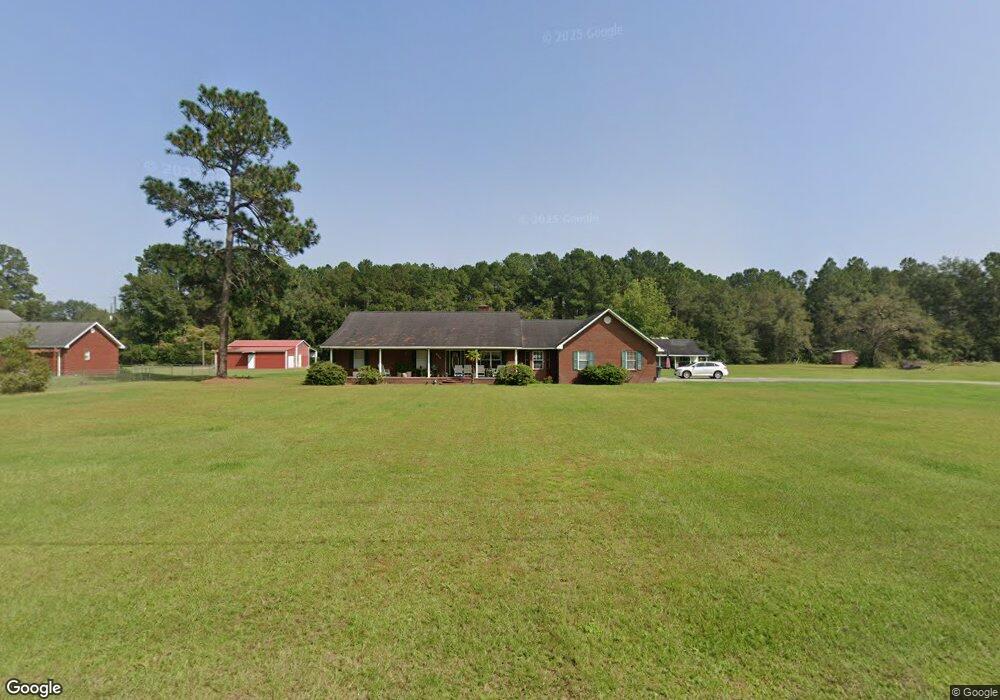
This home is located at 624 Cameron Rd, Jesup, GA 31545 and is currently estimated at $315,609, approximately $139 per square foot. 624 Cameron Rd is a home located in Wayne County with nearby schools including Bacon Elementary School, Martha Puckett Middle School, and Wayne County High School.
Ownership History
Date
Name
Owned For
Owner Type
Purchase Details
Closed on
Dec 1, 2003
Sold by
Smith John H and Smith Patricia A
Bought by
Smith John H
Current Estimated Value
Purchase Details
Closed on
Mar 1, 2000
Bought by
Smith John H and Smith Patricia A
Purchase Details
Closed on
Sep 1, 1997
Purchase Details
Closed on
Apr 1, 1991
Purchase Details
Closed on
Sep 1, 1972
Purchase Details
Closed on
Mar 1, 1972
Create a Home Valuation Report for This Property
The Home Valuation Report is an in-depth analysis detailing your home's value as well as a comparison with similar homes in the area
Home Values in the Area
Average Home Value in this Area
Purchase History
| Date | Buyer | Sale Price | Title Company |
|---|---|---|---|
| Smith John H | -- | -- | |
| Smith John H | $135,000 | -- | |
| -- | -- | -- | |
| -- | $7,000 | -- | |
| -- | -- | -- | |
| -- | -- | -- | |
| -- | -- | -- |
Source: Public Records
Tax History Compared to Growth
Tax History
| Year | Tax Paid | Tax Assessment Tax Assessment Total Assessment is a certain percentage of the fair market value that is determined by local assessors to be the total taxable value of land and additions on the property. | Land | Improvement |
|---|---|---|---|---|
| 2024 | $1,254 | $107,602 | $3,751 | $103,851 |
| 2023 | $968 | $95,101 | $3,751 | $91,350 |
| 2022 | $1,083 | $77,599 | $3,751 | $73,848 |
| 2021 | $1,038 | $68,854 | $3,751 | $65,103 |
| 2020 | $1,096 | $69,768 | $4,665 | $65,103 |
| 2019 | $1,161 | $69,768 | $4,665 | $65,103 |
| 2018 | $1,161 | $69,768 | $4,665 | $65,103 |
| 2017 | $837 | $69,768 | $4,665 | $65,103 |
| 2016 | $772 | $69,768 | $4,665 | $65,103 |
| 2014 | $1,943 | $69,768 | $4,665 | $65,103 |
| 2013 | -- | $69,766 | $4,664 | $65,102 |
Source: Public Records
Map
Nearby Homes
- 129 Norris Dr
- 3808 Waycross Hwy
- 1351 Old Screven Rd
- 675 Foxwood Cir
- 188 Bennetts Cir
- 168 Nature Cir
- 1435 Bennett Crossing
- 1361 Joey Williamson Rd
- 1361 Joey Williamson Rd Jesup Ga
- 7014 Waycross Hwy
- 7114 Waycross Hwy
- 7132 Waycross Hwy
- 00 Photonia Ave
- 113 Tift St
- 125 Sugar Maple St
- TRACT 1 Sunset Blvd
- 00 Sunset Blvd
- 0 Sunset Blvd
- TRACT 2 Sunset Blvd
- 118 Charlton St
- 583 Empire Rd
- 592 Cameron Rd
- 631 Cameron Rd
- 669 Empire Rd
- 589 Cameron Rd
- 550 Cameron Rd
- 628 Empire Rd
- 520 Cameron Rd
- 710 Empire Rd
- 762 Empire Rd
- 535 Cameron Rd
- 100 Norris Dr
- 44 Flint Branch Church Rd
- 75 Norris Dr
- 405 Empire Rd
- 132 Norris Dr
- 400 Cameron Rd
- 111 Flint Branch Church Rd
- 817 Empire Rd
- 136 Flint Branch Church Rd