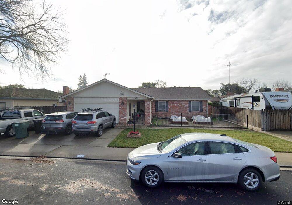
624 Mayflower St Modesto, CA 95356
Central Modesto NeighborhoodEstimated Value: $465,729 - $536,000
3
Beds
2
Baths
1,698
Sq Ft
$295/Sq Ft
Est. Value
About This Home
This home is located at 624 Mayflower St, Modesto, CA 95356 and is currently estimated at $500,932, approximately $295 per square foot. 624 Mayflower St is a home located in Stanislaus County with nearby schools including Woodrow Elementary School, Somerset Middle School, and Grace M. Davis High School.
Ownership History
Date
Name
Owned For
Owner Type
Purchase Details
Closed on
Jun 15, 1999
Sold by
Harper Richard and R E Samantha T Castellanos Tru
Bought by
Corgiat Eric and Corgiat Michele
Current Estimated Value
Home Financials for this Owner
Home Financials are based on the most recent Mortgage that was taken out on this home.
Original Mortgage
$129,090
Outstanding Balance
$33,232
Interest Rate
7.24%
Mortgage Type
FHA
Estimated Equity
$467,700
Purchase Details
Closed on
Dec 6, 1995
Sold by
Mcwhorter Susan Gayle
Bought by
Castellanos R E Samantha T
Create a Home Valuation Report for This Property
The Home Valuation Report is an in-depth analysis detailing your home's value as well as a comparison with similar homes in the area
Home Values in the Area
Average Home Value in this Area
Purchase History
| Date | Buyer | Sale Price | Title Company |
|---|---|---|---|
| Corgiat Eric | $130,000 | North American Title Co | |
| Castellanos R E Samantha T | $130,000 | Fidelity National Title |
Source: Public Records
Mortgage History
| Date | Status | Borrower | Loan Amount |
|---|---|---|---|
| Open | Corgiat Eric | $129,090 |
Source: Public Records
Tax History
| Year | Tax Paid | Tax Assessment Tax Assessment Total Assessment is a certain percentage of the fair market value that is determined by local assessors to be the total taxable value of land and additions on the property. | Land | Improvement |
|---|---|---|---|---|
| 2025 | $2,208 | $199,783 | $53,781 | $146,002 |
| 2024 | $2,168 | $195,867 | $52,727 | $143,140 |
| 2023 | $2,127 | $192,028 | $51,694 | $140,334 |
| 2022 | $2,040 | $188,264 | $50,681 | $137,583 |
| 2021 | $2,005 | $184,574 | $49,688 | $134,886 |
| 2020 | $1,976 | $182,682 | $49,179 | $133,503 |
| 2019 | $1,940 | $179,101 | $48,215 | $130,886 |
| 2018 | $1,902 | $175,590 | $47,270 | $128,320 |
| 2017 | $1,856 | $172,148 | $46,344 | $125,804 |
| 2016 | $1,846 | $168,774 | $45,436 | $123,338 |
| 2015 | $1,819 | $166,240 | $44,754 | $121,486 |
| 2014 | $1,812 | $162,985 | $43,878 | $119,107 |
Source: Public Records
Map
Nearby Homes
- 3724 Columbine Dr
- 3721 Marigold Ln
- 3600 Columbine Dr Unit 6
- 3800 Marigold Ln
- 3804 Semallon Dr
- 325 Standiford Ave Unit 29
- 325 Standiford Ave Unit 52
- 3728 Fuchsia Ln
- 3909 Trillium Ave
- 904 W Union Ave
- 413 Redford Ln
- 3417 John Lee Ln
- 3913 Cougar Place
- 3325 Sherwood Ave
- 920 Kevin Ct
- 3432 Colonial Dr
- 3632 Busher Ct
- 917 Woodrow Ave
- 3313 Colonial Dr
- 3701 Colonial Dr Unit 224
Your Personal Tour Guide
Ask me questions while you tour the home.