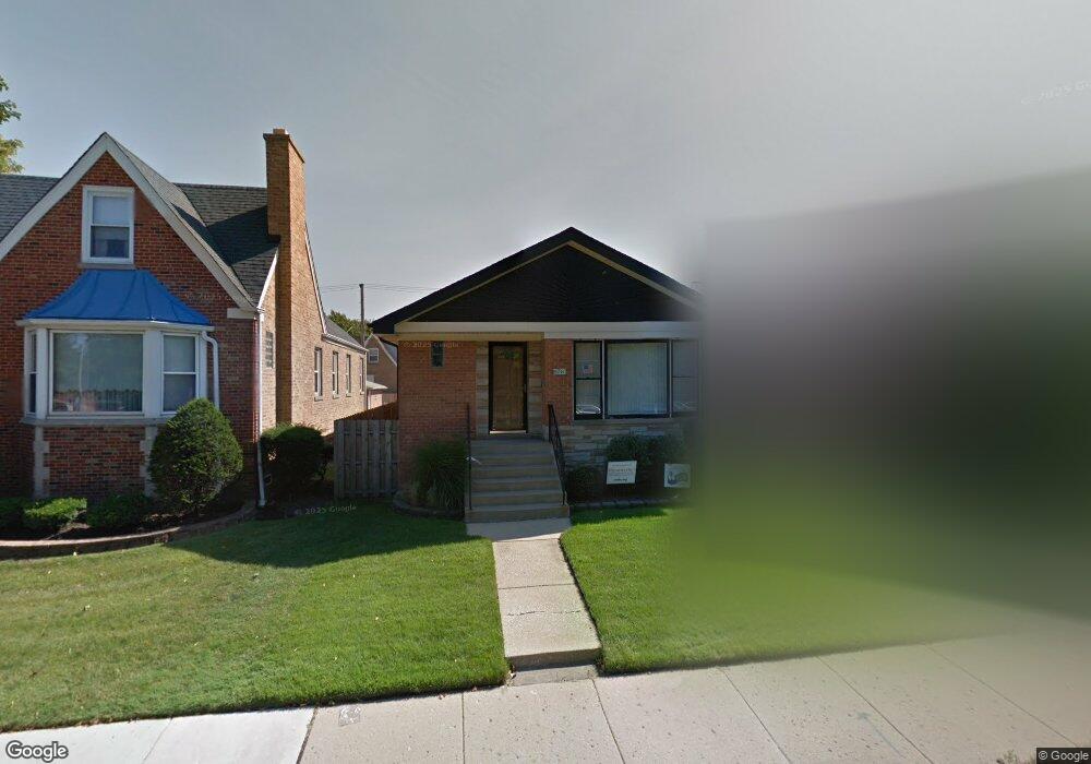
6241 W Devon Ave Chicago, IL 60646
Norwood Park NeighborhoodEstimated Value: $447,135 - $511,000
3
Beds
1
Bath
1,226
Sq Ft
$388/Sq Ft
Est. Value
About This Home
This home is located at 6241 W Devon Ave, Chicago, IL 60646 and is currently estimated at $475,284, approximately $387 per square foot. 6241 W Devon Ave is a home located in Cook County with nearby schools including Onahan Elementary School, William Howard Taft High School, and Logos Christian Academy.
Ownership History
Date
Name
Owned For
Owner Type
Purchase Details
Closed on
Apr 8, 2003
Sold by
Lasalle Bank Na
Bought by
Laveau Gregory and Laveau Dawn
Current Estimated Value
Home Financials for this Owner
Home Financials are based on the most recent Mortgage that was taken out on this home.
Original Mortgage
$140,000
Outstanding Balance
$59,029
Interest Rate
5.86%
Mortgage Type
Purchase Money Mortgage
Estimated Equity
$416,255
Create a Home Valuation Report for This Property
The Home Valuation Report is an in-depth analysis detailing your home's value as well as a comparison with similar homes in the area
Home Values in the Area
Average Home Value in this Area
Purchase History
| Date | Buyer | Sale Price | Title Company |
|---|---|---|---|
| Laveau Gregory | -- | -- | |
| Laveau Gregory | -- | -- |
Source: Public Records
Mortgage History
| Date | Status | Borrower | Loan Amount |
|---|---|---|---|
| Open | Laveau Gregory | $140,000 | |
| Closed | Laveau Gregory | $140,000 |
Source: Public Records
Tax History
| Year | Tax Paid | Tax Assessment Tax Assessment Total Assessment is a certain percentage of the fair market value that is determined by local assessors to be the total taxable value of land and additions on the property. | Land | Improvement |
|---|---|---|---|---|
| 2025 | $6,263 | $36,001 | $17,438 | $18,563 |
| 2024 | $6,263 | $36,001 | $17,438 | $18,563 |
| 2023 | $6,084 | $33,001 | $14,063 | $18,938 |
| 2022 | $6,084 | $33,001 | $14,063 | $18,938 |
| 2021 | $5,966 | $32,999 | $14,062 | $18,937 |
| 2020 | $5,943 | $29,779 | $9,000 | $20,779 |
| 2019 | $5,959 | $33,088 | $9,000 | $24,088 |
| 2018 | $5,857 | $33,088 | $9,000 | $24,088 |
| 2017 | $4,996 | $26,584 | $7,875 | $18,709 |
| 2016 | $5,506 | $29,986 | $7,875 | $22,111 |
| 2015 | $5,166 | $31,565 | $7,875 | $23,690 |
| 2014 | $4,507 | $27,593 | $6,750 | $20,843 |
| 2013 | $4,404 | $27,593 | $6,750 | $20,843 |
Source: Public Records
Map
Nearby Homes
- 6159 N Moody Ave
- 6138 N Meade Ave
- 6247 N Neenah Ave
- 6212 W Norwood St
- 6264 W Peterson Ave
- 6119 N Mason Ave
- 6667 W Devon Ave
- 6600 N Normandy Ave
- 6674 W Hayes Ave
- 6755 N Milwaukee Ave Unit 404
- 6005 N Neola Ave Unit 2B
- 6807 N Milwaukee Ave Unit 510
- 6908 N Mendota Ave
- 6800 W Raven St Unit 205
- 6815 N Milwaukee Ave Unit 201
- 6815 N Milwaukee Ave Unit 707
- 5728 N Mcvicker Ave
- 6701 W Forest View Ln
- 6600 N Lehigh Ave
- 6843 N Loleta Ave
- 6243 W Devon Ave
- 6233 W Devon Ave
- 6247 W Devon Ave
- 6362 N Merrimac Ave
- 6249 W Devon Ave
- 6358 N Merrimac Ave
- 6253 W Devon Ave Unit 1
- 6227 W Devon Ave
- 6356 N Merrimac Ave
- 6365 N Mobile Ave
- 6223 W Devon Ave
- 6257 W Devon Ave
- 6257 W Devon Ave
- 6354 N Merrimac Ave
- 6363 N Mobile Ave
- 6219 W Devon Ave
- 6359 N Mobile Ave
- 6363 N Merrimac Ave
- 6350 N Merrimac Ave
- 6361 N Merrimac Ave
Your Personal Tour Guide
Ask me questions while you tour the home.