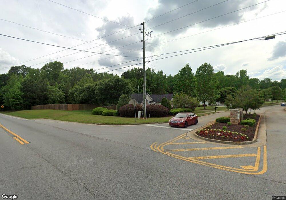
625 Morningside Dr N Stockbridge, GA 30281
Estimated Value: $305,000 - $345,000
4
Beds
2
Baths
1,874
Sq Ft
$174/Sq Ft
Est. Value
About This Home
This home is located at 625 Morningside Dr N, Stockbridge, GA 30281 and is currently estimated at $326,138, approximately $174 per square foot. 625 Morningside Dr N is a home located in Henry County with nearby schools including Woodland Elementary School, Woodland Middle School, and Woodland High School.
Ownership History
Date
Name
Owned For
Owner Type
Purchase Details
Closed on
Aug 31, 2011
Sold by
Secretary Of Housing And U
Bought by
Willis Dacia Denee
Current Estimated Value
Home Financials for this Owner
Home Financials are based on the most recent Mortgage that was taken out on this home.
Original Mortgage
$85,446
Outstanding Balance
$59,655
Interest Rate
4.75%
Mortgage Type
FHA
Estimated Equity
$266,483
Purchase Details
Closed on
Sep 7, 2010
Sold by
Wells Fargo Bk Na
Bought by
Hud-Housing Of Urban Dev
Purchase Details
Closed on
Oct 1, 2004
Sold by
Manor Homes Inc
Bought by
Fears Tony N
Home Financials for this Owner
Home Financials are based on the most recent Mortgage that was taken out on this home.
Original Mortgage
$158,120
Interest Rate
5.64%
Mortgage Type
VA
Create a Home Valuation Report for This Property
The Home Valuation Report is an in-depth analysis detailing your home's value as well as a comparison with similar homes in the area
Home Values in the Area
Average Home Value in this Area
Purchase History
| Date | Buyer | Sale Price | Title Company |
|---|---|---|---|
| Willis Dacia Denee | -- | -- | |
| Hud-Housing Of Urban Dev | -- | -- | |
| Wells Fargo Bk Na | $185,012 | -- | |
| Fears Tony N | $160,700 | -- |
Source: Public Records
Mortgage History
| Date | Status | Borrower | Loan Amount |
|---|---|---|---|
| Open | Willis Dacia Denee | $85,446 | |
| Previous Owner | Fears Tony N | $158,120 |
Source: Public Records
Tax History Compared to Growth
Tax History
| Year | Tax Paid | Tax Assessment Tax Assessment Total Assessment is a certain percentage of the fair market value that is determined by local assessors to be the total taxable value of land and additions on the property. | Land | Improvement |
|---|---|---|---|---|
| 2025 | $3,806 | $134,040 | $18,000 | $116,040 |
| 2024 | $3,806 | $122,480 | $18,000 | $104,480 |
| 2023 | $3,239 | $127,120 | $16,000 | $111,120 |
| 2022 | $3,184 | $103,440 | $12,000 | $91,440 |
| 2021 | $2,767 | $85,760 | $12,000 | $73,760 |
| 2020 | $2,608 | $79,040 | $10,000 | $69,040 |
| 2019 | $2,491 | $74,080 | $10,000 | $64,080 |
| 2018 | $2,434 | $71,680 | $10,000 | $61,680 |
| 2016 | $1,941 | $61,160 | $10,000 | $51,160 |
| 2015 | $1,862 | $56,280 | $7,200 | $49,080 |
| 2014 | $1,710 | $49,400 | $7,200 | $42,200 |
Source: Public Records
Map
Nearby Homes
- 641 Morningside Dr N
- 4881 Highway 155 N
- 415 Tea Rose Ln N
- 0 Valley Rd & Hwy 155 Rd
- 106 Valley Rd
- 230 Mels Way
- 119 Valley Rd
- 0 Georgia 155 S Unit TRACT 3 10311477
- 130 Valley Dr
- 130 Valley Dr Unit 2
- 214 Hemlock Dr
- 5018 Highway 155 N
- 140 Melrose Creek Dr
- 222 Hemlock Dr
- 4850 Highway 138 SW
- 1645 Hemphill Rd
- 88 Bowen Rd
- 5149 Highway 155 N
- 120 Bowen Rd
- 2100 Highway 138 E
- 627 Morningside Dr N
- 629 Morningside Dr N
- 623 Morningside Dr N Unit 2
- 626 Morningside Dr N
- N Morningside Dr N
- 715 Melglory Rose Ct N
- 735 Melglory Rose Ct N
- 631 Morningside Dr N
- 630 Morningside Dr N
- 705 Melglory Rose Ct N
- 0 Melglory Rose Ct N Unit 7481019
- 0 Melglory Rose Ct N Unit 8649489
- 0 Melglory Rose Ct N Unit 8357379
- 0 Melglory Rose Ct N Unit 8149072
- 0 Melglory Rose Ct N Unit 7094825
- 745 Melglory Rose Ct N
- 633 Morningside Dr N
- 672 Morningside Dr N
- 701 Melglory Rose Ct N
- 632 Morningside Dr N
