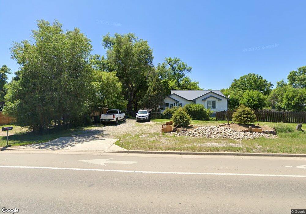
625 N Taft Hill Rd Fort Collins, CO 80521
Estimated Value: $614,771 - $739,000
2
Beds
1
Bath
1,702
Sq Ft
$396/Sq Ft
Est. Value
About This Home
This home is located at 625 N Taft Hill Rd, Fort Collins, CO 80521 and is currently estimated at $673,443, approximately $395 per square foot. 625 N Taft Hill Rd is a home located in Larimer County with nearby schools including Irish Elementary School, Lincoln Middle School, and Poudre High School.
Ownership History
Date
Name
Owned For
Owner Type
Purchase Details
Closed on
Dec 6, 2013
Sold by
Irc Development Llc
Bought by
Chiaramonte William Roger and Chiaramonte Linda Joyce
Current Estimated Value
Home Financials for this Owner
Home Financials are based on the most recent Mortgage that was taken out on this home.
Original Mortgage
$160,000
Interest Rate
5%
Mortgage Type
Seller Take Back
Purchase Details
Closed on
May 1, 2008
Sold by
Cairns Terrence B and Rudmanis Inara A
Bought by
Irc Development Llc
Purchase Details
Closed on
Jul 14, 1997
Sold by
Royval Norman Larry and Royval Diana Lee
Bought by
Cairns Terrence B and Rudmanis Inara A
Home Financials for this Owner
Home Financials are based on the most recent Mortgage that was taken out on this home.
Original Mortgage
$103,000
Interest Rate
7.85%
Create a Home Valuation Report for This Property
The Home Valuation Report is an in-depth analysis detailing your home's value as well as a comparison with similar homes in the area
Home Values in the Area
Average Home Value in this Area
Purchase History
| Date | Buyer | Sale Price | Title Company |
|---|---|---|---|
| Chiaramonte William Roger | $200,000 | Heritage Title | |
| Irc Development Llc | -- | None Available | |
| Cairns Terrence B | $118,000 | -- | |
| Royval Norman Larry | $88,525 | -- |
Source: Public Records
Mortgage History
| Date | Status | Borrower | Loan Amount |
|---|---|---|---|
| Closed | Chiaramonte William Roger | $160,000 | |
| Previous Owner | Cairns Terrence B | $103,000 |
Source: Public Records
Tax History Compared to Growth
Tax History
| Year | Tax Paid | Tax Assessment Tax Assessment Total Assessment is a certain percentage of the fair market value that is determined by local assessors to be the total taxable value of land and additions on the property. | Land | Improvement |
|---|---|---|---|---|
| 2025 | $3,419 | $45,553 | $2,010 | $43,543 |
| 2024 | $3,875 | $45,553 | $2,010 | $43,543 |
| 2022 | $3,335 | $34,938 | $2,085 | $32,853 |
| 2021 | $3,364 | $35,943 | $2,145 | $33,798 |
| 2020 | $2,703 | $28,629 | $2,145 | $26,484 |
| 2019 | $2,715 | $28,629 | $2,145 | $26,484 |
| 2018 | $2,283 | $24,833 | $2,160 | $22,673 |
| 2017 | $2,275 | $24,833 | $2,160 | $22,673 |
| 2016 | $1,704 | $18,499 | $2,388 | $16,111 |
| 2015 | $997 | $10,910 | $2,390 | $8,520 |
| 2014 | $878 | $9,540 | $2,390 | $7,150 |
Source: Public Records
Map
Nearby Homes
- 2121 Liberty Dr
- 241 N Taft Hill Rd
- 123 County Road 19
- 209 N Taft Hill Rd
- 2028 Laporte Ave
- 0 Laporte Ave
- 2205 Stonecrest Dr
- 508 N Sunset St
- 1392 Cherry St
- 100 Grandview Ave
- 329 N Sunset St
- 2810 Cherry Ln
- 1340 N Taft Hill Rd
- 2704 Laporte Ave
- 2708 Laporte Ave
- 200 Bishop St
- 405 Franklin St
- 1343 Cherry St
- 1349 Cherry St
- 1255 Alameda St
- 607 N Taft Hill Rd
- 637 N Taft Hill Rd
- 630 N Taft Hill Rd
- 605 N Taft Hill Rd
- 616 N Taft Hill Rd
- 610 N Taft Hill Rd
- 636 N Taft Hill Rd
- 521 N Taft Hill Rd
- 2106 W Vine Dr
- 2114 W Vine Dr
- 621 Mercer Dr
- 2025 W Vine Dr
- 530 N Taft Hill Rd
- 2120 W Vine Dr
- 2135 W Vine Dr
- 520 N Taft Hill Rd
- 2126 W Vine Dr
- 519 N Taft Hill Rd
- 709 N Taft Hill Rd
- 607 Mercer Dr