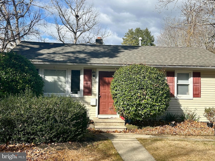
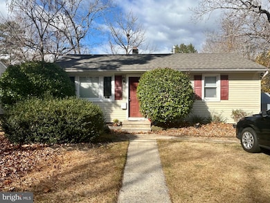
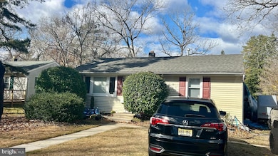
6251 Old Harding Hwy Mays Landing, NJ 08330
Estimated payment $1,446/month
Highlights
- Rambler Architecture
- No HOA
- No Interior Steps
- Cedar Creek High School Rated A-
- Tankless Water Heater
- 90% Forced Air Heating System
About This Home
Excellent investment opportunity! This tenant-occupied 2-bedroom, 1-bathroom home offers steady rental income from day one. The property features a eat in galley kitchen, den or dining room, spacious living room leading out to a deck and large fenced in backyard. The home features a New Roof, New Tankless Hot water Heater plus connected to public water and sewer. With reliable long term tenants already in place and looking to stay, this is a turnkey addition to any rental portfolio. Conveniently located near shopping, schools, and major highways. Instant cash flow and strong rental history make this a smart buy for investors seeking consistent returns. Schedule your appointment Today!
Listing Agent
(609) 217-1880 tracyg@exithomepros.com Exit Homestead Realty Professi License #1863996 Listed on: 11/19/2025

Home Details
Home Type
- Single Family
Est. Annual Taxes
- $3,769
Year Built
- Built in 1958
Lot Details
- 3,778 Sq Ft Lot
- Lot Dimensions are 44.39 x 85.10
- Property is in good condition
- Property is zoned GA-L
Home Design
- Rambler Architecture
- Frame Construction
- Shingle Roof
Interior Spaces
- 896 Sq Ft Home
- Property has 1 Level
- Ceiling Fan
- Crawl Space
- Laundry on main level
Bedrooms and Bathrooms
- 2 Main Level Bedrooms
- 1 Full Bathroom
Parking
- 3 Parking Spaces
- 3 Driveway Spaces
- On-Street Parking
Accessible Home Design
- No Interior Steps
- Level Entry For Accessibility
Schools
- Joseph C. Shaner Memorial Elementary School
- William Davies Middle School
- Oakcrest High School
Utilities
- 90% Forced Air Heating System
- Tankless Water Heater
- Public Septic
Community Details
- No Home Owners Association
Listing and Financial Details
- Tax Lot 00002
- Assessor Parcel Number 12-00703-00002
Map
Home Values in the Area
Average Home Value in this Area
Tax History
| Year | Tax Paid | Tax Assessment Tax Assessment Total Assessment is a certain percentage of the fair market value that is determined by local assessors to be the total taxable value of land and additions on the property. | Land | Improvement |
|---|---|---|---|---|
| 2025 | $3,675 | $107,100 | $34,100 | $73,000 |
| 2024 | $3,675 | $107,100 | $34,100 | $73,000 |
| 2023 | $3,455 | $107,100 | $34,100 | $73,000 |
| 2022 | $3,455 | $107,100 | $34,100 | $73,000 |
| 2021 | $3,448 | $107,100 | $34,100 | $73,000 |
| 2020 | $3,448 | $107,100 | $34,100 | $73,000 |
| 2019 | $3,456 | $107,100 | $34,100 | $73,000 |
| 2018 | $3,335 | $107,100 | $34,100 | $73,000 |
| 2017 | $3,283 | $107,100 | $34,100 | $73,000 |
| 2016 | $3,191 | $107,100 | $34,100 | $73,000 |
| 2015 | $3,082 | $107,100 | $34,100 | $73,000 |
| 2014 | $3,331 | $126,800 | $41,300 | $85,500 |
Property History
| Date | Event | Price | List to Sale | Price per Sq Ft |
|---|---|---|---|---|
| 11/19/2025 11/19/25 | For Sale | $215,000 | -- | $240 / Sq Ft |
Purchase History
| Date | Type | Sale Price | Title Company |
|---|---|---|---|
| Interfamily Deed Transfer | -- | None Available | |
| Bargain Sale Deed | $120,000 | Agents Title Services | |
| Deed | $60,000 | -- |
Source: Bright MLS
MLS Number: NJAC2021730
APN: 12-00703-0000-00002
Disclaimer: Certain information contained herein is derived from information provided by parties other than Homes.com. All information provided is deemed reliable, but is not guaranteed to be accurate and should be independently verified.
![]() The data relating to real estate for sale on this website appears in part through the BRIGHT Internet Data Exchange program, a voluntary cooperative exchange of property listing data between licensed real estate brokerage firms, and is provided by BRIGHT through a licensing agreement.
The data relating to real estate for sale on this website appears in part through the BRIGHT Internet Data Exchange program, a voluntary cooperative exchange of property listing data between licensed real estate brokerage firms, and is provided by BRIGHT through a licensing agreement.
Listing information is from various brokers who participate in the Bright MLS IDX program and not all listings may be visible on the site.
The property information being provided on or through the website is for the personal, non-commercial use of consumers and such information may not be used for any purpose other than to identify prospective properties consumers may be interested in purchasing.
Some properties which appear for sale on the website may no longer be available because they are for instance, under contract, sold or are no longer being offered for sale.
Property information displayed is deemed reliable but is not guaranteed.
Copyright 2025 Bright MLS, Inc.
- 6206 Roberts Ave
- 6302 Palmer Ave
- 0 Harding Hwy Unit 597638
- 0 Harding Hwy Unit NJAC2019438
- 6314 Lance Ave
- 6140 Robin Dr
- 6301 Knight Ave
- 6310 Phillips Ave
- 6126 Longwood Ave
- 80 Mill St
- 87 Devon Rd
- 37 Delancy Ct
- 535 Park Rd
- 565 Park Rd
- Rt 50 and Old Mays Landing Rd
- 526 Bainbridge Ave
- 204 Route 50
- 850 Morningside Dr
- 0 3rd St
- 15 Lowell St
- 30 Mill St
- 908 Morris Ln
- 254 Vail Ct Unit 1504
- 254 Vail Ct
- 4850 Corwen Ct
- 1932 Cologne Ave
- 6216 Cypress St
- 4977 Winterbury Dr Unit 4977 Winterbury Dr
- 2444 Bayberry Ct
- 3401 Montgomery Dr
- 2602 Dogwood Ct Unit 162
- 2465 Arbor Ct Unit 311
- 2744 Mimosa Ct
- 3214 Juniper Ct Unit 652
- 3137 Woodlands Dr Unit C0025
- 2613 Boulder Ct
- 2708 Falcon Ct
- 3616 Starlight Cir
- 3307 Falcon Ct
- 2000 Timber Glen Dr