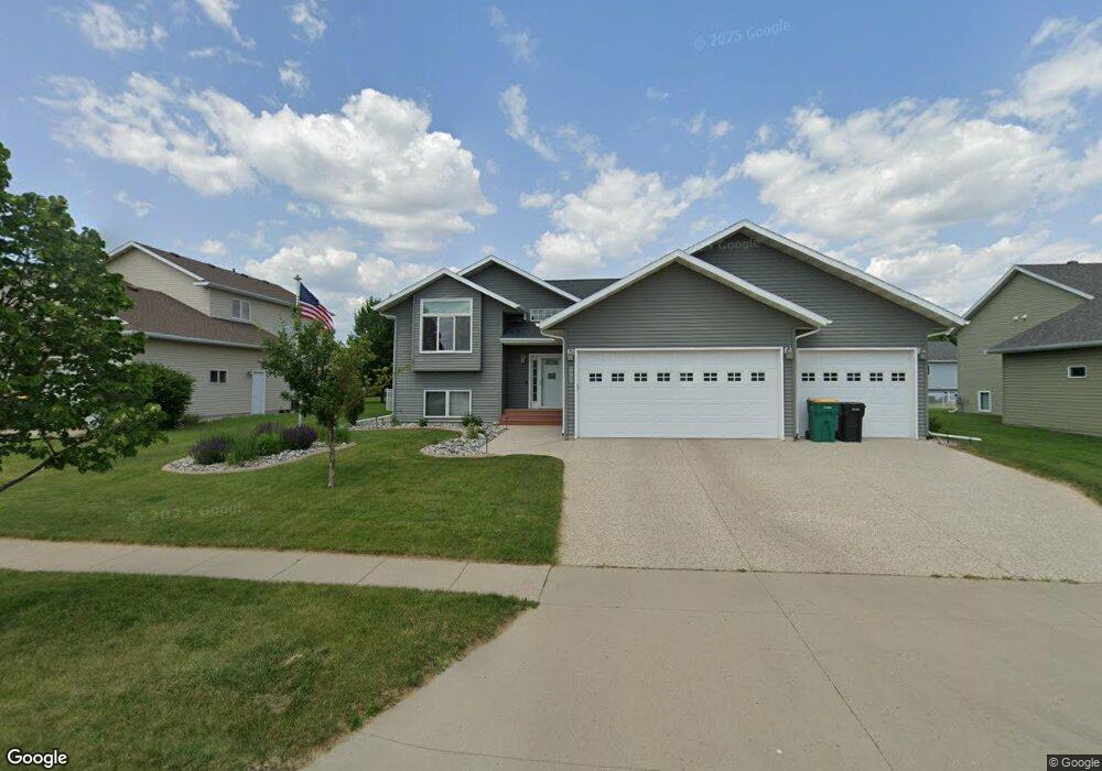
626 17th Ave E West Fargo, ND 58078
Charleswood NeighborhoodEstimated Value: $465,000 - $511,634
4
Beds
3
Baths
3,137
Sq Ft
$156/Sq Ft
Est. Value
About This Home
This home is located at 626 17th Ave E, West Fargo, ND 58078 and is currently estimated at $488,317, approximately $155 per square foot. 626 17th Ave E is a home located in Cass County with nearby schools including South Elementary School, Cheney Middle School, and West Fargo High School.
Ownership History
Date
Name
Owned For
Owner Type
Purchase Details
Closed on
Dec 7, 2023
Sold by
Fryslie Erika
Bought by
Erika Fryslie Living Trust and Fryslie
Current Estimated Value
Purchase Details
Closed on
Sep 30, 2015
Sold by
Moseng Craig E and Moseng Sarah J
Bought by
Fryslie Erika
Home Financials for this Owner
Home Financials are based on the most recent Mortgage that was taken out on this home.
Original Mortgage
$256,400
Interest Rate
3.91%
Mortgage Type
New Conventional
Purchase Details
Closed on
May 26, 2005
Sold by
Charleswood Inc
Bought by
Moseng Craig E and Moseng Sarah J
Home Financials for this Owner
Home Financials are based on the most recent Mortgage that was taken out on this home.
Original Mortgage
$144,000
Interest Rate
5.91%
Mortgage Type
Construction
Create a Home Valuation Report for This Property
The Home Valuation Report is an in-depth analysis detailing your home's value as well as a comparison with similar homes in the area
Home Values in the Area
Average Home Value in this Area
Purchase History
| Date | Buyer | Sale Price | Title Company |
|---|---|---|---|
| Erika Fryslie Living Trust | -- | None Listed On Document | |
| Fryslie Erika | $320,500 | None Available | |
| Moseng Craig E | -- | -- |
Source: Public Records
Mortgage History
| Date | Status | Borrower | Loan Amount |
|---|---|---|---|
| Previous Owner | Fryslie Erika | $256,400 | |
| Previous Owner | Moseng Craig E | $144,000 |
Source: Public Records
Tax History
| Year | Tax Paid | Tax Assessment Tax Assessment Total Assessment is a certain percentage of the fair market value that is determined by local assessors to be the total taxable value of land and additions on the property. | Land | Improvement |
|---|---|---|---|---|
| 2024 | $5,975 | $210,950 | $33,650 | $177,300 |
| 2023 | $5,667 | $198,100 | $33,650 | $164,450 |
| 2022 | $5,753 | $192,750 | $33,650 | $159,100 |
| 2021 | $5,366 | $172,450 | $27,700 | $144,750 |
| 2020 | $5,095 | $167,100 | $27,700 | $139,400 |
| 2019 | $5,625 | $164,500 | $27,700 | $136,800 |
| 2018 | $5,429 | $163,200 | $27,700 | $135,500 |
| 2017 | $5,729 | $164,700 | $27,700 | $137,000 |
| 2016 | $5,313 | $161,350 | $27,700 | $133,650 |
| 2015 | $3,689 | $120,300 | $16,250 | $104,050 |
| 2014 | $3,302 | $112,450 | $16,250 | $96,200 |
| 2013 | $3,262 | $107,850 | $16,250 | $91,600 |
Source: Public Records
Map
Nearby Homes
- 1811 7th St E
- 1827 7th St E
- 715 Northridge Way
- 1929 Pentland St
- 1844 1st St
- 722 14 1 2 Ave E
- 790 Lakeridge Dr
- 783 14 1 2 Ave E
- 306 13th Ave E
- 118 W Beaton Dr
- 868 Lakeridge Place
- 1264 Marlys Dr W
- 1550 Sheyenne St
- 245 12th Ave E
- 602 12 1 2 Ave E Unit 5
- 1409 Heatherwood Ct
- 430 19th Ave W Unit A
- 1755 Huntington Dr
- 1829 13th St E
- 622 12th Ave E
- 620 17th Ave E
- 632 17th Ave E
- 659 Wyndemere Dr
- 663 Wyndemere Dr
- 638 17th Ave E
- 1691 6th St E
- 1683 6th St E
- 667 Wyndemere Dr
- 1675 6th St E
- 644 17th Ave E
- 655 Wyndemere Dr
- 621 17th Ave E
- 627 17th Ave E
- 1667 6th St E
- 615 17th Ave E
- 671 Wyndemere Dr
- 633 17th Ave E
- 650 17th Ave E
- 609 17th Ave E
- 639 17th Ave E
Your Personal Tour Guide
Ask me questions while you tour the home.