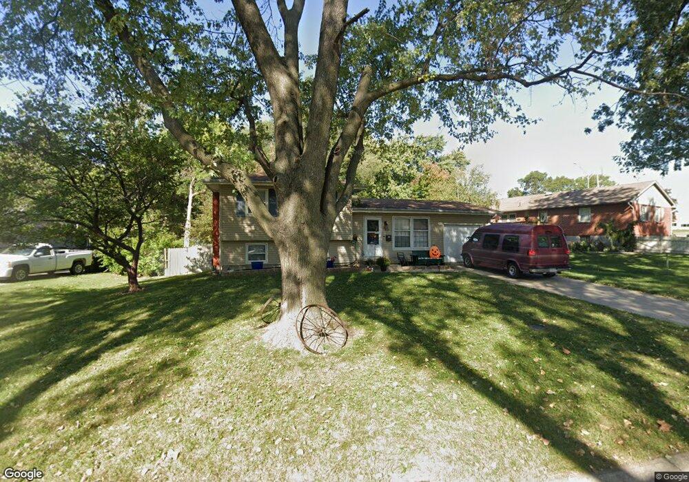
626 NW Fair Ln Lees Summit, MO 64063
Estimated Value: $230,261 - $254,000
3
Beds
1
Bath
919
Sq Ft
$265/Sq Ft
Est. Value
About This Home
This home is located at 626 NW Fair Ln, Lees Summit, MO 64063 and is currently estimated at $243,315, approximately $264 per square foot. 626 NW Fair Ln is a home located in Jackson County with nearby schools including Bernard C. Campbell Middle School, Westview Elementary School, and Lee's Summit North High School.
Ownership History
Date
Name
Owned For
Owner Type
Purchase Details
Closed on
Dec 14, 2001
Sold by
Dominick Brian David and Dominick Kimberly S
Bought by
Dominick Brian David and Dominick Kimberly S
Current Estimated Value
Home Financials for this Owner
Home Financials are based on the most recent Mortgage that was taken out on this home.
Original Mortgage
$67,000
Interest Rate
6.39%
Mortgage Type
Purchase Money Mortgage
Purchase Details
Closed on
Oct 25, 1996
Sold by
Driskill Elvin E and Driskill Donna Kay
Bought by
Dominick Brian David
Home Financials for this Owner
Home Financials are based on the most recent Mortgage that was taken out on this home.
Original Mortgage
$60,276
Interest Rate
8.15%
Mortgage Type
FHA
Create a Home Valuation Report for This Property
The Home Valuation Report is an in-depth analysis detailing your home's value as well as a comparison with similar homes in the area
Home Values in the Area
Average Home Value in this Area
Purchase History
| Date | Buyer | Sale Price | Title Company |
|---|---|---|---|
| Dominick Brian David | -- | Stewart Title | |
| Dominick Brian David | -- | Stewart Title |
Source: Public Records
Mortgage History
| Date | Status | Borrower | Loan Amount |
|---|---|---|---|
| Closed | Dominick Brian David | $67,000 | |
| Closed | Dominick Brian David | $60,276 |
Source: Public Records
Tax History
| Year | Tax Paid | Tax Assessment Tax Assessment Total Assessment is a certain percentage of the fair market value that is determined by local assessors to be the total taxable value of land and additions on the property. | Land | Improvement |
|---|---|---|---|---|
| 2025 | $2,449 | $29,398 | $8,240 | $21,158 |
| 2024 | $2,431 | $33,915 | $6,688 | $27,227 |
| 2023 | $2,431 | $33,915 | $4,473 | $29,442 |
| 2022 | $1,795 | $22,230 | $4,579 | $17,651 |
| 2021 | $1,832 | $22,230 | $4,579 | $17,651 |
| 2020 | $1,765 | $21,217 | $4,579 | $16,638 |
| 2019 | $1,717 | $21,217 | $4,579 | $16,638 |
| 2018 | $1,841 | $21,105 | $4,115 | $16,990 |
| 2017 | $1,841 | $21,105 | $4,115 | $16,990 |
| 2016 | $1,813 | $20,577 | $3,762 | $16,815 |
Source: Public Records
Map
Nearby Homes
- 626 NW Kay Dr
- 626 NW Village Dr
- 622 NW Village Dr
- 620 NW Village Dr
- 412 NW Donovan Rd
- 206 NW Woodbine Ave
- 207 NW Woodbine Ave
- 211-213 NW Orchard Ct
- 27002 NW Olive St
- 27003 NW Olive St
- 211 NW Orchard Ct
- 213 NW Orchard Ct
- 219 NW Orchard Ct
- 217 NW Orchard Ct
- 231 NW Orchard Ct
- 1005 NW Maple St
- 104 SW Alderson Place
- 1 NW Walnut St
- 109 SW Walnut St
- 300 W 1st St
- 624 NW Fair Ln
- 701 NW Chipman Rd
- 627 NW Fair Ln
- 625 NW Fair Ln
- 623 NW Fair Ln
- 629 NW Fair Ln
- 705 NW Chipman Rd
- 622 NW Fair Ln
- 620 NW Fair Cir
- 707 NW Chipman Rd
- 621 NW Fair Ln
- 619 NW Fair Ln
- 709 NW Chipman Rd
- 618 NW Fair Cir
- 628 NW Kay Dr
- 624 NW Kay Dr
- 617 NW Fair Ln
- 630 NW Kay Dr
- 632 NW Kay Dr
- 622 NW Kay Dr
Your Personal Tour Guide
Ask me questions while you tour the home.